
Thunacar Knott is a fell in the central part of the English Lake District in the county of Cumbria.

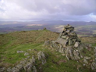
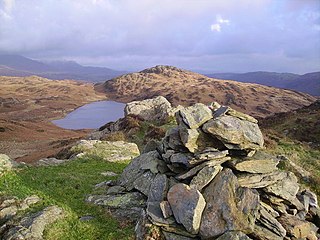
Stickle Pike is an outlying fell located in the southern Lake District near the small town of Broughton-in-Furness, with the summit situated between the lower Duddon Valley and the quiet smaller valley of Dunnerdale. Despite its low altitude the sharp, conical summit is prominent in views from the Broughton and high Furness areas. As with many of the Dunnerdale and Coniston fells, there are reminders of the area's former mining past in the form of many spoil heaps, disused levels and shafts. The fell is also notable for its wide-ranging views despite its low altitude, especially to the Scafells to the north and the sands of the Duddon Estuary to the south. A "stickle" is a hill with a prominent rocky top.

Shipman Knotts is a fell in the English Lake District in Cumbria, England. It reaches a height of 587 metres (1,926 ft) and is situated in one of the quieter areas of the national park, 2 kilometres (1.2 mi) north-east of Kentmere village. Although not one of the best-known Lake District fells and strictly speaking it is just the southern shoulder of Kentmere Pike it earned a separate chapter in Alfred Wainwright’s Pictorial Guide to the Lakeland Fells due to “Its characteristic roughness…rocky outcrops are everywhere on its steep slopes”.

Orrest Head is a hill in the English Lake District on the eastern shores of Windermere. It is the subject of a chapter in Wainwright's The Outlying Fells of Lakeland, and the first fell he climbed. He describes it as "our first ascent in Lakeland, our first sight of mountains in tumultuous array across glittering waters, our awakening to beauty" and also as "a fitting finale, too, to a life made happy by fellwandering".

The Outlying Fells of Lakeland is a book written by Alfred Wainwright, dealing with hills in and around the Lake District of England. It differs from Wainwright's Pictorial Guides in that each of its 56 chapters describes a walk, sometimes taking in several summits, rather than a single fell. This has caused some confusion on the part of authors attempting to prepare a definitive list of peaks. The Outlying Fells do not form part of the 214 hills generally accepted as making up the Wainwrights, but they are included in Category 2B of the Hill Walkers' Register maintained by the Long Distance Walkers Association.

Potter Fell is a fell near the villages of Burneside and Staveley, Cumbria, England. A number of tarns are present on the fell, including Gurnal Dubs Tarn and Potter Tarn. Potter Fell has four major summits, two of which are mentioned in Alfred Wainwright's The Outlying Fells of Lakeland.

School Knott is a hill in the Lake District, England, to the east of Windermere town, Cumbria. It is the subject of a chapter of Wainwright's book The Outlying Fells of Lakeland. His recommended route starts at Windermere railway station and includes Grandsire at 818 feet (249 m) and a nameless summit at 806 feet (246 m). The summit is at 760 feet (230 m) and offers a view of four sections of Windermere, the lake. It has a rocky outcrop but no trig point and, as reported by Wainwright, no cairn. Schoolknott Tarn is to the south-east of the summit.

The Bannisdale Horseshoe is an upland area near the eastern boundary of the Lake District National Park, surrounding the valley of Bannisdale Beck, a tributary of the River Mint. It is described in the final chapter of Wainwright's book The Outlying Fells of Lakeland. It describes

Stainton Pike is a hill in the English Lake District, near Waberthwaite, Cumbria. It is the subject of a chapter of Wainwright's book The Outlying Fells of Lakeland. It reaches 1,550 feet (470 m) and Wainwright's anticlockwise circuit also visits The Knott at 1,071 feet (326 m). The walk also passes the waterfall Rowantree Force and collection of ancient enclosures and hut circles known as Barnscar or City of Barnscar.

The Naddle Horseshoe is a group of summits in the English Lake District, south of Mardale valley, Cumbria. It is the subject of a chapter of Wainwright's book The Outlying Fells of Lakeland.

Newton Fell is a hill in the English Lake District near High Newton, south east of Newby Bridge, Cumbria. It lies to the north east of the A590 road. It is the subject of a chapter of Wainwright's book The Outlying Fells of Lakeland. Wainwright describes two walks, to the summits he calls Newton Fell (north) at 780 feet (240 m) and Newton Fell (south) or Dixon Heights at 585 feet (178 m). There are no public rights of way to either summit, and he states that the walks should be done "by courtesy of the owners and tenants".

Bigland Barrow is a hill in the English Lake District, near Backbarrow, Cumbria. It is the subject of a chapter of Wainwright's book The Outlying Fells of Lakeland. It reaches 630 feet (190 m), and there is a concrete lookout tower on the summit which Wainwright describes as "a wartime relic". Wainwright's route is an anticlockwise circuit from Newby Bridge.
Blawith Knott is a hill in the south of the English Lake District, near Woodland, Cumbria. It is the subject of a chapter of Wainwright's book The Outlying Fells of Lakeland. It reaches 806 feet (246 m) and Wainwright's clockwise route from the fell road to the south-west also includes Tottlebank Height at 775 feet (236 m). He describes Blawith Knott as "a magnificent viewpoint", with both a panorama of Lake District fells to the north and, to the east to south, views which, on a clear day, include the Howgill Fells, Whernside and Ingleborough.

Brant Fell is a hill in the English Lake District, near Bowness-on-Windermere, Cumbria. It is the subject of a chapter of Wainwright's book The Outlying Fells of Lakeland. It reaches 629 feet (192 m). Wainwright's route leaves Bowness along the path of the Dales Way, makes an anticlockwise loop over the viewpoint of Post Knott to the summit, and either returns along the Dales Way or follows a woodland path to Helm Road from where another viewpoint, Biskey Howe, is only a slight detour before continuing down Helm Road to Bowness. He commends its "fine prospect of Windermere".

Hugill Fell is a hill in the English Lake District, near Staveley, Cumbria, on the western side of the Kentmere valley. It is the subject of a chapter of Wainwright's book The Outlying Fells of Lakeland. It reaches 840 feet (260 m) and Wainwright's walk is an ascent from Staveley and return on the same route. There is a cairn on the summit.

Irton Pike is a hill in the west of the English Lake District, near Santon Bridge, Cumbria. It is the subject of a chapter of Alfred Wainwright's book The Outlying Fells of Lakeland. The hill reaches a height of 751 feet (229 m). Wainwright's walk as described in Lakeland is an anticlockwise circuit from Irton Road station on the Ravenglass and Eskdale Railway, near Eskdale Green. He describes "this tiny top" as "a near-perfect solace for reminiscences of past happy days on the higher fells", adding "Climb Irton Pike while ye may!"

Green Quarter Fell is an upland area in the east of the English Lake District, near Kentmere village, Cumbria. It is the subject of a chapter of Wainwright's book The Outlying Fells of Lakeland. Wainwright's walk is an anticlockwise circuit from Kentmere, reaching the summit of Hollow Moor at 1,394 feet (425 m) and a nameless summit at 1,370 feet (420 m) and making a detour to admire the tarn of Skeggles Water. He says that the walk offers: "... a perfectly-balanced and lovely view of upper Kentmere ... that cries aloud for a camera."

Knipescar Common, or Knipe Scar, is an upland area in the east of the English Lake District, above the River Lowther, near Bampton, Cumbria. It is the subject of a chapter of Wainwright's book The Outlying Fells of Lakeland. The summit is "indefinite" but reaches 1,118 feet (341 m) and there are limestone outcrops and an ancient enclosure. Wainwright commends the views which include Blencathra to the north and "a continuous skyline of the higher Pennines."
Woodland Fell is an upland area in the south of the English Lake District, south of Torver, Cumbria. It is the subject of a chapter of Wainwright's book The Outlying Fells of Lakeland. Wainwright's route is a clockwise circuit from the hamlet of Woodland, and includes the summits of Yew Bank at 678 feet (207 m) and Wool Knott at 730 feet (220 m), with Beacon Tarn between them. He describes the walk as: "a connoisseur's piece, every step an uninhibited joy, every corner a delight."

Latterbarrow is a hill in the English Lake District, east of Hawkshead, Cumbria. It is the subject of a chapter of Wainwright's book The Outlying Fells of Lakeland. It reaches 803 feet (245 m) and is surmounted by a monument, but Wainwright, unusually, makes no comment on the monument's age or purpose, merely mentioning this "... elegant obelisk being prominently in view from Hawkshead and the Ambleside district." He recommends an anticlockwise circuit from Colthouse, near Hawkshead, and describes it as "a circular walk needing little effort yet yielding much delight".
