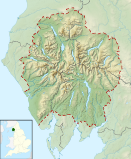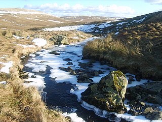
Hard Knott is a fell in the English Lake District, at the head of Eskdale.

Whitfell is a hill in the southwestern part of the Lake District. It is the highest point between Black Combe and Harter Fell on the broad ridge to the west of the Duddon Valley. Views from the summit include the full length of the Duddon Valley including its estuary; the western side of the Coniston fells; the Eskdale fells including Scafell and Bowfell; much of western Cumbria including the estuary of the Rivers Esk, Mite and Irt; the Isle of Man; as well as the hills to the south culminating in Black Combe.

Binsey is a hill on the northern edge of the Lake District in Cumbria, England. It is detached from the rest of the Lakeland hills, and thus provides a good spot to look out at the Northern and North Western Fells of the Lake District, as well as the coastal plain and, across the Solway Firth, Scotland. Snaefell on the Isle of Man is also visible on a clear day. It is the northernmost of the Wainwrights.

Castle Crag is a hill in the North Western Fells of the English Lake District. It is the smallest hill included in Alfred Wainwright's influential Pictorial Guide to the Lakeland Fells, the only Wainwright below 1,000 feet (300 m).

Black Combe is a fell in the south-west corner of the Lake District National Park, England, just four miles from the Irish Sea. It lies near the west coast of Cumbria in the borough of Copeland and more specifically, in the ancient district of Millom. It is 1970 feet (600m) high and stands in isolation, some 10 miles away from any higher ground; this factor offers an excellent all-round panoramic view of land and sea; weather permitting.

Devoke Water is a small lake in the mid-west region of the English Lake District, in the county of Cumbria. It is the largest tarn in the Lake District.

The mountains and hills of the British Isles are categorised into various lists based on different combinations of elevation, prominence, and other criteria such as isolation. These lists are used for peak bagging, whereby hillwalkers attempt to reach all the summits on a given list, the oldest being the 282 Munros in Scotland, created in 1891.

Stickle Pike is an outlying fell located in the southern Lake District near the small town of Broughton-in-Furness, with the summit situated between the lower Duddon Valley and the quiet smaller valley of Dunnerdale. Despite its low altitude the sharp, conical summit is prominent in views from the Broughton and high Furness areas. As with many of the Dunnerdale and Coniston fells, there are reminders of the area's former mining past in the form of many spoil heaps, disused levels and shafts. The fell is also notable for its superb views despite its low altitude, especially to the Scafells to the north and the sands of the Duddon Estuary to the south. A "stickle" is a hill with a prominent rocky top.

Shipman Knotts is a fell in the English Lake District in Cumbria, England. It reaches a height of 587 metres (1,926 ft) and is situated in one of the quieter areas of the national park, 2 kilometres (1.2 mi) north-east of Kentmere village. Although not one of the best-known Lake District fells and strictly speaking it is just the southern shoulder of Kentmere Pike it earned a separate chapter in Alfred Wainwright’s Pictorial Guide to the Lakeland Fells due to “Its characteristic roughness…rocky outcrops are everywhere on its steep slopes”.

Seat Sandal is a fell in the English Lake District, situated four kilometres north of the village of Grasmere from where it is very well seen. Nevertheless, it tends to be overshadowed by its more illustrious neighbours in the Eastern Fells, Helvellyn and Fairfield.

Brae Fell is a fell in the English Lake District, situated 12 kilometres north of Keswick it reaches a height of 586 m (1,923 ft) and is regarded as part of the Caldbeck Fells along with High Pike and Carrock Fell even though it has ridge links to the Uldale Fells. The fell's name has Scottish overtones and translates from the Scots language as a hillside or slope. Its northern flanks face the Scottish Borders country across the Eden Valley and Solway Firth.

Top o'Selside is a hill in the Lake District in Cumbria, England. At 335 metres (1,099 ft), it is the highest point of the group of hills situated between Coniston Water and Windermere. This group also includes the Wainwright of Black Fell and the summits of Black Brows and Rusland Heights. Top o'Selside lies not in the centre of this region, but in the south-western corner, just outside the forestry plantations of Grizedale Forest and only two-thirds of a mile from the eastern shore of Coniston Water. This large separation from any higher ground gives it enough relative height to make it a Marilyn.

The Outlying Fells of Lakeland is a book written by Alfred Wainwright, dealing with hills in and around the Lake District of England. It differs from Wainwright's Pictorial Guides in that each of its 56 chapters describes a walk, sometimes taking in several summits, rather than a single fell. This has caused some confusion on the part of authors attempting to prepare a definitive list of peaks. The Outlying Fells do not form part of the 214 hills generally accepted as making up the Wainwrights, but they are included in Category 2B of the Hill Walkers' Register maintained by the Long Distance Walkers Association.

Cold Fell is a hill in the west of the English Lake District. It is easily climbed from the road between Ennerdale Bridge and Calder Bridge. This road is in fact known as Cold Fell Road and is used by many Sellafield employees living in Cockermouth.

Caer Mote is a small hill in the north of the English Lake District near Bothel, Cumbria. Its summit at 920 feet (280 m) lies just outside the boundary of the Lake District National Park. It offers a view of Bassenthwaite Lake from its summit, upon which is an ancient earthwork enclosure of undetermined age, known as "The Battery". Under the name Caermote Hill it is the subject of a chapter of Wainwright's book The Outlying Fells of Lakeland. Wainwright's route is an ascent from Bothel via the northern summit St. John's Hill at 935 feet (285 m) in an anticlockwise circuit.

The Bannisdale Horseshoe is an upland area near the eastern boundary of the Lake District National Park, surrounding the valley of Bannisdale Beck, a tributary of the River Mint. It is described in the final chapter of Wainwright's book The Outlying Fells of Lakeland. It describes

Hesk Fell is a hill in the south-west of the English Lake District, between the Duddon Valley and Eskdale near Ulpha, Cumbria. It is the subject of a chapter of Wainwright's book The Outlying Fells of Lakeland. It reaches 1,566 feet (477 m) and Wainwright's route, an anticlockwise circuit from the Birker Fell road, also visits The Pike at 1,214 feet (370 m). Wainwright admits that the fell "has many shortcomings" and that the view of Scafell Pike and its neighbours is "the only reward for the ascent".

Scout Scar, also called Underbarrow Scar, is a hill in the English Lake District, west of Kendal, Cumbria and above the village of Underbarrow. It reaches 771 feet (235 m). Scout Scar is the subject of a chapter of Wainwright's book The Outlying Fells of Lakeland, but the summit he describes is a lower summit at 764 feet (233 m), 270m south of the highest point. Wainwright's anticlockwise recommended route also includes Cunswick Scar at 679 feet (207 m). The higher summit of Scout Scar has a topographic prominence of 109m and is thus classified as a HuMP, a hill with a prominence of at least 100m.

The Crookdale Horseshoe is a group of hills on the eastern edge of the English Lake District, in Cumbria, west of the A6 road. They are the subject of a chapter of Wainwright's book The Outlying Fells of Lakeland. Wainwright describes an anticlockwise walk starting along the valley of Crookdale Beck to reach Lord's Seat at 1,719 feet (524 m), and returning over Robin Hood at 1,613 feet (492 m) and High House Bank at 1,627 feet (496 m). As he points out, the ridge forming the northern part of the "horseshoe" is described in his Wasdale Horseshoe chapter.


