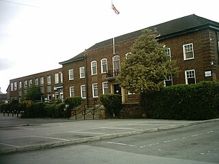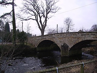
Kirkham is a village in the civil parish of Westow, in North Yorkshire, England, close to Malton, situated in the Howardian Hills alongside the River Derwent, and is notable for the nearby ruins of Kirkham Priory, an Augustinian establishment.

Great Shunner Fell is the third-highest mountain in the Yorkshire Dales, North Yorkshire, England, and the highest point in Wensleydale; at 716 metres above sea level. In clear weather the summit affords views of Wensleydale to the south, Ribblesdale to the southwest and Swaledale to the north, as well as views into Cumbria and County Durham beyond the A66.

Catton is a village and civil parish in the Hambleton District of North Yorkshire, England. It is situated between Thirsk and Ripon, on the River Swale.

Arkendale is a village and civil parish in the Harrogate district of North Yorkshire, England. It is 6 miles (10 km) north-east of Harrogate town, and a had a population of 278 according to the 2001 census, increasing to 394 at the 2011 census. It has a pub, a village hall and a church and is close to Staveley village.

Burton-cum-Walden is a civil parish in North Yorkshire, England, in the Yorkshire Dales National Park. It had a population of 303 according to the 2011 census.

Skipton was a rural district in the West Riding of Yorkshire from 1894 to 1974. It was named after Skipton, which constituted an urban district on its southern border.

Wetherby was a rural district in the West Riding of Yorkshire from 1894 to 1974. It was named after the town of Wetherby.

Thornton-on-the-Hill is a small dispersed village and civil parish in the Hambleton district of North Yorkshire, England, about two miles to the north of Easingwold. The population of the civil parish taken at the 2011 Census was less than 100. Details are included in the civil parish of Oulston.

Dalby-cum-Skewsby is a civil parish in the Hambleton district of North Yorkshire, England. The population of the civil parish taken at the 2011 Census was less than 100. Details are included in the civil parish of Brandsby-cum-Stearsby. It is situated around 14 miles (23 km) north of York and comprises the hamlets of Dalby, Skewsby and Witherholm. It is part of the group of spring line villages to the south of the Howardian Hills.

Hartforth is a small village in the Richmondshire district of North Yorkshire, England. The village is situated approximately 9 miles (14 km) south-west from the market town of Darlington, and is part of the civil parish of Gilling with Hartforth and Sedbury. The population was 558 at the 2021 census.

Copt Hewick is a village and civil parish in the Harrogate district of North Yorkshire, England. The village lies about two miles east of Ripon. It had a population of 180 in 2004 according to the North Yorkshire County Council, increasing to 253 at the 2011 census.

Oswaldkirk is a small village and civil parish 4 miles (6.4 km) south of Helmsley and 20 miles (32 km) north of York in North Yorkshire, England. It is named after the village church of St Oswald, King and Martyr, the Anglo-Saxon King of Northumbria who was slain by the pagan, Penda in 642. There was previously a Catholic church, dedicated to St Aidan, which closed in 2020. The population of the village as taken at the 2011 census was 230.

East Gill Force is a waterfall in Swaledale, 330 yards (300 m) east of the hamlet of Keld, in the Yorkshire Dales National Park, North Yorkshire, England. The falls are located on East Gill at grid reference NY896012, just before its confluence with the River Swale at the point where the Pennine Way and the Coast to Coast Walk intersect. The falls are a popular spot for visitors, not just long-distance walkers but also families and picnickers because of the proximity of the road. East Gill Force has two main torrents: the upper falls have an impressive 15-foot (4.5 m) drop whilst the lower section is a series of stepped cascades that fall 9.8 feet (3 m) as East Gill enters the River Swale.

Speeton is a village in the civil parish of Reighton, in North Yorkshire, England. It lies near the edge of the coastal cliffs midway between Filey and Bridlington. It is North Yorkshire's easternmost settlement, but historically lay in the East Riding of Yorkshire until local government re-organisation in 1974. It was part of the Borough of Scarborough from 1974 until 2023.

Cloughton is a small village and civil parish in the Scarborough district of North Yorkshire, England.

Atley Hill is a hamlet in the Hambleton district of North Yorkshire, England. It is situated on the B1263 road between the A167 and the village of Scorton.

The River Wenning is a tributary of the River Lune, flowing through North Yorkshire and Lancashire. The name derives from the Old English Wann, meaning dark river.

The River Bain is a river in North Yorkshire, England. As a tributary of the River Ure, it is one of the shortest, named rivers in England. The river is home to the small scale hydroelectricity project River Bain Hydro located at Bainbridge.
Swinton is a village and civil parish in North Yorkshire, England. It is about 2 miles (3.2 km) west of Malton on the B1257 road, and is on the edge of the Howardian Hills AONB to the immediate north. The village appears in the Domesday Book as 'Swintune' which is derived from 'pig farm'.

Little Whernside is a hill in the Yorkshire Dales, North Yorkshire, England, 2.82 miles (4.54 km) north east of Great Whernside. It is on the boundary between the Yorkshire Dales National Park and Nidderdale Area of Outstanding Natural Beauty, and forms part of the watershed between Coverdale and Nidderdale. The highest point is marked by a cairn, a few metres inside the National Park.


