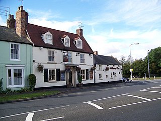
Leven is a village and civil parish in the East Riding of Yorkshire, England. It is situated approximately 7 miles (11 km) west of Hornsea town centre, and north-west of the A165 road.

Leconfield is a village and civil parish in the East Riding of Yorkshire, England, about 3 miles (5 km) north-west of Beverley town centre on the A164 road. The civil parish consists of Leconfield, the village of Arram and the hamlet of Scorborough. The 2011 UK census gave the parish a population of 2,127, an increase on the 2001 UK census figure of 1,990.

Mappleton is a village and civil parish in the East Riding of Yorkshire, England. It is situated on the North Sea coastline in an area known as Holderness, lying approximately 3 miles (5 km) south of the seaside resort of Hornsea. The civil parish is formed by the village of Mappleton and the hamlets of Cowden, Great Cowden and Rolston. According to the 2011 UK census, Mappleton parish had a population of 342, an increase on the 2001 UK census figure of 249.

Garton on the Wolds is a village and civil parish on the Yorkshire Wolds in the East Riding of Yorkshire, England. It is situated approximately 3 miles (5 km) north-west of Driffield town centre and lies on the A166 road.

Harpham is a small village and civil parish in the East Riding of Yorkshire, England. It is located just south of the A614 road, approximately 5 miles (8 km) north-east of Driffield and 7 miles (11 km) south-west of Bridlington.

Aldbrough is a village and civil parish in the East Riding of Yorkshire, England, about 12 miles (19 km) north-east of Hull at the junction of the B1242 and B1238 roads. It lies near to the North Sea coast within the area of Holderness.

Beeford is a village and civil parish in the East Riding of Yorkshire, England. It is situated at the junction of the A165 and the B1249, and approximately 10 miles (16 km) north-east from Beverley and 8 miles (13 km) south from Bridlington.

Brandesburton is a village and civil parish in the East Riding of Yorkshire, England. It is situated approximately 7 miles (11 km) west of Hornsea and 9 miles (14 km) north-east of the market town of Beverley.

Sigglesthorne is a small village and civil parish in the East Riding of Yorkshire, England. It is situated approximately 3 miles (4.8 km) west of Hornsea on the A1035 road where it meets the B1243 road.

Withernwick is a village and civil parish in the East Riding of Yorkshire, England. It is situated approximately 10 miles (16 km) north-east of Hull city centre and 5 miles (8 km) south of Hornsea.

Ulrome is a village and civil parish in the East Riding of Yorkshire, England. It is situated approximately 6 miles (9.7 km) north of the town of Hornsea and on the east side of the B1242 road. The parish includes the village of Lissett. Its area is 1,139.535 hectares, in 2011 had a population of 239, a reduction on the 2001 UK census figure of 260.

Lockington is a small village and civil parish in the East Riding of Yorkshire, England. It is situated approximately 6 miles (10 km) north-west of Beverley town centre.

Rise is a village and civil parish in Holderness, the East Riding of Yorkshire, England. It is situated approximately 7 miles (11 km) east of the town of Beverley and 5 miles (8 km) south-west of Hornsea. It lies to the east of the B1243 road.

North Frodingham is a village and civil parish in the East Riding of Yorkshire, England. It is situated approximately 5.5 miles (9 km) south-east of the town of Driffield and lies on the B1249 road.

North Dalton is a village and civil parish in the East Riding of Yorkshire, England. It is situated approximately 6 miles (10 km) south-west of the town of Driffield and 8 miles (13 km) north-east of the town of Pocklington. 4 miles (6.4 km) to the north-west lies the village of Huggate. South Dalton lies some 4.5 miles (7 km) to the south-east, with villages in between. North Dalton itself lies on the B1246 road.

Molescroft is a village and civil parish in the East Riding of Yorkshire, England. It is situated approximately 0.5 miles (0.8 km) north-west of Beverley town centre adjoining its northern border. It lies to the north of the A1174 road.

Lund is a village and civil parish in the East Riding of Yorkshire, England. It is situated approximately 6 miles (10 km) north-west of Beverley town centre, 7 miles (11 km) south-west of Driffield town centre, and to the east of the B1248 road.

Londesborough is a village and civil parish in the East Riding of Yorkshire, England. It is situated approximately 2.5 miles (4 km) north of the market town of Market Weighton. The civil parish is formed by the village of Londesborough and the hamlet of Middlethorpe. According to the 2011 UK census, Londesborough parish had a population of 182, a reduction of one on the 2001 UK census figure.

Etton is a village and civil parish in the East Riding of Yorkshire, England. It is situated approximately 4 miles (6 km) north-west of Beverley town centre and 2 miles (3.2 km) west of the village of Leconfield. 1 mile (1.6 km) to the south-east is Cherry Burton. To the west lie the hamlets of Kiplingcotes and Gardham. South Dalton lies 1.5 miles to the north-west.

Fridaythorpe is a village and civil parish in the East Riding of Yorkshire, England. It is situated approximately 8 miles (13 km) north-east of Pocklington town centre and lies on the A166 road. It is 550 feet (170 m) above sea level, making it the highest village in the Yorkshire Wolds.


