Cedar Point, Texas

Last updated

Cedar Point, Texas
CDP
Coordinates: 30°47′51″N95°04′30″W / 30.79750°N 95.07500°W / 30.79750; -95.07500
Country Flag of the United States.svg  United States
State Flag of Texas.svg  Texas
County Polk
Area
  Total1.9 sq mi (4.9 km2)
  Land0.9 sq mi (2.3 km2)
  Water1.0 sq mi (2.6 km2)
Elevation
[1]
128 ft (39 m)
Population
 (2010)
  Total630
  Density330/sq mi (130/km2)
Time zone UTC-6 (Central (CST))
  Summer (DST) UTC-5 (CDT)
Zip Code
77351
GNIS feature ID2586918 [1]

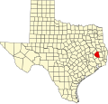
Cedar Point is a census-designated place (CDP) in Polk County, Texas, United States. This was a new CDP for the 2010 census, with a population of 630. [2]
Contents

Geography

Cedar Point has a total area of 1.9 square miles (4.9 km2), of which 0.9 square miles (2.3 km2) is land and 1.0 square mile (2.6 km2) is water. [3]

Demographics

Historical population
CensusPop.Note
2010 630
2020 85135.1%
U.S. Decennial Census [4]
1850–1900 [5] 1910 [6]
1920 [7] 1930 [8] 1940 [9]
1950 [10] 1960 [11] 1970 [12]
1980 [13] 1990 [14] 2000 [15]
2010 [16] 2020 [17]

Cedar Point first appeared as a census designated place in the 2010 U.S. Census. [16]

2020 census

Cedar Point CDP, Texas – Racial and ethnic composition
Note: the US Census treats Hispanic/Latino as an ethnic category. This table excludes Latinos from the racial categories and assigns them to a separate category. Hispanics/Latinos may be of any race.
Race / Ethnicity (NH = Non-Hispanic)Pop 2010 [18] Pop 2020 [17] % 2010% 2020
White alone (NH)57172490.63%85.08%
Black or African American alone (NH)16132.54%1.53%
Native American or Alaska Native alone (NH)270.32%0.82%
Asian alone (NH)360.48%0.71%
Pacific Islander alone (NH)000.00%0.00%
Other race alone (NH)060.00%0.71%
Mixed race or Multiracial (NH)2280.32%3.29%
Hispanic or Latino (any race)36675.71%7.87%
Total630851100.00%100.00%

Related Research Articles

Lamar is a small, unincorporated community and census-designated place (CDP) in Aransas County, Texas, United States, 10 miles (16 km) north of Rockport and 40 miles (64 km) north of Corpus Christi. As of the 2010 census it had a population of 636. The community was named for Mirabeau B. Lamar, the second president of the Republic of Texas. This was a new CDP for the 2010 census.

Boling is a census-designated place (CDP) in Wharton County, Texas, United States. This was a new CDP formed from parts of the Boling-Iago CDP prior to the 2010 census with a population of 1122.

Hilltop Lakes is a census-designated place and unincorporated community in Leon County, Texas, United States. As of the 2010 census, the population was 1,101.

Lake Medina Shores is a census-designated place in Bandera and Medina counties, Texas, United States. Its population was 1,235 as of the 2010 census. This was a new CDP for the 2010 census.

<span class="mw-page-title-main">Redland, Texas</span> Census-designated place in Texas, United States

Redland is an unincorporated town and census-designated place (CDP) in Angelina County, Texas, United States. The population was 1,047 at the 2010 census. This was a new CDP for the 2010 census.

Thunderbird Bay is a census-designated place (CDP) in Brown County in central Texas, United States. The population was 663 at the 2010 census.

Bluetown is a census-designated place (CDP) in Cameron County, in the U.S. state of Texas. The population was 356 at the 2010 census. It is part of the Brownsville–Harlingen Metropolitan Statistical Area.

Arroyo Gardens is a census-designated place (CDP) in Cameron County, in the U.S. state of Texas. The population was 456 at the 2010 census. Prior to the 2010 census, the community was part of the Arroyo Gardens-La Tina Ranch CDP. It is part of the Brownsville–Harlingen Metropolitan Statistical Area.

La Tina Ranch is a census-designated place (CDP) in Cameron County, in the U.S. state of Texas. The population was 618 at the 2010 census. Prior to the 2010 census, the community was part of the Arroyo Gardens-La Tina Ranch CDP. It is part of the Brownsville–Harlingen Metropolitan Statistical Area.

Iglesia Antigua is a census-designated place (CDP) in Cameron County, in the U.S. state of Texas. The population was 413 at the 2010 census. Prior to the 2010 census, the community was part of the Bluetown-Iglesia Antigua CDP. It is part of the Brownsville–Harlingen Metropolitan Statistical Area.

Orason is a census-designated place (CDP) in Cameron County, in the U.S. state of Texas. The population was 129 at the 2010 census. Prior to the 2010 census, the community was part of the Chula Vista-Orason CDP. It is part of the Brownsville–Harlingen Metropolitan Statistical Area.

Las Palmas II is a census-designated place (CDP) in Cameron County, in the U.S. state of Texas. The population was 1,605 at the 2010 census. Prior to the 2010 census, the community was part of the Las Palmas-Juarez CDP. It is part of the Brownsville–Harlingen Metropolitan Statistical Area.

Las Palmas is a census-designated place (CDP) in Zapata County in the U.S. state of Texas. It was a new CDP from the 2010 census, with a population of 67. It is part of the Zapata Micropolitan Statistical Area.

Shadybrook is a census-designated place (CDP) in Cherokee County, Texas, United States. The population was 1,967 at the 2010 census.

Pleasant Hill is a census-designated place (CDP) in Polk County, Texas, United States. This was a new CDP for the 2010 census, with a population of 522.

Indian Springs is a census-designated place (CDP) in Polk County, Texas, United States. This was a new CDP for the 2010 census, with a population of 785.

Buchanan Lake Village is an unincorporated community and census-designated place in Llano County, Texas, United States. Its population was 692 as of the 2010 census.

Siesta Acres is an unincorporated community and census-designated place in Maverick County, Texas, United States. Its population was 1,866 as of the 2020 census. U.S. Route 277 passes through the community.

Nocona Hills is an unincorporated community and census-designated place in Montague County, Texas, United States. Its population was 675 as of the 2010 census.

Canyon Creek is an unincorporated community and census-designated place (CDP) in Hood County, Texas, United States. The population was 916 at the 2010 census. It is part of the Granbury micropolitan area as well as the Dallas–Fort Worth metroplex.

References

  1. 1 2 U.S. Geological Survey Geographic Names Information System: Cedar Point, Texas
  2. "Population and Housing Unit Counts, 2010 Census of Population and Housing" (PDF). Texas: 2010.
  3. "Cedar Point, Texas :: Boundary Map of Cedar Point, Texas". Maptechnica.com. Archived from the original on December 20, 2016. Retrieved December 18, 2016.
  4. "Decennial Census by Decade". United States Census Bureau .
  5. "1900 Census of Population - Population of Texas By Counties And Minor Civil Divisions" (PDF). United States Census Bureau .
  6. "1910 Census of Population - Supplement for Texas" (PDF). United States Census Bureau .
  7. "1920 Census of Population - Number of Inhabitants - Texas" (PDF). United States Census Bureau .
  8. "1930 Census of Population - Number of Inhabitants - Texas" (PDF). United States Census Bureau .
  9. "1940 Census of Population - Number of Inhabitants - Texas" (PDF). United States Census Bureau .
  10. "1950 Census of Population - Number of Inhabitants - Texas" (PDF). United States Census Bureau .
  11. "1960 Census of Population - Number of Inhabitants - Texas" (PDF). United States Census Bureau .
  12. "1970 Census of Population - Number of Inhabitants - Texas" (PDF). United States Census Bureau .
  13. "1980 Census of Population - Number of Inhabitants - Texas" (PDF). United States Census Bureau .
  14. "1990 Census of Population - Population and Housing Unit Counts - Texas" (PDF). United States Census Bureau .
  15. "2000 Census of Population - Population and Housing Unit Counts - Texas" (PDF). United States Census Bureau .
  16. 1 2 "2010 Census of Population - Population and Housing Unit Counts - Texas" (PDF). United States Census Bureau .
  17. 1 2 "P2 Hispanic or Latino, and Not Hispanic or Latino by Race – 2020: DEC Redistricting Data (PL 94-171) – Cedar Point CDP, Texas". United States Census Bureau .
  18. "P2 Hispanic or Latino, and Not Hispanic or Latino by Race – 2010: DEC Redistricting Data (PL 94-171) – Cedar Point CDP, Texas". United States Census Bureau .