Centerville, Maine

Last updated
Centerville, Maine
Township
Coordinates: 44°42′26″N67°39′13″W / 44.70722°N 67.65361°W / 44.70722; -67.65361
Country United States
State Maine
County Washington
Area
  Total43.0 sq mi (111.3 km2)
  Land41.9 sq mi (108.6 km2)
  Water1.1 sq mi (2.7 km2)
Elevation
105 ft (32 m)
Population
 (2000)
  Total26
  Density0.6/sq mi (0.2/km2)
Time zone UTC-5 (Eastern (EST))
  Summer (DST) UTC-4 (EDT)
ZIP code
04623
Area code 207
FIPS code 23-11755
GNIS feature ID0582399

Centerville is a township in Washington County, Maine, in the United States. As of the 2000 census, the town population was 26.

Contents

As of 2003, the town meeting voted to dissolve the town government and return it to unincorporated territory; the disincorporation was effective as of July 1, 2004. The former town is now included in the North Washington Unorganized Territory.

Geography

According to the United States Census Bureau, the town had a total area of 111.3 km2 (43.0 sq mi). 108.6 km2 (41.9 sq mi) of it is land and 2.7 km2 (1.0 sq mi) of it (2.47%) is water.

Demographics

As of the census [1] of 2000, there were 26 people, 12 households, and 6 families residing in the town. The population density was 0.2 people/km2 (0.52 people/sq mi). There were 24 housing units at an average density of 0.2 units/km2 (0.52 units/sq mi). The racial makeup of the town was 100.00% White.

There were 12 households, out of which 25.0% had children under the age of 18 living with them, 50.0% were married couples living together, 8.3% had a female householder with no husband present, and 41.7% were non-families. 41.7% of all households were made up of individuals, and none had someone living alone who was 65 years of age or older. The average household size was 2.17 and the average family size was 2.71.

In the town, the population was spread out, with 23.1% under the age of 18, 30.8% from 25 to 44, 38.5% from 45 to 64, and 7.7% who were 65 years of age or older. The median age was 44 years. For every 100 females, there were 85.7 males. For every 100 females age 18 and over, there were 100.0 males.

The median income for a household in the town was $26,458, and the median income for a family was $27,500. Males had a median income of $16,250 versus $18,750 for females. The per capita income for the town was $19,958. None of the population and none of the families were below the poverty line.

44°42′20″N67°40′44″W / 44.70556°N 67.67889°W / 44.70556; -67.67889

Related Research Articles

<span class="mw-page-title-main">Cale, Arkansas</span> Town in Arkansas, United States

Cale is a town in Nevada County, Arkansas, United States. The population was 75 at the 2000 census. It is part of the Hope Micropolitan Statistical Area.

<span class="mw-page-title-main">Mansfield Center, Connecticut</span> CDP in Connecticut, United States

Mansfield Center is a village within the town of Mansfield in Tolland County, Connecticut, United States. The village is the basis of a census-designated place (CDP) of the same name with a population of 947 at the 2010 census. The CDP includes the original settlement of Mansfield, Mansfield Center or Mansfield Village, as well as the village of Mansfield Hollow. Mansfield Hollow State Park is also located within the boundaries of the CDP.

<span class="mw-page-title-main">Madrid, Maine</span> Disincorporated town in Maine, United States

Madrid is a former town, now a part of the unorganized territory of East Central Franklin, in Franklin County, Maine, United States. The population was 173 at the 2000 census.

Danforth is a town in Washington County, Maine, United States. The town was named for proprietor Thomas Danforth. The population was 587 at the 2020 census. The town contains the villages of Danforth and Eaton. East Grand High School is located in Danforth.

<span class="mw-page-title-main">Norton Center, Massachusetts</span> Census-designated place in Massachusetts, United States

Norton Center is a census-designated place (CDP) in the town of Norton in Bristol County, Massachusetts, United States. The population was 2,671 at the 2010 census.

Riceland Township is a township in Freeborn County, Minnesota, United States. The population was 489 at the 2000 census.

Park Township is a township in Pine County, Minnesota, United States. The population was 37 at the 2000 census.

Camp 5 Township is a township in Saint Louis County, Minnesota, United States. The population was 35 at the 2010 census.

Rocky Ford is a census-designated place (CDP) in Delaware and Cherokee counties, Oklahoma, United States. The population was 61 at the 2010 census.

<span class="mw-page-title-main">Armenia Township, Pennsylvania</span> Township in Pennsylvania, United States

Armenia Township is a township in Bradford County, Pennsylvania, United States. It is part of Northeastern Pennsylvania. The population was 206 at the 2020 census.

<span class="mw-page-title-main">Deer Creek Township, Mercer County, Pennsylvania</span> Township in Pennsylvania, United States

Deer Creek Township is a township in Mercer County, Pennsylvania, United States. The population was 456 at the 2020 census, a decline from the figure of 502 in 2010.

<span class="mw-page-title-main">Homer Township, Potter County, Pennsylvania</span> Township in Pennsylvania, United States

Homer Township is a township in Potter County, Pennsylvania, United States. The population was 438 at the 2020 census.

<span class="mw-page-title-main">Colley Township, Sullivan County, Pennsylvania</span> Township in Pennsylvania, United States

Colley Township is a township in Sullivan County, Pennsylvania, United States. The population was 626 at the 2020 census. The village of Lopez is located in the township.

<span class="mw-page-title-main">Elk Township, Tioga County, Pennsylvania</span> Township in Pennsylvania, United States

Elk Township is a township in Tioga County, Pennsylvania, United States. The population was 45 at the 2020 census, and 49 at the 2010 census. There were five children under the age of 19 years.

<span class="mw-page-title-main">Cherry Grove Township, Warren County, Pennsylvania</span> Township in Pennsylvania, United States

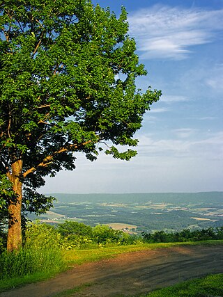
Cherry Grove Township is a township in Warren County, Pennsylvania, United States. The population at the 2020 census was 173, down from 216 in the 2010 census.

<span class="mw-page-title-main">Willington, South Carolina</span> CDP in South Carolina, United States

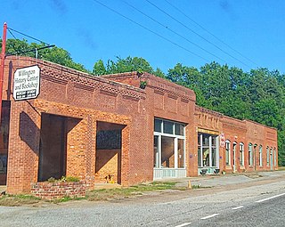
Willington is a census-designated place (CDP) in McCormick County, South Carolina, United States. The population was 177 at the 2000 census.

Westlake Corner is a census-designated place in Franklin County, Virginia, United States. The population was 1,553 at the 2020 census up fro 976 at the 2010 census. It is part of the Roanoke Metropolitan Statistical Area.

Northwest Somerset is an unorganized territory in Somerset County, Maine, United States. The population was 41 at the 2020 census.

Hush Lake is an unorganized territory in Saint Louis County, Minnesota, United States. As of the 2000 census, the unorganized territory had a total population of three.

Seymour is a census-designated place (CDP) in Eau Claire County, Wisconsin, United States. The population was 1,418 at the 2010 census. It is located within the town of Seymour and is part of the Eau Claire urban area.

References

  1. "U.S. Census website". United States Census Bureau . Retrieved 2008-01-31.