Jonesboro, Maine

Last updated

Jonesboro, Maine
USA Maine location map.svg
Red pog.svg
Jonesboro, Maine
Location within the state of Maine
Coordinates: 44°39′48″N67°35′43″W / 44.66333°N 67.59528°W / 44.66333; -67.59528
Country United States
State Maine
County Washington
Area
[1]
  Total38.36 sq mi (99.35 km2)
  Land36.58 sq mi (94.74 km2)
  Water1.78 sq mi (4.61 km2)
Elevation
105 ft (32 m)
Population
 (2020)
  Total587
  Density16/sq mi (6.2/km2)
Time zone UTC-5 (Eastern (EST))
  Summer (DST) UTC-4 (EDT)
ZIP code
04648
Area code 207
FIPS code 23-35905
GNIS feature ID0582536

Jonesboro is a town in Washington County, Maine, United States. The town was named for John Coffin Jones, a landholder. [2] [3] The population was 587 at the 2020 census. [4]

Contents

Geography

According to the United States Census Bureau, the town has a total area of 38.36 square miles (99.35 km2), of which 36.58 square miles (94.74 km2) is land and 1.78 square miles (4.61 km2) is water. [1]

Climate

This climatic region is typified by large seasonal temperature differences, with warm to hot (and often humid) summers and cold (sometimes severely cold) winters. According to the Köppen Climate Classification system, Jonesboro has a humid continental climate, abbreviated "Dfb" on climate maps. [5]

Demographics

Historical population
CensusPop.Note
1810 553
1820 67522.1%
1830 81020.0%
1840 392−51.6%
1850 46618.9%
1860 51811.2%
1870 5220.8%
1880 5556.3%
1890 62412.4%
1900 606−2.9%
1910 519−14.4%
1920 461−11.2%
1930 4681.5%
1940 4792.4%
1950 459−4.2%
1960 428−6.8%
1970 4484.7%
1980 55323.4%
1990 5855.8%
2000 5941.5%
2010 583−1.9%
2020 5870.7%
U.S. Decennial Census [6]

2010 census

As of the census [7] of 2010, there were 583 people, 256 households, and 151 families living in the town. The population density was 15.9 inhabitants per square mile (6.1/km2). There were 332 housing units at an average density of 9.1 per square mile (3.5/km2). The racial makeup of the town was 96.7% White, 0.2% African American, 0.5% Native American, 0.3% Asian, 0.5% from other races, and 1.7% from two or more races. Hispanic or Latino of any race were 0.9% of the population.

There were 256 households, of which 25.8% had children under the age of 18 living with them, 47.3% were married couples living together, 8.6% had a female householder with no husband present, 3.1% had a male householder with no wife present, and 41.0% were non-families. 32.4% of all households were made up of individuals, and 14.8% had someone living alone who was 65 years of age or older. The average household size was 2.28 and the average family size was 2.89.

The median age in the town was 45.2 years. 21.6% of residents were under the age of 18; 5.5% were between the ages of 18 and 24; 22.7% were from 25 to 44; 34.1% were from 45 to 64; and 16.1% were 65 years of age or older. The gender makeup of the town was 50.6% male and 49.4% female.

2000 census

As of the census [8] of 2000, there were 594 people, 257 households, and 172 families living in the town. The population density was 16.2 inhabitants per square mile (6.3/km2). There were 325 housing units at an average density of 8.9 per square mile (3.4/km2). The racial makeup of the town was 99.33% White, 0.17% African American, and 0.51% from two or more races. Hispanic or Latino of any race were 0.51% of the population.

There were 257 households, out of which 29.2% had children under the age of 18 living with them, 57.6% were married couples living together, 5.8% had a female householder with no husband present, and 32.7% were non-families. 29.2% of all households were made up of individuals, and 14.8% had someone living alone who was 65 years of age or older. The average household size was 2.31 and the average family size was 2.82.

In the town, the population was spread out, with 24.6% under the age of 18, 5.1% from 18 to 24, 27.8% from 25 to 44, 25.3% from 45 to 64, and 17.3% who were 65 years of age or older. The median age was 41 years. For every 100 females, there were 99.3 males. For every 100 females age 18 and over, there were 95.6 males.

The median income for a household in the town was $27,639, and the median income for a family was $36,458. Males had a median income of $31,389 versus $20,956 for females. The per capita income for the town was $14,418. About 9.6% of families and 16.1% of the population were below the poverty line, including 17.6% of those under age 18 and 12.0% of those age 65 or over.

Education

Area schools include Jonesboro Elementary School, Rose M. Gaffney Elementary School, Washington Academy, and Machias Memorial High School. [9]

Notable people

Related Research Articles

<span class="mw-page-title-main">Jonesboro, Illinois</span> City in Illinois, United States

Jonesboro is a city in Union County, Illinois, United States. The population was 1,821 at the 2010 census, a decline from 1,853 in 2000. It is the county seat of Union County. The city is known for being tied to its close neighbor Anna, together known as Anna-Jonesboro.

<span class="mw-page-title-main">Jonesboro, Indiana</span> City in Indiana, United States

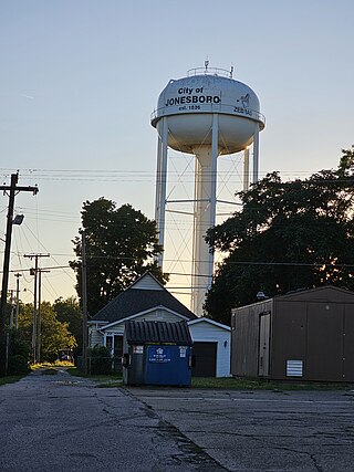
Jonesboro is a city in Grant County, Indiana, United States, located along the Mississinewa River opposite Gas City. The population was 1,756 at the 2010 census. According to the 2010 census, Jonesboro had the third smallest population of a city in Indiana.

<span class="mw-page-title-main">Greene, Maine</span> Town in the state of Maine, United States

Greene is a town in Androscoggin County, Maine, United States. The population was 4,376 at the 2020 census. It is included in both the Lewiston-Auburn, Maine metropolitan statistical area and the Lewiston-Auburn, Maine Metropolitan New England city and town area. The central village in the town comprises the Greene census-designated place.

<span class="mw-page-title-main">Eagle Lake, Maine</span> Town in the state of Maine, United States

Eagle Lake is a town in Aroostook County, Maine, United States. The population was 772 at the 2020 census. The town was named by a body of troops heading from Bangor to the Aroostook War for the many eagles that they saw around the lake. A total of 49.0% of the population speaks French, reflecting a trend in Northeastern Maine.

<span class="mw-page-title-main">St. Francis, Maine</span> Town in the state of Maine, United States

St. Francis is a town in Aroostook County, Maine, United States on the Canada–United States border at the junction of the St. Francis River and the Saint John River. The population was 438 at the 2020 census. First settled by English speakers from southern Maine, the original population has been supplanted by French-speaking Acadians.

<span class="mw-page-title-main">Washburn, Maine</span> Town in the state of Maine, United States

Washburn is a town in Aroostook County, Maine, United States. It was incorporated on February 25, 1861, and named after Israel Washburn, the governor of Maine at the time. The population was 1,527 at the 2020 census. Benjamin C. Wilder House, which was built in 1852, is located on Main Street in Washburn and predates the town's incorporation by nine years.

Frenchboro is a town in Hancock County, Maine, United States, and a village within this town located on Long Island, southeast of Swans Island. The population was 29 at the 2020 census. The town is accessible by state ferry service from Bass Harbor.

<span class="mw-page-title-main">Southwest Harbor, Maine</span> Town in the state of Maine, United States

Southwest Harbor is a town in Hancock County, Maine, United States. Located on Mount Desert Island, the population was 1,756 at the 2020 census. The municipality contains within it the villages of Southwest Harbor, Manset, Seawall, Wonderland, and Pemetic Hills.

<span class="mw-page-title-main">Manchester, Maine</span> Town in Maine, United States

Manchester is a town in Kennebec County, Maine, United States, located at 44.33°N 69.87°W. The population was 2,456 at the 2020 census. The southern part of the town bordering Cobbosseecontee Lake is a popular recreation spot in central Maine, and part of the Winthrop Lakes Region. Manchester is included in the Augusta, Maine micropolitan New England City and Town Area.

<span class="mw-page-title-main">Mount Vernon, Maine</span> Town in the state of Maine, United States

Mount Vernon is a town in Kennebec County, Maine, United States. The population was 1,721 at the 2020 census. Mount Vernon is included in the Augusta, Maine micropolitan New England City and Town Area. A popular recreation spot in central Maine, the northern area of Mount Vernon is part of the Belgrade Lakes Region, while the southern area is part of the Winthrop Lakes Region.

<span class="mw-page-title-main">Hartford, Maine</span> Town in the state of Maine, United States

Hartford is a town in Oxford County, Maine, United States. Hartford is included in the Lewiston-Auburn metropolitan New England City and Town Area. The population was 1,203 at the 2020 census.

<span class="mw-page-title-main">Stow, Maine</span> Town in the state of Maine, United States

Stow is a town in Oxford County, Maine, United States. The population was 393 at the 2020 census.

<span class="mw-page-title-main">Upton, Maine</span> Town in the state of Maine, United States

Upton is a town in Oxford County, Maine, United States. The population was 69 at the 2020 census.

Holden is a town in Penobscot County, Maine, United States. The population was 3,277 at the 2020 census.

Kenduskeag is a town in Penobscot County, Maine, United States. The population was 1,346 at the 2020 census.

<span class="mw-page-title-main">West Bath, Maine</span> Town in the state of Maine, United States

West Bath is a town in Sagadahoc County, Maine, United States. The population was 1,910 at the 2020 census. A sub-locality of West Bath is Winnegance. West Bath is part of the Portland–South Portland–Biddeford, Maine metropolitan statistical area.

Beddington is a town in Washington County, Maine, United States. The population was 60 at the 2020 census. It is the third-smallest organized town in Maine after Frye Island and Frenchboro.

<span class="mw-page-title-main">Jonesport, Maine</span> Town in Maine, United States

Jonesport is a town in Washington County, Maine, United States. The population was 1,245 at the 2020 census. Jonesport is a fishing and lobstering town. It contains the villages or hamlets of Jonesport, Mason Bay, Monsapec, and West Jonesport.

<span class="mw-page-title-main">Van Buren, Maine</span> Town in Maine, United States

Van Buren is a town on the Saint John River in Aroostook County, Maine, United States; located across from Saint-Leonard, New Brunswick, Canada. The population was 2,038 at the 2020 census. It is named after U.S. President Martin Van Buren.

<span class="mw-page-title-main">East Millinocket, Maine</span> Town in the state of Maine, United States

East Millinocket is a town in Penobscot County, Maine, United States. The population was 1,572 at the 2020 census.

References

  1. 1 2 "US Gazetteer files 2010". United States Census Bureau. Archived from the original on July 8, 2017. Retrieved December 16, 2012.
  2. Gannett, Henry (1905). The Origin of Certain Place Names in the United States. Govt. Print. Off. p. 170.
  3. "Profile for Jonesboro, Maine". ePodunk . Retrieved May 8, 2010.
  4. "Census - Geography Profile: Jonesboro town, Washington County, Maine". United States Census Bureau . Retrieved January 30, 2022.
  5. Climate Summary for Jonesboro, Maine
  6. "Census of Population and Housing". Census.gov. Retrieved June 4, 2015.
  7. "U.S. Census website". United States Census Bureau . Retrieved December 16, 2012.
  8. "U.S. Census website". United States Census Bureau . Retrieved January 31, 2008.
  9. "Jonesboro Elementary School". Jonesboro Elementary School. Retrieved October 6, 2012.

44°39′45″N67°34′21″W / 44.66250°N 67.57250°W / 44.66250; -67.57250