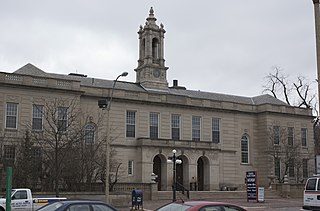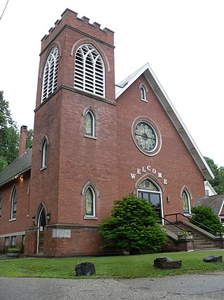
The Amherst Central Business District is a historic district encompassing the heart of downtown Amherst, Massachusetts. Centered on the northern section of the long town common, the area has been the civic and commercial heart of the town since the 18th century. The district was listed on the National Register of Historic Places in 1991, and slightly enlarged in 2011.

The Main Street Historic District encompasses the historic late 19th and early 20th-century commercial heart of Webster, Massachusetts. It consists of fourteen buildings on Main Street in downtown Webster, between High and Church Streets. This area contains the highest concentration of period commercial buildings in the town. The district was listed on the National Register of Historic Places in 1982.

The Ayer Main Street Historic District encompasses most of the historic central business district of Ayer, Massachusetts. It extends along Main Street between Park and Columbia Streets, and was mostly developed between 1872 and 1898 as a hub of railroad and roadway-based economic activity. The district was listed on the National Register of Historic Places in 1989.

The Central New Bedford Historic District is one of nine historic districts in New Bedford, Massachusetts, United States. The district encompasses the city's central business district, built up during the time in the late 19th century when textiles had replaced whaling as the city's main industry. It is a 29-acre (12 ha) rectangular area bounded by Acushnet Avenue and the older New Bedford Historic District on the east, School Street to the south, Middle Street on the north and 6th Street in the west. It was added to the National Register of Historic Places in 1980.

North Becket Village Historic District is a historic district encompassing the historic village of North Becket in the Berkshire hill town of Becket, Massachusetts. The village developed rapidly as the main economic and civic center of the town in a 20-year period beginning in 1841 with the arrival of the Western Railroad, and retains many fine examples of Greek Revival architecture. It was listed on the National Register of Historic Places in 1988.

The Huntington Village Historic District encompasses the historic village center of Huntington, Massachusetts, USA. The village lies on the west branch of the Westfield River, at the junction of US Route 20 and Massachusetts Route 112. The district was listed on the National Register of Historic Places in 1999. The village is the most densely populated part of Huntington, and has been its commercial and civic heart since the early 19th century. It has been divided by the river because its unifying feature, a location where bridges stood since 1810, no longer has one, and the modern replacement bridge built after a 1938 flood just south of the center, does not readily combine the developed areas on either side.

East Gloucester Square Historic District is a historic district encapsulating the evolutionary history of the active maritime community of Gloucester, Massachusetts, United States, over a period of more than 200 years. East Gloucester is located on the south side of Gloucester's Inner Harbor, opposite the city's main downtown area. The district is essentially linear in character extending along East Main Street between Rocky Neck Avenue and Montgomery Place, with a southward extension along Highland, Chapel, and Plum Streets to Mount Pleasant Avenue. East Main Street was formally laid out in 1704 to East Gloucester Square, and provides access to numerous waterfront facilities, including stone wharves and 19th century ship building and repair facilities. Housing is set on the roads leading up the hill from East Gloucester Square, and is generally densely set Greek Revival or Italianate in style, reflecting the dominant period of the area's development, the mid-to-late 19th century. Higher style residences were placed on larger lots on Mount Pleasant Avenue.

The Front Street Block is a series of four connected commercial blocks in the West End of Gloucester, Massachusetts, USA. They were built in 1831 after a fire had devastated Gloucester's downtown the previous year.

The Spicket Falls Historic District encompasses the historic industrial and commercial heart of Methuen, Massachusetts, and one of the lower Merrimack River's best-preserved 19th century mill complexes. It is centered on the falls of the Spicket River, from which the 19th century textile mills of Methuen derived their power. The historic district, listed on the National Register of Historic Places in 1984, includes commercial and civic buildings in and near Gaunt Square, the heart of the city, and along both sides of the Spicket River between Gaunt Square and the Boston and Maine Railroad tracks south of the river. It abuts the residential Pleasant-High Historic District, which lies to its east.

The Arlington Center Historic District includes the civic and commercial heart of Arlington, Massachusetts. It runs along the town's main commercial district, Massachusetts Avenue, from Jason Street to Franklin Street, and includes adjacent 19th- and early 20th-century residential areas roughly bounded by Jason Street, Pleasant Street, and Gray Street. The district was listed on the National Register of Historic Places in 1974.

The Central Square Historic District is a historic district encompassing much of the central business district of Stoneham, Massachusetts. It includes the town's largest concentration of 19th and early-20th century commercial architecture, in an area that developed in importance as a commercial center after the construction of the Andover-Medford Turnpike. The district was added to the National Register of Historic Places in 1990.

The Pleasant Street Firehouse is an historic former firehouse at 408 Pleasant Street in Worcester, Massachusetts. One of three fire stations built by the city in 1873, it was Worcester's oldest active firehouse when it was listed on the National Register of Historic Places in 1980. It has since been converted to commercial retail use.

The Front Street Historic District in Exeter, New Hampshire, encompasses a portion of the town's historic center. The district extends from Swasey Pavilion, at the junction of Front and Water streets, southwesterly along Front Street to Gale Park, about five blocks. Front Street is one of Exeter's oldest roads, and is lined with a series of 18th and 19th-century civic, religious, and residential structures, many of which are well preserved. The district was listed on the National Register of Historic Places (NRHP) in 1973.

The Exeter Waterfront Commercial Historic District encompasses the historic commercial and residential waterfront areas of Exeter, New Hampshire. The district extends along the north side of Water Street, roughly from Main Street to Front Street, and then along both sides of Water and High streets to the latter's junction with Portsmouth Street. It also includes properties on Chestnut Street on the north side of the Squamscott River. This area was where the early settlement of Exeter took place in 1638, and soon developed as a shipbuilding center. The district was listed on the National Register of Historic Places in 1980. It was enlarged in 1986 to include the mill complex of the Exeter Manufacturing Company on Chestnut Street.

The Town Center Historic District encompasses the historic village center of South Hampton, New Hampshire. Centered around the Barnard Green, the town common, on New Hampshire Route 107A, it includes architectural reminders of the town's growth and change over time. The district was listed on the National Register of Historic Places in 1983.

The Bethel Village Historic District encompasses the historic core of the village of Bethel in the town of Bethel, Vermont, USA. The L-shaped district extends along Main and Church Streets, including many of the village's commercial and civic buildings, as well as a significant number of 19th and early 20th-century residences. The district was listed on the National Register of Historic Places in 1976, and was slightly enlarged in 1990.

The Governor Shirley Square Historic District encompasses a cluster of civic, residential, and religious buildings at the junction of Dudley, Hampden, and Dunmore Streets in the Roxbury neighborhood of Boston, Massachusetts. Named for colonial governor William Shirley in 1913, the square was developed in the 1870s and 1880s as a major locus of civic development after the city of Roxbury was annexed to Boston in 1868. The district was listed on the National Register of Historic Places in 2016.

The Springfield Downtown Historic District encompasses the historic central business district of the town of Springfield, Vermont. Located in a narrow valley on the banks of the Black River, the town's architecture is primarily reflective of its importance as a manufacturing center in the late 19th and early-to-mid 20th centuries, with a cluster of commercial buildings surrounded by residential and industrial areas. It was listed on the National Register of Historic Places in 1983, and enlarged slightly in 1986.

The St. Johnsbury Main Street Historic District encompasses the historic civic and cultural center of the town of St. Johnsbury, Vermont. Organized along the town's Main Street, it includes high-quality architecture spanning the 19th and early 20th centuries, and includes the National Historic Landmark St. Johnsbury Athenaeum. Many of the district's buildings were designed by Lambert Packard, a prominent local architect. The district was listed on the National Register of Historic Places in 1975, and was enlarged slightly in 1976. It was subsumed into the larger St. Johnsbury Historic District in 1980.

The Lenox Village Historic District is a historic district encompassing the historic village center of Lenox, Massachusetts. Settled in the 1760s, Lenox was the second county seat of Berkshire County, a role it served until 1868, and its early economic success revolved around this role and local mining industries. The village center is reflective of this early role, as well as its later role as a hub for wealthy vacationers. The district was listed on the National Register of Historic Places in 2022.


