Greater Moncton Roméo LeBlanc International Airport or Moncton/Greater Moncton Roméo LeBlanc International Airport is located in the city of Dieppe 4 nautical miles east northeast of downtown Moncton, New Brunswick, Canada. Originally named Greater Moncton International Airport, the airport was renamed in 2016, in honour of former Governor General Roméo LeBlanc.

Charlottetown Airport is located 3 nautical miles north of Charlottetown, Prince Edward Island, Canada. The airport is currently run by the Charlottetown Airport Authority, is owned by Transport Canada and forms part of the National Airports System.

Pembroke Airport is located 5.2 nautical miles northwest of the city of Pembroke, Ontario, Canada.

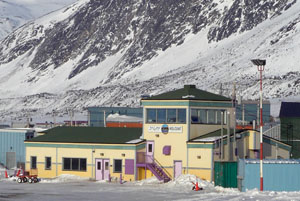
Pangnirtung Airport is located at Pangnirtung, Nunavut, Canada, and is operated by the Government of Nunavut.

Summerside Airport is located 3.5 nautical miles north-northwest of Summerside, Prince Edward Island, Canada.

Deer Lake Regional Airport is located 3 nautical miles north northeast of Deer Lake, Newfoundland and Labrador, Canada. It is currently run by the Deer Lake Regional Airport Authority and is the closest airport to Gros Morne National Park and Corner Brook. It is the second busiest airport on Newfoundland after St. John's International Airport serving 300,000 passengers annually. Deer Lake Airport serves a large area of Newfoundland, from the Great Northern Peninsula to Channel-Port aux Basques.
Charlo Airport is located 4.8 nautical miles south-southeast of Charlo, New Brunswick, Canada.
Cartwright Airport is 1.5 nautical miles southwest of Cartwright, Newfoundland and Labrador, Canada.
Churchill Falls Airport is owned and operated by Churchill Falls Labrador Corporation Limited. Provincial Airlines provides regularly scheduled passenger service at the airport, which handled about 1,400 passengers annually over between 2000 and 2003. The airport is located 4 nautical miles northwest of Churchill Falls, Newfoundland and Labrador, Canada.
Fogo Aerodrome is a local airport located 4 nautical miles south of Fogo, Newfoundland and Labrador, Canada on Fogo Island. It is the island's only infrastructure for air transport.
Port Hope Simpson Airport is 1 nautical mile south of Port Hope Simpson, Newfoundland and Labrador, Canada.

Postville Airport is located adjacent to Postville, Newfoundland and Labrador, Canada.
Chevery Airport is located on the north-eastern shore of the Gulf of Saint Lawrence, Quebec, Canada in the town of Chevery. It is uncontrolled but has an automated weather observation system (AWOS).
Havre Saint-Pierre Airport is located 3 nautical miles north of Havre-Saint-Pierre, Quebec, Canada. It serves Labrador, the lower and central North Shore and southern Quebec, including Anticosti Island.
Kégashka Airport is located 1 nautical mile north of Kegaska, Quebec, Canada.

La Tabatière Airport is an airport at La Tabatière, Quebec, Canada.
Natashquan Airport is located adjacent to Natashquan, Quebec, Canada.
Tête-à-la-Baleine Airport is located 2.5 nautical miles southwest of Tête-à-la-Baleine, Quebec, Canada.

Exploits Valley Air Services, also known as EVAS or EVAS Air, is a Canadian aviation services company, based in Gander, Newfoundland and Labrador.


