Rocky Mountain National Park is a national park of the United States located approximately 55 mi (89 km) northwest of Denver in north-central Colorado, within the Front Range of the Rocky Mountains. The park is situated between the towns of Estes Park to the east and Grand Lake to the west. The eastern and western slopes of the Continental Divide run directly through the center of the park with the headwaters of the Colorado River located in the park's northwestern region. The main features of the park include mountains, alpine lakes and a wide variety of wildlife within various climates and environments, from wooded forests to mountain tundra.

Pinus flexilis, the limber pine, is a species of pine tree in the family Pinaceae that occurs in the mountains of the Western United States, Mexico, and Canada. It is also called Rocky Mountain white pine.

The ecology of the Sierra Nevada, located in the U.S. states of California and Nevada, is diverse and complex. The combination of climate, topography, moisture, and soils influences the distribution of ecological communities across an elevation gradient from 500 to 14,500 feet. Biotic zones range from scrub and chaparral communities at lower elevations, to subalpine forests and alpine meadows at the higher elevations. Particular ecoregions that follow elevation contours are often described as a series of belts that follow the length of the Sierra Nevada. There are many hiking trails, paved and unpaved roads, and vast public lands in the Sierra Nevada for exploring the many different biomes and ecosystems.

The San Francisco Peaks are a volcanic mountain range in the San Francisco volcanic field in north central Arizona, just north of Flagstaff and a remnant of the former San Francisco Mountain. The highest summit in the range, Humphreys Peak, is the highest point in the state of Arizona at 12,633 feet (3,851 m) in elevation. The San Francisco Peaks are the remains of an eroded stratovolcano. An aquifer within the caldera supplies much of Flagstaff's water while the mountain itself is in the Coconino National Forest, a popular recreation site. The Arizona Snowbowl ski area is on the western slopes of Humphreys Peak, and has been the subject of major controversy involving several tribes and environmental groups.

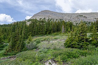
The Rocky Mountains subalpine zone is the biotic zone immediately below tree line in the Rocky Mountains of North America. In northern New Mexico, the subalpine zone occupies elevations approximately from 9,000 to 12,000 feet ; while in northern Alberta, the subalpine zone extends from 1,350 to 2,300 metres.

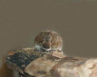
The Tatra pine vole, also called the Tatra vole or Tatra ground vole, is a species of vole endemic to the Carpathian mountain range in Slovakia, Poland, Ukraine and Romania. Two subspecies have been recognised. M. t. tatricus occupies the western part of the range in Slovakia and Poland, and M. t. zykovi is found in Ukraine and Romania.

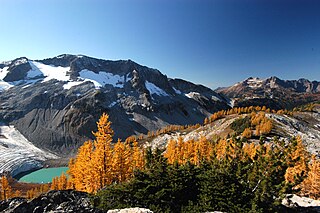
The Sierra Nevada subalpine zone refers to a biotic zone below treeline in the Sierra Nevada mountain range of California, United States. This subalpine zone is positioned between the upper montane zone at its lower limit, and tree line at its upper limit.

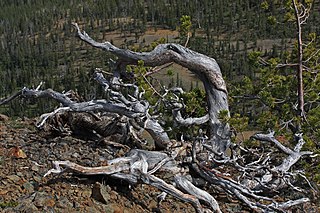
Krummholz — also called knieholz — is a type of stunted, deformed vegetation encountered in the subarctic and subalpine tree line landscapes, shaped by continual exposure to fierce, freezing winds. Under these conditions, trees can only survive where they are sheltered by rock formations or snow cover. As the lower portion of these trees continues to grow, the coverage becomes extremely dense near the ground. In Newfoundland and Labrador, the formation is known as tuckamore. Krummholz trees are also found on beaches such as the Oregon coast, where trees can become much taller than their subalpine cousins.

Caltha leptosepala, the white marsh marigold, twinflowered marsh marigold, or broadleaved marsh marigold, is a North American species of flowering plant in the buttercup family. The species has regionally distinct variations.
The biogeoclimatic zones of British Columbia are units of a classification system used by the British Columbia Ministry of Forests for the Canadian province's fourteen different broad, climatic ecosystems. The classification system, termed Biogeoclimatic Ecosystem Classification, exists independently of other ecoregion systems, one created by the World Wildlife Fund and the other in use by Environment Canada, which is based on one created by the Commission for Environmental Cooperation (CEC) and also in use by the US Environmental Protection Agency (EPA). The system of biogeoclimatic ecosystem classification was partly created for the purpose of managing forestry resources, but is also in use by the British Columbia Ministry of Environment and Climate Change Strategy and other provincial agencies. A biogeoclimatic zone is defined as "a geographic area having similar patterns of energy flow, vegetation and soils as a result of a broadly homogenous macroclimate."

The Ecology of the North Cascades is heavily influenced by the high elevation and rain shadow effects of the mountain range. The North Cascades is a section of the Cascade Range from the South Fork of the Snoqualmie River in Washington, United States, to the confluence of the Thompson and Fraser Rivers in British Columbia, Canada, where the range is officially called the Cascade Mountains but is usually referred to as the Canadian Cascades. The North Cascades Ecoregion is a Level III ecoregion in the Commission for Environmental Cooperation's classification system.

The ecology of the Rocky Mountains is diverse due to the effects of a variety of environmental factors. The Rocky Mountains are the major mountain range in western North America, running from the far north of British Columbia in Canada to New Mexico in the southwestern United States, climbing from the Great Plains at or below 1,800 feet (550 m) to peaks of over 14,000 feet (4,300 m). Temperature and rainfall varies greatly also and thus the Rockies are home to a mixture of habitats including the alpine, subalpine and boreal habitats of the Northern Rocky Mountains in British Columbia and Alberta, the coniferous forests of Montana and Idaho, the wetlands and prairie where the Rockies meet the plains, a different mix of conifers on the Yellowstone Plateau in Wyoming, the montane forests of Utah, and in the high Rockies of Colorado and New Mexico, and finally the alpine tundra of the highest elevations.

The North Central Rockies forests is a temperate coniferous forest ecoregion of Canada and the United States. This region overlaps in large part with the North American inland temperate rainforest and gets more rain on average than the South Central Rockies forests and is notable for containing the only inland populations of many species from the Pacific coast.

There are 62 named Ecological Systems found in Montana These systems are described in the Montana Field Guides-Ecological Systems of Montana.

The Siffleur Wilderness Area is a provincially designated wilderness area in the Canadian Rockies of Alberta. It was established in 1961 and it, as one of the three wilderness areas of Alberta, has the strictest form of government protection available in Canada. All development is forbidden and only travel by foot is permitted. Hunting and fishing are not allowed. The other two wilderness areas are White Goat Wilderness Area and Ghost River Wilderness Area and together the three areas total 249,548.80 acres (100,988.82 ha).

Montane ecosystems are found on the slopes of mountains. The alpine climate in these regions strongly affects the ecosystem because temperatures fall as elevation increases, causing the ecosystem to stratify. This stratification is a crucial factor in shaping plant community, biodiversity, metabolic processes and ecosystem dynamics for montane ecosystems. Dense montane forests are common at moderate elevations, due to moderate temperatures and high rainfall. At higher elevations, the climate is harsher, with lower temperatures and higher winds, preventing the growth of trees and causing the plant community to transition to montane grasslands and shrublands or alpine tundra. Due to the unique climate conditions of montane ecosystems, they contain increased numbers of endemic species. Montane ecosystems also exhibit variation in ecosystem services, which include carbon storage and water supply.
The ecology of the Himalayas varies with climate, rainfall, altitude, and soils. The climate ranges from tropical at the base of the mountains to permanent ice and snow at the highest elevations. The amount of yearly rainfall increases from west to east along the southern front of the range. This diversity of climate, altitude, rainfall and soil conditions supports a variety of distinct plant and animal species, such as the Nepal gray langur
Draba exunguiculata is a species of flowering plant in the family Brassicaceae known by the common names clawless draba and Grays Peak draba. It is endemic to Colorado in the United States.

Erigeron glacialis, the glacial daisy, glacial fleabane, Subalpine fleabane, or wandering fleabane, is a western North American perennial plant in the family Asteraceae.

Waterton Biosphere Region is a UNESCO Biosphere Reserve encompassing Waterton Lakes National Park in the extreme southwest of the Province of Alberta, Canada. The region includes a section of the east slopes of the Rocky Mountains extending from the Continental Divide to the edge of the Canadian Great Plains to the east, including the Municipality of Pincher Creek and Cardston County. The Glacier Biosphere Reserve and National Park in Montana, USA is located to the south of the area.


