Cherryville Township, Gaston County, North Carolina

Last updated
Cherryville Township, Gaston County, North Carolina
Country Flag of the United States.svg United States
State Flag of North Carolina.svg North Carolina
County Gaston
Area
  Total65.6 sq mi (170.0 km2)
  Land65.2 sq mi (168.8 km2)
  Water0.5 sq mi (1.3 km2)
Population
 (2010)
  Total16,500
  Density253/sq mi (97.8/km2)
FIPS code 37-90644 [1]
GNIS feature ID1026696 [1]

Cherryville Township is a township in northwestern Gaston County, North Carolina, United States. As of the 2010 census it had a population of 16,500. [2] It includes the incorporated city of Cherryville, the inactive incorporated town of Dellview, the unincorporated community of Tryon, and a portion of the town of High Shoals (most of which is in Dallas Township). It is represented on the Gaston County Board of Commissioners by Allen Fraley of Cherryville.

Contents

Demographics

Cherryville Township had a reported population in the 2000 United States Census of 15,724. This includes 5361 people in the incorporated City of Cherryville. The racial makeup of the township was 92.12% White, 6.24% African American, 0.20% Native American, 0.38% Asian, 0.54% from other races, and 0.51% from two or more races. Hispanic or Latino of any race were 2.07% of the population. [3]

Voting-age population figures from the 2000 Census are reported for each of the township's five voting precincts. Three of the precincts are in the northwestern part of the township near Cherryville, one in the south near Tryon, and one in the northeast near Landers Chapel Methodist Church. The township's total voting-age population was 8507, or itemized by area: [4]

Geography

Cherryville Township occupies a total area of 65.33 square miles (169.2 km2). Pasour Mountain, a monadnock ridge and local high point at elevation 1,220 feet (370 m), forms the boundary between Cherryville Township and Dallas Township to the east. [5]

Cherryville Township lies within six watersheds. The northwest corner of the township is in the Buffalo Creek watershed and the area southwest of Cherryville in the watershed of Muddy Fork Creek (itself a tributary of Buffalo Creek). These watersheds are in the Broad River catchment basin and most of their area is in Cleveland County. Highway 274 / Mountain Street generally follows the watershed separating the catchment basins of the Broad and Catawba rivers. Areas north of Cherryville are in the Indian Creek watershed, drained by Mill Creek, Lick Fork Creek and an unnamed tributary of Indian Creek. Indian Creek is a tributary of the South Fork Catawba River, entering the river near Laboratory, North Carolina. Most of central and eastern Cherryville Township is in the Beaverdam Creek watershed, drained by the 8.4-mile (13.5 km)-long Beaverdam Creek and its 4.8-mile (7.7 km)-long tributary Little Beaverdam Creek. Beaverdam Creek is a tributary of the South Fork Catawba River, entering the river near High Shoals. The southern section of the township is in the Long Creek watershed. Long Creek flows east through Bessemer City, Dallas, and Gastonia before emptying into the South Fork Catawba River in Ranlo. Finally, a small area in the far northeastern corner of the township is in the Hoyle Creek watershed. [6]

Community services

Fire protection in unincorporated areas of the township in provided by the Hughs Pond Volunteer Fire Department (VFD) in areas northwest of Cherryville, Waco Community Fire Department (of Cleveland County) southwest of Cherryville, Crouse VFD (of Lincoln County) northeast of Cherryville, Tryonota VFD southeast of Cherryville, High Shoals VFD in the northeast corner of the township, and Agricultural Center VFD in areas along the eastern boundary of the township. [7]

Education

Most of Cherryville Township is in the Cherryville High School attendance district. Students in southern parts of the township go to Bessemer City High School and far eastern parts to North Gaston High School in Dallas [8]

Religious life

Saint Mark's Lutheran Church (ELCA), located about 4 miles (6.4 km) east of the City of Cherryville, is one of the oldest churches in the township and is among the older Lutheran congregations in the entire Piedmont area (and in the Lutheran Synod of North Carolina). It was originally organized in 1790 as Beaver Dam Lutheran Church and located at a site about 1 mile (1.6 km) east of the present location. The first congregants were immigrants from southern Germany. The congregation moved to its present site in 1858 and changed the church's name to St. Marks. The cemetery at the original site was restored in 1992. [9]

Mount Zion Baptist Church, located 2.5 miles (4.0 km) northwest of Cherryville, is the oldest Baptist church in the township. It was organized on October 7, 1857. The site had been the location of a Presbyterian meeting house called Anthony's Meeting House, established on May 18, 1807. The meeting house later became an inter-denominational place of worship for Lutherans, Presbyterians, and Baptists, called Hebron Meeting House. [10]

Other rural churches in Cherryville Township include Zion Hill Baptist Church, Oak Grove AME Zion Church, Shady Grove Baptist Church (organized in 1881 [11] ), Iglesia Bautista Hispana, Creekside Community Church (Tryon), Concord United Methodist Church (Tryon), Mount Pisgah Baptist Church, Mount Beulah Baptist Church (organized 1916 [12] ), Sunnyside Baptist Church, Bethel Evangelical Lutheran Church, and Landers Chapel United Methodist Church.

Historic properties

Cherryville Township has three sites designated as Gaston County Historic Properties. [13] The Tryon County Courthouse site near the Tryon Community was the location of a courthouse at the time of the American Revolution. Bethel Lutheran Church in the eastern part of the township dates to 1893. The cemetery, school, and church building at Landers Chapel United Methodist Church in the northeastern part of the township date to 1875, 1912, and 1925, respectively. [14]

Related Research Articles

Gaston County, North Carolina U.S. county in North Carolina

Gaston County is a county in the U.S. state of North Carolina. As of the 2010 census, the population was 206,086. The county seat is Gastonia. Dallas served as the original county seat from 1846 until 1911.
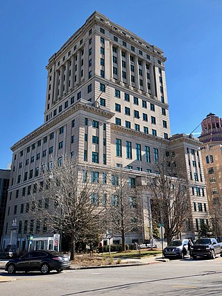
Belmont, North Carolina City in North Carolina, United States

Belmont is a small suburban city in Gaston County, North Carolina, United States, located about 15 miles (24 km) west of uptown Charlotte and 9 miles (14 km) east of Gastonia. The population was 10,076 at the 2010 census. Once known as Garibaldi Station, the name change for Belmont is disputed. Some say it was named for a prominent New York banker - August Belmont. Others contend the Pope ordered the abbot of the monastery to change the name since he would not tolerate an abbey in a place that bore the Garibaldi name. The abbot could see Crowder's mountain from the property and named the town Belmont - "beautiful mountain". Belmont is home to Belmont Abbey College.
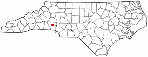
Cherryville, North Carolina City in North Carolina, United States

Cherryville is a small city in northwestern Gaston County, North Carolina, United States. The population was 5,760 at the 2010 census. The New Year's Shooters celebrate the area's German heritage by beginning each year with a customary chant and the honorary shooting of muskets. Cherryville is located approximately 40 miles (64 km) west of Charlotte and 13 miles (21 km) northwest of Gastonia.

Cramerton, North Carolina Town in North Carolina, United States

Cramerton is a small town in Gaston County, North Carolina, United States. It is a suburb of Charlotte and located east of Gastonia. The population was 4,165 at the 2010 census. A well-known feature is the Cramer Mountain gated development featuring homes around an 18-hole golf course at Cramer Mountain Country Club.

Dallas, North Carolina Town in North Carolina, United States

Dallas is a small town in Gaston County, North Carolina, and a suburb of Charlotte, located north of Gastonia. The population was 4,488 at the 2010 census. It was named for George M. Dallas, Vice President of the United States under James K. Polk.

High Shoals, North Carolina Town in North Carolina, United States

High Shoals is a town in Gaston County, North Carolina, United States named for the high rocky shoal across the Catawba River. The population was 696 at the 2010 census.

Lincolnton, North Carolina City in North Carolina, United States

Lincolnton is a small city in Lincoln County, North Carolina, United States, within the Charlotte metropolitan area. The population was 10,683 at the 2010 census. Lincolnton is northwest of Charlotte, on the South Fork of the Catawba River. The junction of State Highway 27 and U.S. Route 321 is located nearby. The city is the county seat of Lincoln County, and is the only legally incorporated municipality wholly within the rural county.

Larrys Creek tributary of the West Branch Susquehanna River

Larrys Creek is a 22.9-mile-long (36.9 km) tributary of the West Branch Susquehanna River in Lycoming County in the U.S. state of Pennsylvania. A part of the Chesapeake Bay drainage basin, its watershed drains 89.1 square miles (231 km2) in six townships and a borough. The creek flows south from the dissected Allegheny Plateau to the Ridge-and-valley Appalachians through sandstone, limestone, and shale from the Devonian, Mississippian, and Pennsylvanian periods.

Kettle Creek (Pennsylvania) tributary of the West Branch Susquehanna River

Kettle Creek is a tributary of the West Branch Susquehanna River running through Tioga, Potter, and Clinton counties, in Pennsylvania. It is slightly less than 43 miles (69 km) long. Although many streams in the Kettle Creek watershed are considered "Class A Wild Trout streams" by the Pennsylvania Fish and Boat Commission, the lower reaches of the stream experience acid mine drainage. The upper reaches of the creek are considered to be very high-quality.

Soque River river in the United States of America

The Soque River and its watershed are located entirely within the county boundaries of Habersham County in northeast Georgia. The Soque is a tributary of the Chattahoochee River. Portions of the river run along State Route 197.

Mehoopany Creek tributary of the Susquehanna River

Mehoopany Creek is a tributary of the Susquehanna River in Sullivan and Wyoming counties, Pennsylvania, in the United States. It is approximately 26.8 miles (43.1 km) long. In Sullivan County the creek flows through Colley Township and in Wyoming County it flows through Forkston Township and Mehoopany Township. The stream's watershed has an area of 123 square miles (320 km2). Its major tributaries include Stony Brook and North Fork Mehoopany Creek.

Dellview, North Carolina Town in North Carolina, United States

Dellview is an inactive incorporated town in Gaston County, North Carolina, United States. Its population was 13 at the 2010 census, and was at one point as low as 10.

Broad Run (Loudoun County, Virginia) tributary of the Potomac River in Virginia, United States

Broad Run is a tributary of the Potomac River in Loudoun County, Virginia. The creek, located between Goose Creek and Sugarland Run, principally drains portions of eastern Loudoun County, as well as a small portion of western Fairfax County.

Mount Ulla Township, Rowan County, North Carolina Township in North Carolina, United States

Mount Ulla Township is one of fourteen townships in Rowan County, North Carolina, United States. It is currently the smallest township in Rowan County by population.

Manchester Township, Dearborn County, Indiana Township in Indiana, United States

Manchester Township is one of fourteen townships in Dearborn County, Indiana. As of the 2010 census, its population was 3,215 and it contained 1,233 housing units.

Madison Township, Jefferson County, Indiana Township in Indiana, United States

Madison Township is one of ten townships in Jefferson County, Indiana, United States. As of the 2010 census, its population was 17,415 and it contained 8,087 housing units.

Milton Township, Jefferson County, Indiana Township in Indiana, United States

Milton Township is one of ten townships in Jefferson County, Indiana, United States. As of the 2010 census, its population was 896 and it contained 470 housing units.

Lockhart Township, Pike County, Indiana Township in Indiana, United States

Lockhart Township is one of nine townships in Pike County, Indiana, United States. As of the 2010 census, its population was 907 and it contained 433 housing units.

Tryon, Gaston County, North Carolina Unincorporated community in North Carolina, United States

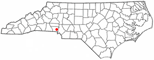
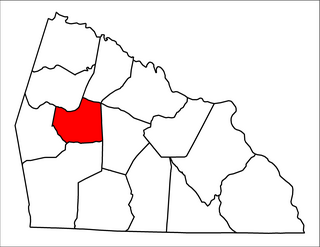
Tryon is an unincorporated community in Gaston County, North Carolina, United States. It is in Cherryville Township, located approximately 4.7 miles (7.6 km) southeast of the city of Cherryville on North Carolina Highway 274. The rural Gaston County election precinct centered on Tryon had a voting-age population of 1524 in the 2000 Census.

Fall Creek (Indiana)

Fall Creek is a navigable in law waterway in the U.S. state of Indiana, and a tributary of the White River. It is 57.5 miles (92.5 km) long and has a watershed drainage area of 318 square miles (820 km2) in central Indiana before flowing into the White River in Indianapolis. As it flows southwest, Fall Creek is the namesake of three townships in Indiana, in Henry County, Madison County, and then Hamilton County.

References

  1. 1 2 "US Board on Geographic Names". United States Geological Survey. 2007-10-25. Retrieved 2008-01-31.
  2. "Geographic Identifiers: 2010 Demographic Profile Data (G001): Cherryville township, Gaston County, North Carolina". U.S. Census Bureau, American Factfinder. Archived from the original on February 10, 2020. Retrieved March 27, 2013.
  3. Census of population and housing (2000): North Carolina Summary Population and Housing Characteristics. DIANE Publishing, ISBN   1-4289-8663-4
  4. Gaston County Census Tract Boundary Map & Election Precinct District Overlay Archived 2009-10-14 at the Wayback Machine , Gaston County official government website. Retrieved on 2008-08-03.
  5. USGS Geographic Names Information System. Retrieved on 2008-08-03.
  6. Gaston County Watersheds Archived 2008-04-04 at the Wayback Machine , Gaston County official government website. Retrieved on 2008-08-04.
  7. Gaston County Fire Districts Archived October 14, 2009, at the Wayback Machine , Gaston County official government website. Retrieved on 2008-08-03.
  8. Gaston County GIS Archived March 3, 2008, at the Wayback Machine , Gaston County official government website. Retrieved on 2008-08-03.
  9. History of Beaver Dam Lutheran Church Archived May 9, 2008, at the Wayback Machine . Retrieved on 2008-08-05.
  10. History of Mt. Zion Baptist Church Archived May 15, 2008, at the Wayback Machine . Retrieved on 2008-08-05.
  11. Shady Grove Baptist Church History Archived March 3, 2008, at the Wayback Machine . Retrieved on 2008-08-03.
  12. Mount Beulah Baptist Church History. Retrieved on 2008-08-04.
  13. Designated Gaston County Historic Properties Archived 2008-12-25 at the Wayback Machine , Gaston County official government website. Retrieved on 2008-08-03.
  14. Gaston County Historic Preservation Commission Year End Report 2006 Archived December 3, 2008, at the Wayback Machine , Gaston County official government website. Retrieved on 2008-08-03.

Coordinates: 35°22′06″N81°21′12″W / 35.36833°N 81.35333°W / 35.36833; -81.35333