High Shoals, North Carolina | |
---|---|
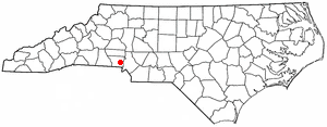
Coordinates: 35°23′45″N81°12′17″W / 35.39583°N 81.20472°W | |
Country | United States |
State | North Carolina |
County | Gaston |
Incorporated | November 6, 1973 |
Government | |
• Mayor | P.J. Rathbone |
Area | |
• Total | 2.66 sq mi (6.88 km2) |
• Land | 2.60 sq mi (6.74 km2) |
• Water | 0.06 sq mi (0.14 km2) |
Elevation | 715 ft (218 m) |
Population (2020) | |
• Total | 595 |
• Density | 228.67/sq mi (88.28/km2) |
Time zone | UTC-5 (Eastern (EST)) |
• Summer (DST) | UTC-4 (EDT) |
ZIP code | 28077 |
Area code | 704 |
FIPS code | 37-31440 [3] |
GNIS feature ID | 2405829 [2] |
High Shoals is a city [4] [5] in Gaston County, North Carolina, United States, named for the high rocky shoal across the Catawba River. [6] The population was 700 at the 2010 census. [7]
High Shoals was the location of the High Shoals Iron Works, founded by Swiss-born John Fulenwider in about 1795. Fulenwider developed one of the earliest methods of making pig iron with the charcoal process. During the War of 1812, his High Shoals ironworks produced cannonballs for use by the United States Army. Fulenwider died in 1826 and is buried at High Shoals cemetery. The ironworks he developed remained in operation until 1875. [8]
In the last decade of the 19th century, the community of High Shoals became totally owned by High Shoals Mills, a textile company founded by Charlotte industrialist Daniel A. Tompkins. [9]
Eventually, the mill homes were sold to private owners. High Shoals was incorporated on November 6, 1973, the most-recently incorporated municipality in Gaston County. [10]
According to the United States Census Bureau, the town has a total area of 2.7 square miles (6.9 km2), of which 2.6 square miles (6.7 km2) is land and 0.04 square miles (0.1 km2), or 2.10%, is water. [7]
The South Fork Catawba River flows through High Shoals. Areas northeast of the river are assigned to the Hoyle Creek watershed, while those southwest of the river are in the Beaverdam Creek watershed. Sulfur Branch flows through western High Shoals (including Briarcreek Golf Course) and enters the South Fork at the south end of town.
Most of High Shoals is located in Dallas Township, except for a western portion of the town which is in Cherryville Township.
Census | Pop. | Note | %± |
---|---|---|---|
1980 | 586 | — | |
1990 | 605 | 3.2% | |
2000 | 729 | 20.5% | |
2010 | 696 | −4.5% | |
2020 | 595 | −14.5% | |
U.S. Decennial Census [11] |
As of the census [3] of 2000, there were 729 people, 284 households, and 214 families residing in the town. The population density was 407.5 inhabitants per square mile (157.3/km2). There were 315 housing units at an average density of 176.1 per square mile (68.0/km2). The racial makeup of the town was 88.07% White, 9.33% African American, 0.27% Native American, 0.14% from other races, and 2.19% from two or more races. Hispanic or Latino of any race were 2.33% of the population.
There were 284 households, out of which 38.7% had children under the age of 18 living with them, 51.8% were married couples living together, 19.0% had a female householder with no husband present, and 24.6% were non-families. 21.5% of all households were made up of individuals, and 8.5% had someone living alone who was 65 years of age or older. The average household size was 2.57 and the average family size was 2.96.
In the town, the population was spread out, with 29.2% under the age of 18, 8.9% from 18 to 24, 34.6% from 25 to 44, 17.7% from 45 to 64, and 9.6% who were 65 years of age or older. The median age was 31 years. For every 100 females, there were 96.5 males. For every 100 females age 18 and over, there were 96.9 males.
The median income for a household in the town was $33,906, and the median income for a family was $36,429. Males had a median income of $31,711 versus $20,833 for females. The per capita income for the town was $14,881. About 15.5% of families and 17.5% of the population were below the poverty line, including 25.5% of those under age 18 and 18.1% of those age 65 or over.
Public education in High Shoals is administered by the Gaston County Schools public school system. There had been one elementary school in the town. However, High Shoals Elementary was closed in 1998 for financial reasons and consolidated with Costner Elementary School near Dallas, North Carolina. [12]
Today, most of High Shoals is within the attendance district for Costner Elementary, except for a section on the eastern edge of town which belongs to the attendance district of Springfield Elementary School (grades K-2) and Kiser Elementary School (grades 3-5), both in Stanley. All elementary school graduates from High Shoals feed into W.C. Friday Middle School and North Gaston High School, both in Dallas. [13]
Churches in High Shoals include First Baptist Church, New Heights Baptist Church, High Shoals Church of God, and Riverview True Holiness Church of God.
Lincoln County is a county located in the U.S. state of North Carolina. As of the 2020 census, the population was 86,810, making it the most populous "Lincoln County" in the United States. Its county seat is Lincolnton. Lincoln County is included in the Charlotte-Concord-Gastonia, NC-SC Metropolitan Statistical Area.
Gaston County is a county in the U.S. state of North Carolina. As of the 2020 census, the population was 227,943. The county seat is Gastonia. Dallas served as the original county seat from 1846 until 1911.
Catawba County is a county in the U.S. state of North Carolina. As of the 2020 census, the population was 160,610. Its county seat is Newton, and its largest community is Hickory.
Valdese is a town in Burke County, North Carolina, United States. The population was 4,689 at the 2020 census. It is part of the Hickory-Lenoir-Morganton Metropolitan Statistical Area. One of the largest Waldensian congregations in the United States was founded in the town in the late nineteenth century, now known as the Waldensian Presbyterian Church. The town was settled by immigrants from the Cottian Alps in the Piedmont region of Italy.
Granite Falls is a town in Caldwell County, North Carolina, United States. The population was 4,722 at the 2010 census. It is part of the Hickory–Lenoir–Morganton Metropolitan Statistical Area.
Sherrills Ford is an unincorporated community and former census-designated place (CDP) in Catawba County, North Carolina, United States. Since the 2010 census, it has been included within the Lake Norman of Catawba CDP. It is part of the Hickory-Lenoir-Morganton Metropolitan Statistical Area.
Belmont is a small suburban city in Gaston County, North Carolina, United States, located about 9 miles (14 km) east of Gastonia. The population was 10,076 at the 2010 census. Once known as Garibaldi Station, it was named for the New York banker August Belmont. Belmont is home to Belmont Abbey College.
Cramerton is a small town in Gaston County, North Carolina, United States. It is a suburb of Charlotte and located east of Gastonia. The population was 4,165 at the 2010 census. A well-known feature is the Cramer Mountain gated development, featuring homes around an 18-hole golf course at Cramer Mountain Country Club.
Dallas is a town in Gaston County, North Carolina, United States, and a suburb of Charlotte, located north of Gastonia. The population was 4,488 at the 2010 census. It was named for George M. Dallas, Vice President of the United States under James K. Polk.
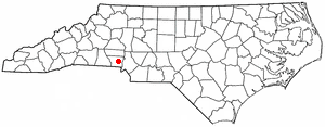
Lowell is a small city in Gaston County, North Carolina, United States, located east of Gastonia. The population was 3,526 at the 2010 census.
McAdenville is a small town in Gaston County, North Carolina, United States. It is a suburb of Gastonia and located east of Gastonia. The population was 890 at the 2020 census.
Mount Holly is a small suburban city in northeastern Gaston County, North Carolina, United States. The city is situated just west of the Catawba River, north of Interstate 85, south of North Carolina State Highway 16. The population was 17,703 at the 2020 census, up from 13,656 in 2010.
Stanley is a town in Gaston County, North Carolina, United States. The population was 3,556 at the 2010 census.
Lincolnton is a city in Lincoln County, North Carolina, United States within the Charlotte metropolitan area. The population was 10,486 at the 2010 census. Lincolnton is northwest of Charlotte, on the South Fork of the Catawba River. The city is the county seat of Lincoln County.
Gaston is a town in Northampton County, North Carolina, United States. The population was 1,152 at the 2010 census. It is part of the Roanoke Rapids, North Carolina Micropolitan Statistical Area.
Madison is a town located in Rockingham County, North Carolina. At the 2020 census, the town had a total population of 2,132. Madison is part of the Greensboro-High Point Metropolitan Statistical Area of the Piedmont Triad metro region. It was home to the corporate headquarters of Remington Arms until 2020, when the company was made defunct by bankruptcy proceedings. It is still home to Marlin Firearms, which was an asset of Remington now owned by Sturm, Ruger & Co.
Gaston is a town in Lexington County, South Carolina, United States. The population was 1,645 at the 2010 census. It is part of the Columbia, South Carolina Metropolitan Statistical Area.
Clover is a town in York County, South Carolina, United States. It is located in the greater Charlotte metropolitan area. As of 2020, the population was at 6,671 within the town limits. Clover is twinned with the Northern Irish town of Larne on County Antrim's East Coast.
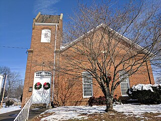
Maiden is a town in Catawba and Lincoln counties in the U.S. state of North Carolina. The population was 3,310 at the 2010 census.
Piedmont is a census-designated place (CDP) along the Saluda River in Anderson and Greenville counties in the U.S. state of South Carolina. The population was 5,411 at the 2020 census.