Ranlo, North Carolina

Last updated

Ranlo, North Carolina
Motto: 
“Built with Pride”
NCMap-doton-Ranlo.PNG
Location of Ranlo, North Carolina
Coordinates: 35°17′24″N81°07′39″W / 35.29000°N 81.12750°W / 35.29000; -81.12750
CountryUnited States
State North Carolina
County Gaston
Government
  MayorLynn Black
Area
[1]
  Total2.06 sq mi (5.34 km2)
  Land2.06 sq mi (5.34 km2)
  Water0.00 sq mi (0.01 km2)
Elevation
[2]
810 ft (250 m)
Population
 (2020)
  Total4,511
  Density2,189.81/sq mi (845.37/km2)
Time zone UTC-5 (Eastern (EST))
  Summer (DST) UTC-4 (EDT)
ZIP code
28054
Area code 704 & 980
FIPS code 37-55260 [3]
GNIS feature ID2407175 [2]
Website www.ranlo.org

Ranlo is a small town in Gaston County, North Carolina, United States and a suburb of Charlotte, located north of Gastonia. As of the 2020 census, the town population was 4,511, [4] up from 3,434 in 2010.

Contents

Geography

According to the United States Census Bureau, the town has 2.06 sq. mi of land and 0.002 sq. mi of water. [5]

History

Ranlo was named for John Calvin Rankin and William Thomas Love, two prominent area industrialists - "Ranlo" was a contraction of RANkin and LOve. The community grew up around their textile mills, which produced cotton goods. Rex Spinning Company was begun in 1915, Ranlo Manufacturing Company in 1916, and Priscilla Spinning Company in 1921. Nearby, the community of Smyre was developed around the A. M. Smyre Manufacturing Company, which was founded in 1917. In 1963, Ranlo and Smyre were incorporated as the Town of Ranlo, in reaction to the concern over possible annexation into Gastonia. [6] However, the part of the Smyre mill village south of the Norfolk Southern Railway was not included, and was eventually annexed by Gastonia in June 1996. [7]

Row houses were erected in the 1920s and 1930s and still stand today. At the time, they were owned by the mill and rented at very low rates to workers. They have long since been sold to individuals, and the mills are 75-80% closed. Only one or two still operate and they are at low capacity. The town, however, has become a "bedroom community" and prides itself on its facilities and growth. New industry has started to move in and new neighborhoods are being built.

Demographics

Historical population
CensusPop.Note
1970 2,092
1980 1,774−15.2%
1990 1,650−7.0%
2000 2,19833.2%
2010 3,43456.2%
2020 4,51131.4%
U.S. Decennial Census [8]

2020 census

Ranlo racial composition [9]
RaceNum.Perc.
White (non-Hispanic)2,59957.61%
Black or African American (non-Hispanic)1,03823.01%
Native American 180.4%
Asian 1162.57%
Other/Mixed 1884.17%
Hispanic or Latino 55212.24%

As of the 2020 United States census, there were 4,511 people, 1,346 households, and 972 families residing in the town.

2000 census

As of the census [3] of 2000, there were 2,198 people, 857 households, and 642 families residing in the town. The population density was 1,598.5 inhabitants per square mile (617.2/km2). There were 917 housing units at an average density of 666.9 per square mile (257.5/km2). The racial makeup of the town was 91.86% White, 6.10% African American, 0.32% Native American, 0.36% Asian, 0.27% Pacific Islander, 0.14% from other races, and 0.96% from two or more races. Hispanic or Latino of any race were 0.55% of the population.

There were 857 households, out of which 26.5% had children under the age of 18 living with them, 56.2% were married couples living together, 14.4% had a female householder with no husband present, and 25.0% were non-families. 21.2% of all households were made up of individuals, and 9.1% had someone living alone who was 65 years of age or older. The average household size was 2.56 and the average family size was 2.95.

In the town, the population was spread out, with 23.0% under the age of 18, 7.7% from 18 to 24, 28.4% from 25 to 44, 26.3% from 45 to 64, and 14.6% who were 65 years of age or older. The median age was 38 years. For every 100 females, there were 95.0 males. For every 100 females age 18 and over, there were 89.8 males.

The median income for a household in the town was $35,160, and the median income for a family was $40,391. Males had a median income of $31,534 versus $21,250 for females. The per capita income for the town was $17,180. About 6.7% of families and 8.1% of the population were below the poverty line, including 12.3% of those under age 18 and 7.8% of those age 65 or over.

Related Research Articles

<span class="mw-page-title-main">Porterdale, Georgia</span> Town in Georgia, United States

Porterdale is a town in Newton County, Georgia, the United States. The population was 1,429 at the 2010 census.

<span class="mw-page-title-main">Belwood, North Carolina</span> Town in North Carolina, United States

Belwood is a town in Cleveland County, North Carolina, United States. The population was 950 at the 2010 census.

<span class="mw-page-title-main">Belmont, North Carolina</span> City in North Carolina, United States

Belmont is a small suburban city in Gaston County, North Carolina, United States, located about 13 miles (21 km) west of uptown Charlotte and 9 miles (14 km) east of Gastonia. The population was 10,076 at the 2010 census. Once known as Garibaldi Station, it was named for the New York banker August Belmont. Belmont is home to Belmont Abbey College.

<span class="mw-page-title-main">Bessemer City, North Carolina</span> City in North Carolina, United States

Bessemer City is a small suburban city in Gaston County, North Carolina, United States. The population is 5,340. The city is approximately 6 miles (10 km) northwest of Gastonia and 25 miles (40 km) west of Charlotte. It was settled in 1756 and founded in 1893.

<span class="mw-page-title-main">Cramerton, North Carolina</span> Town in North Carolina, United States

Cramerton is a small town in Gaston County, North Carolina, United States. It is a suburb of Charlotte and located east of Gastonia. The population was 4,165 at the 2010 census. A well-known feature is the Cramer Mountain gated development, featuring homes around an 18-hole golf course at Cramer Mountain Country Club.

<span class="mw-page-title-main">Dallas, North Carolina</span> Town in North Carolina, United States

Dallas is a town in Gaston County, North Carolina, United States, and a suburb of Charlotte, located north of Gastonia. The population was 4,488 at the 2010 census. It was named for George M. Dallas, Vice President of the United States under James K. Polk.

<span class="mw-page-title-main">Gastonia, North Carolina</span> City in North Carolina, United States

Gastonia is the most populous city in and county seat of Gaston County, North Carolina, United States. It is the second-largest satellite city of the Charlotte area, behind Concord. The population was 80,411 in the 2020 census, up from 71,741 in 2010. Gastonia is the 13th-most populous city in North Carolina. It is part of the Charlotte-Concord-Gastonia, NC-SC Metropolitan Statistical Area, which is part of the Charlotte-Concord, NC-SC Combined Statistical Area.

<span class="mw-page-title-main">High Shoals, North Carolina</span> City in North Carolina, United States

High Shoals is a city in Gaston County, North Carolina, United States, named for the high rocky shoal across the Catawba River. The population was 696 at the 2010 census.

<span class="mw-page-title-main">Lowell, North Carolina</span> City in North Carolina, United States

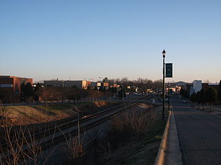
Lowell is a small city in Gaston County, North Carolina, United States, located east of Gastonia. The population was 3,526 at the 2010 census.

<span class="mw-page-title-main">McAdenville, North Carolina</span> Town in North Carolina, United States

McAdenville is a small town in Gaston County, North Carolina, United States. It is a suburb of Charlotte and located east of Gastonia. The population was 890 at the 2020 census.

<span class="mw-page-title-main">Mount Holly, North Carolina</span> City in North Carolina, United States

Mount Holly is a small suburban city in northeastern Gaston County, North Carolina, United States. The city is situated just west of the Catawba River, north of Interstate 85, south of North Carolina State Highway 16, and west of Charlotte. The population was 17,703 at the 2020 census, up from 13,656 in 2010.

<span class="mw-page-title-main">South Gastonia, North Carolina</span> Neighborhood in Gaston, North Carolina, United States

South Gastonia is a neighborhood of Gastonia in Gaston County, North Carolina, United States. The population was 5,433 at the 2000 census, at which time it was erroneously listed as a census-designated place. The majority of the community has now been annexed into the city of Gastonia and is now considered to be a neighborhood on the southside of Gastonia.

<span class="mw-page-title-main">Spencer Mountain, North Carolina</span> Town in North Carolina, United States

Spencer Mountain is a town in Gaston County, North Carolina, United States. The population was 37 at the 2010 census.

<span class="mw-page-title-main">St. Pauls, North Carolina</span> Town in North Carolina, United States

St. Pauls is a town in Robeson County, North Carolina, United States. The population was 2,035 at the 2010 census.

<span class="mw-page-title-main">Spindale, North Carolina</span> Town in North Carolina, United States

Spindale is a town in Rutherford County, North Carolina, United States. The population was 4,321 at the 2010 census.

<span class="mw-page-title-main">Whitmire, South Carolina</span> Town in South Carolina, United States

Whitmire is a town in Newberry County, South Carolina, United States, along the Enoree River. The population was 1,441 at the 2010 census. The town was named for George Fredrick Whitmire, who came from Stuttgart, Germany.

<span class="mw-page-title-main">Clover, South Carolina</span> Town in South Carolina, United States

Clover is a town in York County, South Carolina, United States. It is located in the greater Charlotte metropolitan area. As of 2020, the population was at 6,671 within the town limits. Clover is twinned with the Northern Irish town of Larne on County Antrim's East Coast.

<span class="mw-page-title-main">Maiden, North Carolina</span> Town in North Carolina, United States

Maiden is a town in Catawba and Lincoln counties in the U.S. state of North Carolina. The population was 3,310 at the 2010 census.

<span class="mw-page-title-main">Kings Mountain, North Carolina</span> City in North Carolina, United States

Kings Mountain is a small suburban city within the Charlotte metropolitan area in Cleveland and Gaston counties, North Carolina, United States. Most of the city is in Cleveland County, with a small eastern portion in Gaston County. The population was 10,296 at the 2010 census.

<span class="mw-page-title-main">Honea Path, South Carolina</span> Town in South Carolina, United States

Honea Path is a town primarily in Anderson County, South Carolina and extending into Abbeville County in the northwest part of the state. The population was 3,686 at the 2020 census.

References

  1. "ArcGIS REST Services Directory". United States Census Bureau. Retrieved September 20, 2022.
  2. 1 2 U.S. Geological Survey Geographic Names Information System: Ranlo, North Carolina
  3. 1 2 "U.S. Census website". United States Census Bureau . Retrieved January 31, 2008.
  4. "Explore Census Data". data.census.gov. Retrieved April 11, 2022.
  5. "2023 U.S. Gazetteer Files – Places – North Carolina". United States Census Bureau.
  6. Robert A. Ragan. "Ranlo: Another town spun from textile mills", Gaston Gazette, September 23, 2001. Retrieved from Gaston-Lincoln Regional Library System Archived 2008-04-10 at the Wayback Machine on 2008-07-13.
  7. Smyre Village Plan Archived 2007-10-24 at the Wayback Machine , City of Gastonia, May 16, 2000, retrieved on 2008-07-13
  8. "Census of Population and Housing". Census.gov. Retrieved June 4, 2015.
  9. "Explore Census Data". data.census.gov. Retrieved December 19, 2021.