Nadapuram is a census town and a special grade Panchayath located in Kozhikode District of Kerala, coming under Nadapuram assembly constituency. It is in North Malabar region of Kerala, India; spread over an area of 20.44 km2
Edacheri is a small panchayath in the district of Kozhikode in the South Indian state of Kerala.
Villiappally is a census town in Kozhikode district in the Indian state of Kerala. Villiappally is the headquarters of Villiappally Panchayath, which contains two villages, Memunda and Villiappally. There is a Vocational Higher Secondary School in this village.The name "villiyapalli" came from "valiya palli(Big mosque)"in Malayalam language turns to name of the city which was built by late Jawa Ahmmed Haji.

Kulathuvayal is a place near Perambra in Kozhikode district of Kerala state, India. Administratively, Kulathuvayal comes under the Chakkittapara panchayat, Perambra block panchayat and Koyilandy Taluk.

Chempanoda/Chempanod is a village located in the northeastern part of the Kozhikode district of Kerala, India. It is situated near the popular tourist destination of Peruvannamuzhi.
Azhiyoor is a village in Vatakara taluk of Kozhikode district in the state of Kerala, India. Azhiyur is part of Greater Mahé Region.. Mahé Railway Station is located nearby Azhiyoor.
Eramala is a village in Kozhikode district, Kerala, India. Orkkatteri is the main town in the village. The village is also home to a popular annual celebration called Orkkatteri Chantha.
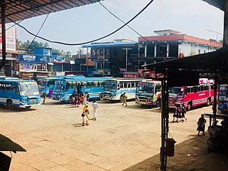
Kodanchery is a town in Kozhikode district in the state of Kerala, India.

Maniyur Grama Panchayat is located in Vadakara Taluk, in the Kozhikode district in the state of Kerala, India. It covers an area of 31.03 km2.

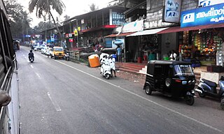
Purameri is a Village Panchayat in Kozhikode district of North Malabar region in the Indian state of Kerala. It is located in the north-western part of the district, on the way from Vatakara to Nadapuram.
Valayam is a town in Kozhikode district in the state of Kerala, India.
Anamangad is a village in Malappuram district in the state of Kerala, India.
Morayur or Morayoor is a tiny town near Malappuram Located on Palakkad-Kozhikoad Highway. It is one of the villages in Malappuram district of state of Kerala.

Triprangode is a village in Malappuram district in the state of Kerala, India. As of 2001 India census, Triprangode had a population of 37175 with 17422 males and 19753 females. Three sides of the village is surrounded by water bodies.
Urangattiri is a village in Malappuram district in the state of Kerala, India. It is situated in the valley of Chaliyar. There are 21 wards in this village.
Kattippara often called as Kattipara, is a Panchayat in Kozhikode district, Kerala. It is located about 10 km from Thamarassery town. It is a village with a lot of hilly areas. As the name indicates, it is famous for hard rocks which we can find everywhere in this village. The adjacent villages are Thalayad, Chamal, Kolikkal, Unnikulam, Puthupadi and Thamarassery.
Puthantheru is a small town on the coastline between Tirur and Tanur Malappuram district of Kerala state, South India. Previously it was called Theru, but as the town developed its name became Puthantheru. It comes under Tanalur Gram panchayat.
Chelamala is a hilly village in Malappuram district in Kerala. It is located about 20 kilometres (12 mi) east of the city of Malappuram.
Karinkallathani is a town in Perinthalmanna taluk of the Malappuram district of the Indian state of Kerala.

Chamal is a village under Kattippara, village panchayat in Koduvally, Kozhikode district, Kerala, India. It is situated near National Highway-212 and also 3 km distance from Kattippara. In Chamal there is a post office, South Malabar Gramin Bank, school up to 7th standard, Masjid and Church. It is located about 10 km from Thamarassery town. It is a village with a lot of hilly areas. The adjacent villages are Chundakuzhy, Perumpally, Thalayad, Unnikulam, Puthuppadi and Thamarassery.

