| Chung Mei | |||||||||
|---|---|---|---|---|---|---|---|---|---|
| Traditional Chinese | 涌尾 | ||||||||
| |||||||||


Chung Mei is an area on the Tsing Yi Island in Hong Kong. It is also the name of a village on the island.
| Chung Mei | |||||||||
|---|---|---|---|---|---|---|---|---|---|
| Traditional Chinese | 涌尾 | ||||||||
| |||||||||
Chung Mei is an area on the Tsing Yi Island in Hong Kong. It is also the name of a village on the island.
Chung Mei means the end (尾) of a stream (涌),in Cantonese. It might refer the stream of Liu To or a much shorter where the former villages sited. Both streams are located near the Tsing Yi Lagoon. [1]
The original Chung Mei was located on the valley at the present-day Lam Tin Resite Village,below Tiger's Head (虎頭山). Chung Mei was two villages. One was Ha Chung Mei (下涌尾),namely "lower Chung Mei". Another was Sheung Chung Mei (上涌尾),namely "upper Chung Mei". While Ha Chung Mei was sited near the Tsing Yi Lagoon,Sheung Chung Mei was sited higher on valley. [1] The position of Ha Chung Mei is close to present-day TWGHs S. C. Gaw Memorial College. The stream of Liu To and Sheung Chung Mei made cultivation available. According to James Hayes,the cultivation on the island was mainly rice and pineapple.
Along the shore of Tsing Yi Lagoon,from the villages,to the east was Sheung Ko Tan and to the north was Tai Wong Ha. The Tsing Yi Town was at the northeast of Chung Mei,across the lagoon. [1]
In the 1980s,the villages were forced to re-site during the expansion of Tsuen Wan New Town. The original Chung Mei and its surrounding was flatten and reclaimed for re-siting four villages on the Tsing Yi Island. The villages of Chung Mei was combined with Lo Uk (老屋) and relocated east on the higher ground above Sheung Ko Tan. The resited villages was named Chung Mei Lo Uk Tsuen (涌美老屋村) though they are administrated separately. Apart from villages,owing to the destruction of old Tsing Yi Town,many retailers have moved their shops into this village and formed a market. The market still operates everyday even though many new markets were built on the island.
As the new establishment of the village,the name of Chung Mei also commonly refers to its present site and surrounding villages,rather than its former location.
The original Chung Mei Tsuen was composed of indigenous inhabitants of Chan (陳) family. They have representatives in the Tsing Yi Rural Committee,a composition organisation of Heung Yee Kuk. But after the relocation,many outsiders moved in. The villages thus also has to create one representative for non-indigenous inhabitants. [2]
The villages of Chung Mei and Lo Uk are recognized villages under the New Territories Small House Policy. [3]
West of Chung Mei is an unnamed valley. To its east is resite village of Sheung Ko Tan and Tsing Yi Lutheran Village.
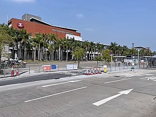
There is one road named after the village,namely Chung Mei Road. The road connects Ching Hong Road and Tsing Yi Heung Sze Wui Road. It is one of major roads of the island.
Across Chung Mei Road is Cheung Hong Estate,the largest public housing estates on the island.

Kwai Tsing is one of the 18 districts of Hong Kong. It consists of two parts - Kwai Chung and Tsing Yi Island. Kwai Tsing is part of the New Territories. It had a population of 520,572 in 2016. The district has the third least educated residents and their income is below average.

Tsing Yi,sometimes referred to as Tsing Yi Island,is an island in the urban area of Hong Kong,to the northwest of Hong Kong Island and south of Tsuen Wan. With an area of 10.69 km2 (4.13 sq mi),the island has extended drastically by reclamation along almost all its natural shore and the annexation of Nga Ying Chau (牙鷹洲) and Chau Tsai. Three major bays or harbours,Tsing Yi Lagoon,Mun Tsai Tong and Tsing Yi Bay (青衣灣) in the northeast,have been completely reclaimed for new towns.

North District is the northernmost district of the 18 districts of Hong Kong. It is located in the northeastern part of the New Territories. The new town of Fanling–Sheung Shui is within this district. It had a population of 298,657 in 2001. The district has the second lowest population density in Hong Kong.

Kwai Chung is an urban area within Tsuen Wan New Town in the New Territories of Hong Kong. Together with Tsing Yi Island,it is part of the Kwai Tsing District District of Hong Kong. It is also part of Tsuen Wan New Town.

Most of the walled villages of Hong Kong are located in the New Territories.
Kam Sheung Road is an MTR station on the Tuen Ma line,located between Pat Heung and Kam Tin in Hong Kong. It is situated between Tsuen Wan West and Yuen Long stations. Kam Sheung Road was the arena for the KCR West Rail's opening ceremony.

Nam Chung is an area in the north eastern New Territories of Hong Kong,west of Luk Keng and to the southwest of the Starling Inlet,opposite Sha Tau Kok.

Tsing Yi Bay was a bay on the east side of Hong Kong's Tsing Yi Island,beside the Rambler Channel,approximately on the site of modern-day Tsing Yi Park. The whole bay was reclaimed for the development of new town. Before reclamation,it was surrounded by places known as Tsing Leng Tsui,Sheung Ko Tan (上高灘),Ha Chung Mei,Tai Wong Ha and Tsing Yi Town. The names of these places have since changed,and can now be translated,approximately,as Grand Horizon,Green Field Garden,Fung Shue Wo Road,Tsing Yi Estate and Tsing Yi Garden.
Rural committee is a body representing the welfare of indigenous residents in the New Territories of Hong Kong. The chairman of each rural committee is the representative in the Heung Yee Kuk,and is ex officio member of a district council.

Kwai Chung Road is a throughway in Kwai Chung of the New Territories in Hong Kong. It is one of the busiest roads in Hong Kong. The Transport Department has classified it as a trunk road.
The generic forms of Hong Kong place names are mainly Cantonese,Hakka and British English,although other languages also contribute to Hong Kong place names.

Tsing Yi Police Station,once also known as Tsing Yi Division Police Station (青衣分區警署) is the only police station on Tsing Yi Island in Hong Kong. The station is located at Tsing Yi Heung Sze Wui Road,between Tsing Yi Police Married Quarters and Tsing Yi Fire Station,below Chung Mei Tsuen of Ha Ko Tan. Its front faces Greenfield Garden,a private housing estate.
Articles related to Hong Kong include:
Tsing Yi Hui was a town on Tsing Yi Island,Hong Kong. Many people at that time referred to the town as Tsing Yi Main Street (青衣大街),namely the main street of the town.
Coordinates: 22°21′05″N114°06′18″E / 22.351366°N 114.10497°E