Montana is a landlocked state in the Mountain West subregion of the Western United States. It borders Idaho to the west, North Dakota and South Dakota to the east, Wyoming to the south, and the Canadian provinces of Alberta, British Columbia, and Saskatchewan to the north. It is the fourth-largest state by area, the eighth-least populous state, and the third-least densely populated state. Its capital is Helena, while the most populous city is Billings. The western half of the state contains numerous mountain ranges, while the eastern half is characterized by western prairie terrain and badlands, with smaller mountain ranges found throughout the state.

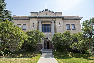
Granite County is a county located in the U.S. state of Montana. As of the 2020 census, the population was 3,309. Its county seat is Philipsburg. The county was founded in 1893, and was named for a mountain which contains the Granite Mountain silver mine.

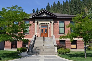
Shoshone County is a county in the U.S. state of Idaho. As of the 2020 census, the population was 13,169. The county seat is Wallace and the largest city is Kellogg. The county was established in 1864, named for the Native American Shoshone tribe.

The Tobacco Root Mountains lie in the northern Rocky Mountains, between the Jefferson and Madison Rivers in southwest Montana. The highest peak is Hollowtop at 10,604 feet (3,232 m). The range contains 43 peaks rising to elevations greater than 10,000 feet (3048 m).

Montana Highway 83 (MT 83) is a 91.118-mile-long (146.640 km) north–south state highway in Flathead, Lake, and Missoula counties in Montana, United States, that connects Montana Highway 200 (MT 200) in Clearwater with Montana Highway 35 (MT 35) on north edge of Bigfork.

Montana Highway 87 (MT 87) is a primary state highway in Madison County in Montana, United States. The highway travels through mainly rural areas in Raynolds Pass, from the Montana–Idaho state line to an intersection with U.S. Route 287 (US 287). The route travels through a portion of Gallatin National Forest. In 1922, a road in the location of MT 87 was added to the highway system, and a few years later the road was designated as portions of two early auto trails. In 1959, the route was rapidly improved due to the collapse of US 287 nearby. During 1967, much of the highway was reconstructed along its current location.

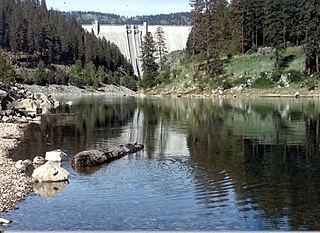
The North Fork Clearwater River is a major tributary of the Clearwater River in the U.S. state of Idaho. From its headwaters in the Bitterroot Mountains of eastern Idaho, it flows 135 miles (217 km) westward and is dammed by the Dworshak Dam just above its mouth in north-central Idaho. Draining a rugged watershed of 2,462 square miles (6,380 km2), the river has an average flow of over 5,600 cubic feet per second (160 m3/s), accounting for a third of the discharge from the Clearwater basin. The river drains parts of Clearwater, Shoshone, Latah, and Idaho counties. Most of the watershed is managed by the U.S. Forest Service. Some of the fish of the river include westslope cutthroat trout, rainbow trout, mountain whitefish, and the threatened bull trout. It also has smallmouth bass and a kokanee salmon run, both from Dworshak Reservoir. The North Fork drainage is home to grizzly bears, cougars, deer, moose, black bear, elk, grey wolves, and osprey. The river used to have a large steelhead run before the implementation of Dworshak Dam. The North Fork of the Clearwater is located within the Clearwater National Forest

The Middle Fork Clearwater River is a short, but high volume river in Idaho County, Idaho, United States and is the major source of the Clearwater River, a tributary of the Snake River.

The Idaho Batholith ecoregion is a Level III ecoregion designated by the United States Environmental Protection Agency (EPA) in the U.S. states of Idaho and Montana. It is contained within the following biomes designated by the World Wild Fund for Nature (WWF): temperate coniferous forests; temperate grasslands, savannas, and shrublands; and deserts and xeric shrublands.

Placid Lake State Park is a public recreation area located 28 miles (45 km) northeast of Missoula, Montana. The state park sits on 31 acres (13 ha) at the eastern end of Placid Lake that include the lake's outlet to Owl Creek, a tributary of the Clearwater River. The park is known for its scenery, camping, aquatic recreation, and fishing.
Salmon Lake State Park is a public recreation area located approximately 32 miles (51 km) northeast of Missoula, Montana. The state park occupies 42 acres (17 ha) on the eastern side of Salmon Lake in the Clearwater River chain between the Mission and Swan mountain ranges.

U.S. Route 20 is a transcontinental east–west U.S. Highway that travels between Newport, Oregon, and Boston, Massachusetts. It passes through southern Montana for approximately 10 miles (16 km), connecting Targhee Pass at the Idaho state line to the town of West Yellowstone and the West Entrance of Yellowstone National Park near the Wyoming border.
The 2020 Central Idaho earthquake occurred in the western United States on March 31, 2020, at 5:52 PM MDT, near Ruffneck Peak in the Sawtooth Mountains of central Idaho, 72 miles (116 km) northeast of Boise and 19 miles (31 km) northwest of Stanley. It had a magnitude of 6.5 and was felt with a maximum intensity of VIII.

Stillwater State Forest is a state forest located in Montana. The forest has an area of approximately 90,000 acres and is one of the seven state forests in Montana.
Swan River State Forest is a state forest located in Montana. The forest has an area of approximately 39,000 acres and is one of the seven state forests in Montana.
Coal Creek State Forest is a state forest located in Montana. The forest has an area of approximately 20,000 acres and is one of the seven state forests in Montana.
Sula State Forest is a state forest located in Montana. The forest has an area of approximately 10,000 acres and is one of the seven state forests in Montana.
Thompson River State Forest is a state forest located in Montana. The forest has an area of approximately 11,704 acres and is one of the seven state forests in Montana.
Lincoln State Forest is a state forest located in Montana. The forest has an area of approximately 8,245 acres and is one of the seven state forests in Montana.


