Clifty, Kentucky | |
---|---|
Coordinates: 36°59′43″N87°08′52″W / 36.99528°N 87.14778°W | |
Country | United States |
State | Kentucky |
County | Todd |
Elevation | 810 ft (250 m) |
Time zone | UTC-6 (Central (CST)) |
• Summer (DST) | UTC-5 (CDT) |
ZIP code | 42216 |
Area code | 270 |
GNIS feature ID | 489678 [1] |
Clifty, formerly called Lickskillet, is an unincorporated community in Todd County, Kentucky, United States.
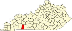
Clifty is located in the northern portion of Todd County at the junction of Kentucky Routes 107, 181, and 890. The community is located about 12.8 miles (20.6 km) north of Elkton. [2]
Clifty has a post office with ZIP code 42216. [3]
Elizaville is a census-designated place and unincorporated community in Fleming County, Kentucky, United States. Its population was 181 as of the 2010 census. Elizaville is located at the junction of Kentucky Route 32 and Kentucky Route 170, 5 miles (8.0 km) west of Flemingsburg. Elizaville has a post office with ZIP code 41037.
Garner is an unincorporated community in Knott County, Kentucky, United States. Garner is located at the junction of Kentucky Route 550 and Kentucky Route 1697 3.4 miles (5.5 km) east-northeast of Hindman. Garner had a post office, which closed on November 12, 2011; it still has its own ZIP code, 41817.
Huddy is an unincorporated community in Pike County, Kentucky. Huddy is located at the junction of U.S. Route 119 and Kentucky Route 199 15.5 miles (24.9 km) east-northeast of Pikeville. Huddy had a post office, which closed on January 22, 2011.
Belcher is an unincorporated community in Pike County, Kentucky. Belcher is located at the junction of U.S. Route 460 and Kentucky Route 80 2.9 miles (4.7 km) north-northwest of Elkhorn City. Belcher has a post office with ZIP code 41513.
Belfry is an unincorporated community in Pike County, Kentucky. Belfry is located on U.S. Route 119, 16.8 miles (27.0 km) northeast of Pikeville. Belfry has a post office with ZIP code 41514, which opened on February 26, 1921. The origin of the name "Belfry" is obscure.
Kimper is an unincorporated community in Pike County, Kentucky. Kimper is located at the junction of Kentucky Route 194 and Kentucky Route 632, 9.3 miles (15.0 km) east of Pikeville. Kimper has a post office with ZIP code 41539, which opened on August 8, 1919.
Pruden is an unincorporated community located partly in Bell County, Kentucky and partly in Claiborne County, Tennessee, in the southeastern United States. It is located along Tennessee State Route 90 and Kentucky Route 74, which intersect at the state line, in the upper Clearfork Valley.
Harned is an unincorporated community in Breckinridge County, Kentucky, United States. Harned is located on U.S. Route 60, 3.2 miles (5.1 km) southeast of Hardinsburg. Harned has a post office with ZIP code 40144.
Locust Hill is an unincorporated community in Breckinridge County, Kentucky, United States. Locust Hill is located at the junction of Kentucky Route 1073 and Kentucky Route 1401, 6.7 miles (10.8 km) east-southeast of Hardinsburg. Locust Hill had a post office from June 4, 1909, to February 22, 1985.
Webster is an unincorporated community in Breckinridge County, Kentucky, United States, located at the junction of Kentucky Route 261, Kentucky Route 333, Kentucky Route 477, and Kentucky Route 2780, 3.1 miles (5.0 km) west of Irvington. Webster has a post office with ZIP code 40176, which opened on August 31, 1852. However, the Webster post office has closed permanently, with the mail being routed through Irvington, Kentucky.
Peoples is an unincorporated community in Jackson County, Kentucky, United States. Peoples is located at the junction of Kentucky Route 2002 and Kentucky Route 3630 5 miles (8.0 km) west-southwest of Annville. Peoples had a post office until it closed on January 3, 2004. The community has the name of the local Peoples family.
Kettle Island is an unincorporated community and coal town in Bell County, Kentucky, United States. Kettle Island is located on Kentucky Route 1630 near Kentucky Route 221, 5.35 miles (8.61 km) east-northeast of Pineville. Kettle Island has a post office with ZIP code 40958, which opened on March 15, 1912. The community also had a station on the Louisville and Nashville Railroad.
Arjay is an unincorporated community and coal town in Bell County, Kentucky, United States. Arjay is located on Kentucky Route 66 4 miles (6.4 km) northeast of Pineville. Arjay has a post office with ZIP code 40902, which opened on February 23, 1911. The community's name comes from the initials of coal operator R. J. Asher.
Stoney Fork is an unincorporated community in Bell County, Kentucky, United States. Stoney Fork is located on Kentucky Route 221 10.1 miles (16.3 km) east-northeast of Pineville. Stoney Fork has a post office with ZIP code 40988, which opened on November 20, 1946.
Ingram is an unincorporated community in Bell County, Kentucky, United States. Ingram is located 6.2 miles (10.0 km) west-southwest of Pineville along Kentucky Route 92. Ingram has a post office with ZIP code 40955, which opened on July 15, 1881.
Rousseau is an unincorporated community in Breathitt County, Kentucky. Rousseau is located on Kentucky Route 30, 8.9 miles (14.3 km) east-northeast of Jackson. Rousseau had a post office until it closed on January 3, 2004; it still has its own ZIP code, 41366.
Vancleve is an unincorporated community in Breathitt County, Kentucky. Vancleve is located at the junction of Kentucky Route 15 and Kentucky Route 205 5.4 miles (8.7 km) north-northwest of Jackson. Vancleve has a post office with ZIP code 41385, which opened on November 6, 1903. Kentucky Mountain Bible College is located in Vancleve.
Lone is an unincorporated community in Lee County, Kentucky. Lone is located on Kentucky Route 708 6.3 miles (10.1 km) east-southeast of Beattyville. Lone has a post office with ZIP code 41347.
Sharon Grove is an unincorporated community located in Todd County, Kentucky, United States.
Kentucky Route 107 (KY 107) is a 56.907-mile-long (91.583 km) east–west state highway in west–central Kentucky. The western (southern) terminus of the route is an "end of state maintenance" terminus near the Fort Campbell military reservation south of Donaldson Creek near La Fayette, and its northern (eastern) terminus is at an intersection with U.S. Route 431 (US 431) in Lewisburg.