Related Research Articles

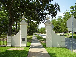
River Oaks is a residential community located in the center of Houston, Texas, United States. Located within the 610 Loop and between Downtown and Uptown, the community spans 1,100 acres (450 ha). Established in the 1920s by brothers Will Hogg and Michael Hogg, the community became a well-publicized national model for community planning. Real estate values in the community range from $1 million to over $20 million. River Oaks was also named the most expensive neighborhood in Houston in 2013. The community is home to River Oaks Country Club, which includes a golf course designed by architect Donald Ross and redesigned in 2015 by Tom Fazio.

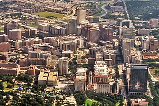
The Texas Medical Center (TMC) is a 2.1-square-mile (5.4 km2) medical district and neighborhood in south-central Houston, Texas, United States, immediately south of the Museum District and west of Texas State Highway 288. Over 60 medical institutions, largely concentrated in a triangular area between Brays Bayou, Rice University, and Hermann Park, are members of the Texas Medical Center Corporation—a non-profit umbrella organization—which constitutes the largest medical complex in the world. The TMC has an extremely high density of clinical facilities for patient care, basic science, and translational research.

South Park is a broad post-World War II development in the south-central area of Houston, Texas, a few miles south of MacGregor Park and directly south of the 610 Loop. According to the 2000 Census, the community has a population of 22,282. 81% of the South Park population is African American, compared to 25% for the city as a whole. Houston's Martin Luther King Boulevard runs through the area. Reflecting its postwar origins, many streets in South Park are named after World War II battle sites and persons. In the 1980s and 1990s crime became a key issue for South Park. Katharine Shilcutt of the Houston Press said "South Park is an overgrown garden these days, its soil only able to be tilled by the most determined or the most desperate. It shows no sign that it will grow again any time in the near future."

Montrose is an area located in west-central Houston, Texas, United States and is one of the city's major cultural areas. Montrose is a 7.5 square miles (19 km2) area roughly bounded by Interstate 69/U.S. Highway 59 to the south, Allen Parkway to the north, South Shepherd Drive to the west, and Taft to Fairview to Bagby to Highway 59 to Main to the east. Montrose neighborhoods include Cherryhurst, Courtlandt Place, Hyde Park, Montrose, Vermont Commons, North and East Montrose, Mandell Place and Winlow Place. Montrose is also less well known by the moniker Neartown, encompassing Superneighborhood #24.

Sharpstown is a master-planned community in the Southwest Management District, Southwest Houston, Texas. It was one of the first communities to be built as a master-planned, automobile centered community and the first in Houston. Frank Sharp (1906–1993), the developer of the subdivision, made provisions not only for homes but also for schools, shopping and recreation areas. While this model has been duplicated countless times in the past fifty years, at the time it was quite revolutionary, attracting national media attention. The development was dedicated on March 13, 1955.

Westbury is a neighborhood in the Brays Oaks district of Southwest Houston, Texas, United States. It is located east of Bob White Road, north of U.S. Highway 90 Alternate, and west of South Post Oak Road, adjacent to the Fondren Southwest and Meyerland neighborhoods, just west of the southwest corner of the 610 Loop.
Alief is a working-class suburb in Southwest Harris County, Texas, United States. Most of Alief is within the city limits of Houston, while a portion of the community is in unincorporated Harris County.

Westchase is a business district and neighborhood in western Houston, Texas, bounded by Westheimer Road on the north, Gessner Road on the east, Houston Center Boulevard on the west, and Westpark Tollway on the south. The area is bisected by Beltway 8. Westchase is adjacent to Greater Sharpstown, the International District, and the Royal Oaks Country Club subdivision. The area is immediately northeast of Alief.

Acres Homes is a neighborhood located in northwest Houston, Texas. The 9-square-mile (23 km2) mile area is loosely bounded by the city limits and West Gulf Bank Road to the north; Pinemont Drive to the south; North Shepherd Drive to the east; and Alabonson Drive to the west. Historically, it has been predominantly African American. Unincorporated for decades, it was annexed to Houston in 1967.

Southampton Place, also known as Southampton, is a neighborhood located in Houston, Texas. The Southampton Civic Club Inc. is the homeowners' association.
Southgate is a neighborhood in Houston, Texas, United States.

Sunnyside is a community in southern Houston, Texas, United States, south of Downtown Houston.

Andrew Carnegie Vanguard High School, named after Andrew Carnegie, is located in the Fourth Ward of Houston, Texas near Downtown and was formerly located in Sunnyside. The school serves grades 9-12 and is part of the Houston Independent School District. It is the only High School Vanguard Program in HISD meaning that all students are labelled as gifted and talented by testing and the school has students take all Advanced Placement core classes as part of its curriculum.

Third Ward is an area of Houston, Texas, United States, that evolved from one of the six historic wards of the same name. It is located in the southeast Houston management district.

Montrose is a neighborhood located in west-central Houston, Texas, United States. Montrose is a 7.5-square-mile (19 km2) area roughly bounded by Interstate 69/U.S. Highway 59 to the south, Allen Parkway to the north, South Shepherd Drive to the west, and Taft to Fairview to Bagby to Highway 59 to Main to the east. The area is also referred to as Neartown or Neartown / Montrose.

Evan Edward Worthing Early College High School is a secondary school located in the Sunnyside area of Houston, Texas, United States.
Near Northside is a historic neighborhood located in Northside, Houston, Texas. Near Northside is primarily occupied by people of Hispanic descent.
Hiram Clarke is an area in Houston, Texas, United States, southwest of NRG Park.
Pro-Vision Academy, is a state-authorized charter school in the Sunnyside area of Houston, Texas. A co-educational facility, it serves grades 3 through 12. It is one of the components of Pro-Vision, Inc., which also operates an after-school program and an aquaponics facility.
KIPP Texas Public Schools, is the branch of the KIPP charter school network in the U.S. state of Texas.
References
- ↑ Caputo, Matt. "Lil Flip: Shamrocks & Shenanigans". AllHipHop.com. Archived from the original on 2007-03-11. Retrieved 2007-02-07.
- ↑ Lomax, John Nova (2005-04-07). "Where's the Beef? Right Here In H-Town". Houston Press. Archived from the original on 2006-12-16. Retrieved 2007-02-07.

