Parks and recreation

The City of Houston acquired the former Heights Transit Center, a METRO facility, in 2018. [17] In 2020 the city government announced the site would become the East Sunset Heights Park. [18] It is now Sunset Heights Park. [19]
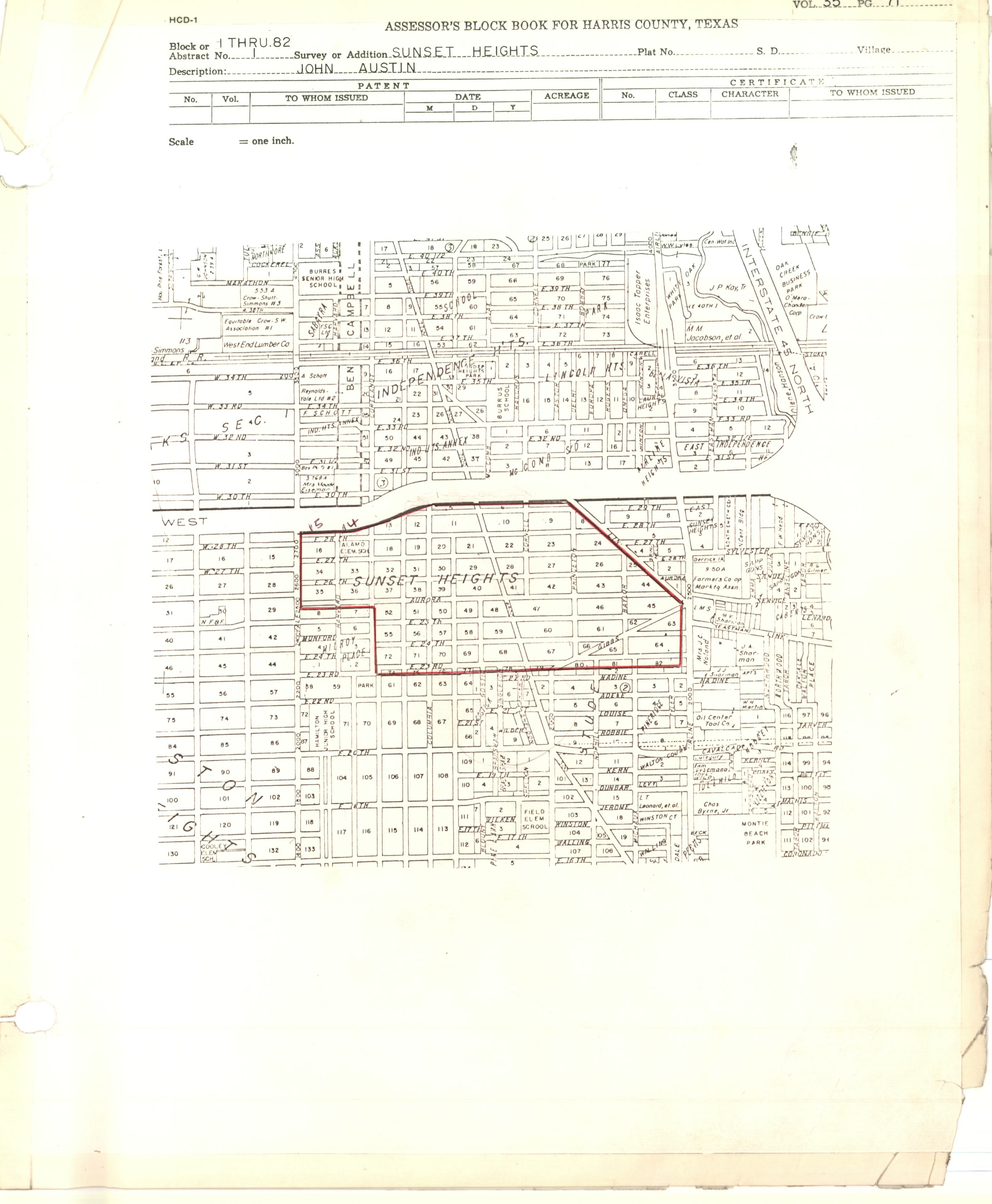
Sunset Heights is a neighborhood in northern Houston.
Sunset Heights Realty Co., established by Richard Rodgers, developed Sunset Heights after the company was created on August 15, 1910. The Houston Heights, when it was an independent municipality, unsuccessfully attempted to annex Sunset Heights. The City of Houston annexed Sunset Heights in 1927. [1]
By 2001 gentrification occurred in the area, with some smaller houses being torn down in favor of newer ones. [2]
East Sunset Heights Association was established in March 2002. By October of that year, there were 97 members. [3]
In 2006 Sunset Heights homeowners signed a petition to the city government to establish a minimum lot size. [4] Minimum lot sizes are pursued when area residents wish to oppose existing lots being divided into smaller ones for townhouses. [5] Later that year the Houston City Planning commission approved the development of a condominium project that went against the wishes of the people who signed the petition even though it strictly speaking complied with the city code planning regulations. [4] The planning commission also chose not to submit a request for deliberating the minimum lot size to Houston City Council, as seven planning commission members voted against it; six voted to do so. Tom Manning of the Houston Chronicle stated that residents disagreed on the issue. [6] On August 8, 2007, Houston City Council did establish a minimum lot size for this area. [7] In the Planning Commission barred a property owner from going below East Sunset Heights' minimum property size. [8]
Many of the houses in the neighborhood are bungalows. [4]
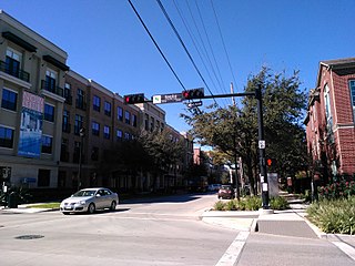
East Sunset Heights; roughly between Airline Drive, 23rd Street, the 610 Loop, and North Main; has about 400 houses. [3]
Harris Health maintains the Sunset Heights Clinic, a "same-day clinic". [9]
The neighborhood is within the Houston Independent School District (HISD). [10] Elementary schools serving sections of Sunset Heights include Field and Helms. [11] [12] All residents are zoned to Hamilton Middle School and Heights High School in the Houston Heights. [13] [14]
The first school established in the community was the Sunset Heights School, a part of Harris County School District 25. It was built in 1912 after taxpayers voted in favor for a referendum to build the school; the taxpayers had raised $20,000 for this purpose beginning the previous year. In 1926 the school was put in a new building and was now known as Alamo Elementary School; [1] it was in Sunset Heights block 76. [10] [15] Its namesake was the Alamo. The school closed in 1980. [16] HISD began storing items in it and later listed it for sale. Preservation Houston stated that it was an endangered historic site. [1]
The City of Houston acquired the former Heights Transit Center, a METRO facility, in 2018. [17] In 2020 the city government announced the site would become the East Sunset Heights Park. [18] It is now Sunset Heights Park. [19]
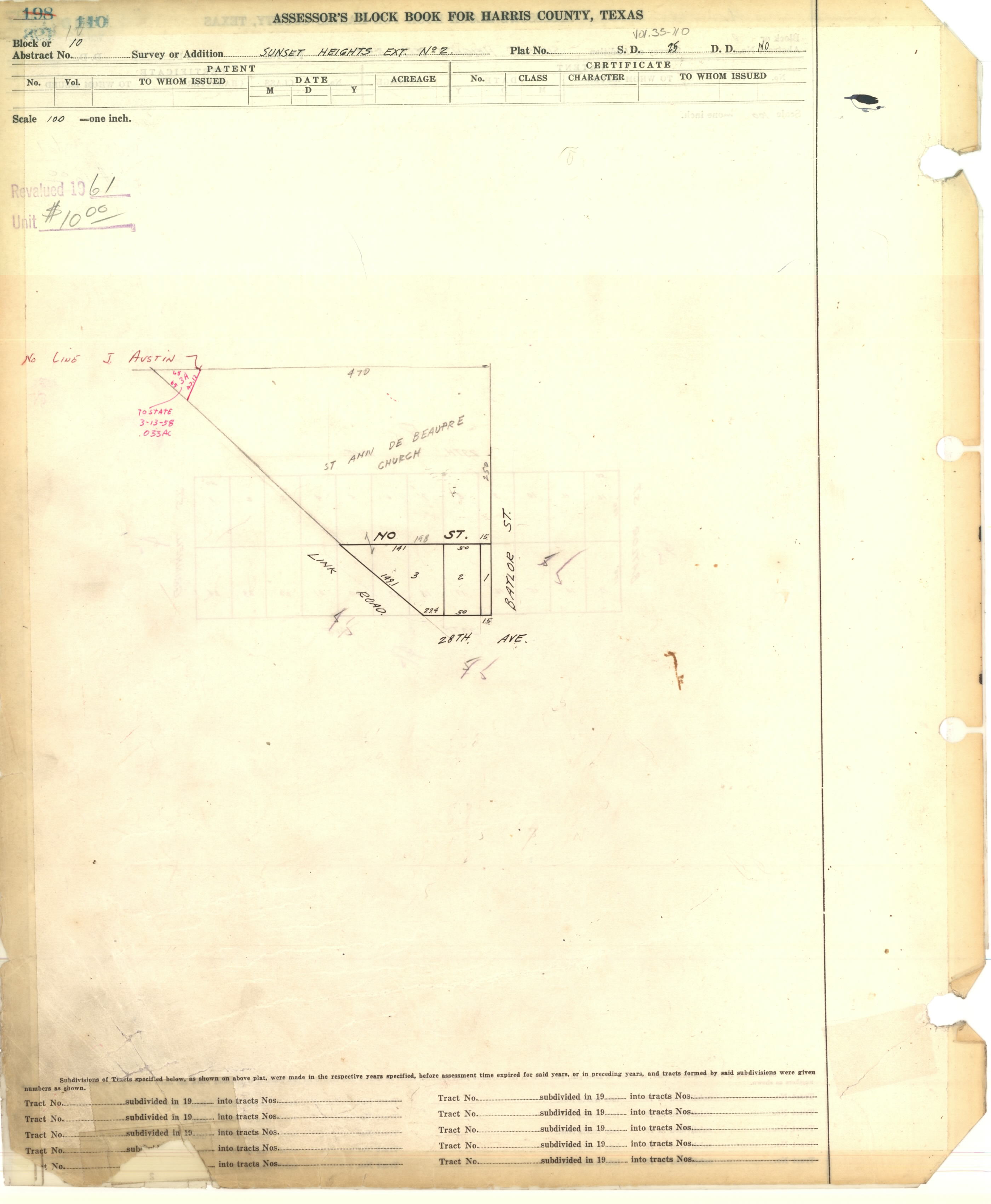
The Roman Catholic Archdiocese of Galveston-Houston operates St. Anne De Beaupre Church in Sunset Heights Extension No. 2. [20] [21] The third black church in the city, named after the Basilica of Sainte-Anne-de-Beaupré in Sainte-Anne-de-Beaupré, Quebec, Canada, it opened in 1938. It was initially a dependency of Our Mother of Mercy Catholic Church. The naming after a Francophone Canadian site reflects the Louisiana Creole culture. [22]
Midtown is a central neighborhood of Houston, located west-southwest of Downtown. Separated from Downtown by an elevated section of Interstate 45, Midtown is characterized by a continuation of Downtown's square grid street plan, anchored by Main Street and the METRORail Red Line. Midtown is bordered by Neartown (Montrose) to the west, the Museum District to the south, and Interstate 69 to the east. Midtown's 325 blocks cover 1.24 square miles (3.2 km2) and contained an estimated population of nearly 8,600 in 2015.
Lamar High School is a comprehensive public secondary school located in Houston, Texas, United States. It is a part of the Houston Independent School District (HISD). Lamar High School, was established in 1936 in memory of Mirabeau B. Lamar (1798–1859), a leader in the Texas Revolution and the second President of the Republic of Texas. Lamar has a four-year program, serving grades 9 through 12.

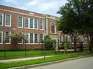
Heights High School, formerly John H. Reagan High School, is a senior high school located in the Houston Heights in Houston, Texas. It serves students in grades nine through twelve and is a part of the Houston Independent School District.

Westbury High School is a secondary school located in the Brays Oaks, of Southwest Houston, Texas, near the Westbury neighborhood. It has grades 9 through 12, and is part of the Houston Independent School District. In 2019, Jerri Nixon succeeded Susan Monaghan as principal, who had retired.
Meyerland is a community in southwest Houston, Texas, outside of the 610 Loop and inside Beltway 8. The neighborhood is named after the Meyer family, who bought and owned 6,000 acres (24 km2) of land in southwest Houston.
Houston Heights is a community in northwest-central Houston, Texas, United States. "The Heights" is often referred to colloquially to describe a larger collection of neighborhoods next to and including the actual Houston Heights. However, Houston Heights has its own history, distinct from Norhill and Woodland Heights.

Braeswood Place is a group of subdivisions in Harris County, Texas, United States. The vast majority of the land is in Houston while a small part is in Southside Place.

Acres Homes is a neighborhood located in northwest Houston, Texas. The 9-square-mile (23 km2) mile area is loosely bounded by the city limits and West Gulf Bank Road to the north; Pinemont Drive to the south; North Shepherd Drive to the east; and Alabonson Drive to the west. Historically, it has been predominantly African American. Unincorporated for decades, it was annexed to Houston in 1967.

Southampton Place, also known as Southampton, is a neighborhood located in Houston, Texas. The Southampton Civic Club Inc. is the homeowners' association.

Oak Forest is a large residential community in northwest Houston, Texas, United States. Oak Forest is the third largest group of subdivisions in Harris County.

East Downtown Houston (EaDo) is a district in Houston, Texas. The East Downtown Management District (EDMD), manages the area with offices headquartered at START Houston, a co-working space 1121 Delano Street. The community is located east of Downtown Houston and north of Interstate 45. It is between the George R. Brown Convention Center and the East End district.
Harvard Elementary School is a public primary school in the Houston Heights neighborhood of Houston, Texas, United States. Harvard, a part of the Houston Independent School District, serves grades Pre-Kindergarten through 5.
Cottage Grove is a community in Houston, Texas.

Westwood is a residential subdivision in Southwest Houston, Texas. The subdivision is bounded by the 610 Loop, the Union Pacific railroad tracks, Stella Link Road, and Willowbend Boulevard. It has about 800 houses.

William H. Wharton K-8 Dual Language Academy, formerly William Wharton Elementary School, is a public school in the Neartown area of Houston, Texas, and part of the Houston Independent School District. Also known as the Wharton Dual Language Academy, the school serves gifted and talented students in the Language Magnet program from Pre-K through 8th grade.
Hyde Park is a historic community located in the Montrose neighborhood of Houston, Texas. Its southeast boundary is the intersection Montrose Boulevard and Westheimer. The neighborhood was established in the late 1800s on the summer farm of the second President of the Republic of Texas, Mirabeau Lamar. In the 1970s, Hyde Park became a central part of the Gay Rights Movement in Houston. Like much of Montrose, the neighborhood is now experiencing significant gentrification, and is home to an abundance of restaurants, including Mexican, Italian, Greek, American, Lebanese, coffee houses, and numerous bars.

Arabic Immersion Magnet School (AIMS) is a magnet school in the Montrose area of Houston, Texas. A part of the Houston Independent School District (HISD), it currently covers elementary school grades. It uses a grant from the Qatar Foundation, and it is one of the first Arabic language immersion schools in the United States. It is a part of HISD's efforts to increase the number of bilingual students. Prior to 2019 the school was in the Houston Heights. Mahassen Ballouli became principal in Summer 2017 after the founding principal, Kate Adams, left.

William B. Travis Elementary School is a public elementary school in the Woodland Heights area of Houston, Texas. It is a part of the Houston Independent School District (HISD).

Ella J. Baker Montessori School, formerly Woodrow Wilson Montessori School and Woodrow Wilson Elementary School, is a public K-8 Montessori school in the Cherryhurst Addition subdivision in the Neartown area of Houston, Texas. A part of the Houston Independent School District (HISD), Baker serves as the neighborhood elementary school for a section of Neartown, including a portion of Montrose. It also serves as a magnet school for all of HISD's territory. As of 2014 it is one of three public Montessori programs in Houston. It was the first HISD school to use the Montessori style for all students, as well as housing HISD's first Montessori middle school program.
St. Anne de Beaupre Houston, TX 2810 Link Rd Houston, Texas 77009
