Clinton Park, Houston

Last updated
Clinton Park Elementary School closed in 2005 ClintonParkESHoustonTX.JPG
Clinton Park Elementary School closed in 2005

Clinton Park is a neighborhood located in Houston, Texas. Clinton Park is located outside the 610 Loop in eastern Houston. Clinton Park is predominantly African-American. Carolyn Campbell of KHOU-TV described Clinton Park, close to the Port of Houston, as "small" and "isolated." [1]

Contents

History

After World War II development in the area began due to the area's close proximity to the Port of Houston. [2] Clinton Park was one of the first communities developed for African-Americans in Texas. [1] When Clinton Park was originally developed, it was marketed to middle class black families. [3] When Clinton Park was first developed, laws required segregation between White people and Black people; Blacks could not live in White neighborhoods. Clinton Park had many businesses. When racial integration occurred, Blacks no longer patronized Clinton Park and the community declined. [1]

In the 2000s Mayor of Houston Bill White started the Houston HOPE program to make some low income neighborhoods attractive to families with children; Clinton Park is one of the neighborhoods in Houston HOPE. A nonprofit job training program in the Clinton Park area closed several years before 2006. [4]

Cityscape

Rafael Longoria and Susan Rogers of the Rice Design Alliance said that the layout of Clinton Park could be described as "rurban," a word coined in 1918 which describes an area with a mix of urban and rural characteristics. [5] Longoria and Rogers said in 2008 that Clinton Park, sparsely populated, "is isolated both geographically and socially from the rest of Houston." The border between Clinton Park and Galena Park, once a predominantly white city, is still barricaded. Longoria and Rogers said that the barricade "provides a stark example of how the prevailing segregationist sentiments of the era is still in evidence." During the same year Longoria and Rogers said that if Clinton Park's trend of population loss continued, Clinton Park would be vacant in under 25 years. [3] In an editorial piece in the Houston Chronicle , Carol Alvarado, a member of the Houston City Council, said that Clinton Park was among the neighborhoods that were the most exposed to air pollutants in the City of Houston. [6]

Education

Clinton Park is served by the Houston Independent School District. Clinton Park is in Trustee District VIII, represented by Diana Dávila as of 2009. [7]

Schools include Pleasantville Elementary School, [8] Holland Middle School, [9] and Furr High School. [10]

Prior to spring 2005, Clinton Park was served by Clinton Park Elementary School at 129 Mississippi Road. [11] [12] After spring 2005, Clinton Park Elementary School closed because it had a too small enrollment; its final enrollment was 148 students. The students were moved to Pleasantville Elementary School. Josephine Espree, a teacher at Clinton Park, said that the school closing was like a "death in the family" for the community. [1] Edwin Davis, president of the Clinton Park Civic Club, criticized the closing of the school. [4]

Residents are within the Houston Community College System boundaries. [13]

Government and infrastructure

Clinton Park is in Houston City Council District I. [14]

The Houston Fire Department Fire Station 42 Ship Channel, a part of Fire District 20, serves Clinton Park. [15] The station, originally a city hall/volunteer fire station located in Clinton Park, was annexed by the City of Houston in 1955. The city moved the station to its current location in 1980. [16]

The Houston Police Department Northeast Patrol Division serves the neighborhood with its headquarters at 8301 Ley Road. [17] [18]

The City of Houston closed a clinic in Clinton Park in the 1970s. [4]

Harris Health System (formerly Harris County Hospital District) designated Ripley Health Center in the East End for ZIP code 77029. [19] In 2000 Ripley was replaced by the Gulfgate Health Center. [20] The designated public hospital is Ben Taub General Hospital in the Texas Medical Center. [19]

Parks

Clinton Park ClintonParkHoustonTX.JPG
Clinton Park

Clinton Park and Clinton Community Center are located at 200 Mississippi Drive. [21] [22] The community center has a swimming pool, lighted tennis courts, a lighted sports field, a playground, an outdoor basketball pavilion, a 0.42 mile hike and bicycle trail, and a nine-hole disc golf course. [22]

See also

Related Research Articles

Galena Park, Texas City in Texas, United States

Galena Park is a city in Harris County, Texas, United States, within the Houston–Sugar Land–Baytown metropolitan area. The population was 10,740 at the 2020 census.

Jacinto City, Texas City in Texas, United States

Jacinto City is a city in Harris County, Texas, United States, east of the intersection of Interstate 10 and the East Loop of Interstate 610. Jacinto City is part of the Houston–Sugar Land–Baytown metropolitan area and is bordered by the cities of Houston and Galena Park. The population was 9,613 at the 2020 census.

Spring Branch, Houston Place

Spring Branch is a district in west-northwest Harris County, Texas, United States, roughly bordered by Tanner Road and Hempstead Road to the north, Beltway 8 to the west, Interstate 10 to the south, and the 610 Loop to the east; it is almost entirely within the City of Houston. Established by the Texas Legislature, the Spring Branch Management District exercises jurisdiction over the area.

Westbury, Houston

Westbury is a neighborhood in the Brays Oaks district of Southwest Houston, Texas, United States. It is located east of Bob White Road, north of U.S. Highway 90 Alternate, and west of South Post Oak Road, adjacent to the Fondren Southwest and Meyerland neighborhoods, just west of the southwest corner of the 610 Loop.

Harrisburg is a community that is now located within the city of Houston, Texas, United States.

Acres Homes, Houston

Acres Homes is a neighborhood located in northwest Houston, Texas. The 9-square-mile (23 km2) mile area is loosely bounded by the city limits and West Gulf Bank Road to the north; Pinemont Drive to the south; North Shepherd Drive to the east; and Alabonson Drive to the west. Historically, it has been predominantly African American. Unincorporated for decades, it was annexed to Houston in 1967.

Sunnyside, Houston

Sunnyside is a community in southern Houston, Texas, United States, south of Downtown Houston.

Oak Forest, Houston

Oak Forest is a large residential community in northwest Houston, Texas, United States. Oak Forest is the third largest group of subdivisions in Harris County.

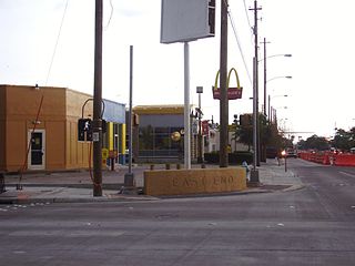
Eastwood is a historic neighborhood in the East End area of Houston, Texas, United States. Eastwood maintains Houston’s largest intact collection of Craftsman, Arts & Crafts, Foursquare and Mission style architecture.

Pecan Park is a neighborhood in Houston, Texas.

Independence Heights is a community in Houston, Texas, bordered by 40th Street east of N. Main and 40th Street west of N. Main to the north, Yale Street to the west, the 610 Loop to the south, and Airline Drive to the east. The Super Neighborhood boundary created by the City of Houston is bordered by Tidwell to the north, Shepherd Drive to the west, the 610 Loop to the south, and Interstate 45 to the east.

Magnolia Park, Houston

Magnolia Park is an area of the East End, Houston, Texas, located near the Houston Ship Channel. One of the oldest Hispanic neighborhoods in the City of Houston, Magnolia Park was formerly incorporated as the City of Magnolia Park in eastern Harris County.

Pleasantville, Houston

Pleasantville is a neighborhood located in Houston, Texas, United States.

East End, Houston

East End Houston, managed by the East End District (EED), is a district in eastern Houston, Texas, United States, located between the eastern edge of downtown to the Port of Houston and South to Hobby Airport. The District is home to Houston's early history and industry and is the site of Harrisburg, the seat of government for the Republic of Texas in 1836. East End Houston consists of many different ethnic groups, including Hispanic, Asian, White, and African American. Latinos make up more than half of the 100,512 residents, The area includes two of Houston's oldest Hispanic neighborhoods, Magnolia Park and Second Ward.

Idylwood, Houston

Idylwood is a historic neighborhood in the southeastern part of the I-610 loop in Houston, Texas. Idylwood, as of 2021, is the most expensive neighborhood in the East End. As of that year its houses were priced between $295,000 and $679,900. It currently has approximately 340 homes. Bill England, a redeveloper in the East End area, stated in 2004 that Idylwood appealed to buyers who are priced out of houses located in the cities of Bellaire and West University Place.

East Downtown Houston District in Houston, Texas, United States

East Downtown Houston (EaDo) is a district in Houston, Texas, United States. The East Downtown Management District (EDMD), manages the area with offices headquartered at START Houston, a co-working space 1121 Delano Street. The community is located east of Downtown Houston and north of Interstate 45. It is between the George R. Brown Convention Center and the East End district.

Port Houston is a neighborhood located on the East Side of Houston, Texas, United States.

Settegast, Houston

Settegast is a neighborhood in northeast Houston with a person/acre average between 1–5. The community is bordered by the 610 Loop, the Union Pacific Railroad Settegast Yard, and the old Beaumont Highway. The community has many small wood-frame houses and empty lots. Habitat for Humanity has a prominent stake in the area, and a community garden is underway. There are few commercial and industrial uses within Settegast. Also, contemporary housing has started to show itself within new construction in the area. The City of Houston designated Settegast as a Houston HOPE neighborhood.

Houston/Trinity Gardens is an African-American neighborhood in Houston.

References

  1. 1 2 3 4 Campbell, Carolyn. "Up Close: School closing 'like a death in the family'." KHOU-TV . Sunday June 26, 2005. Retrieved on April 24, 2009.
  2. "SN#59." City of Houston. Retrieved on April 24, 2009.
  3. 1 2 Longoria, Rafael and Susan Rogers. "The Rurban Horseshoe Archived 2016-02-07 at the Wayback Machine ." Cite 73. The Rice Design Alliance, (Northern Hemisphere) Winter 2008. Page 20. Retrieved on February 24, 2010.
  4. 1 2 3 Snyder, Mike. "PROJECT HOUSTON HOPE / New housing and social services may stem decline in carefully chosen neighborhoods / Creating foundation for return of families." Houston Chronicle . B1 MetFront. Retrieved on August 5, 2009.
  5. Longoria, Rafael and Susan Rogers. "The Rurban Horseshoe Archived 2016-02-07 at the Wayback Machine ." Cite 73. The Rice Design Alliance, (Northern Hemisphere) Winter 2008. Pages 18-19. Retrieved on February 24, 2010.
  6. Longoria, Rafael and Susan Rogers. "The Rurban Horseshoe Archived 2016-02-07 at the Wayback Machine ." Cite 73. The Rice Design Alliance, (Northern Hemisphere) Winter 2008. Pages 20-21. Retrieved on February 24, 2010.
  7. "Trustee Districts Map Archived July 11, 2012, at the Wayback Machine ." Houston Independent School District . Retrieved on November 11, 2008.
  8. "Pleasantville Elementary Attendance Zone Archived 2006-05-16 at the Wayback Machine ." Houston Independent School District . Retrieved on April 24, 2009.
  9. "Holland Middle Attendance Zone Archived 2008-04-11 at the Wayback Machine ." Houston Independent School District . Retrieved on April 24, 2009.
  10. "Furr High School Attendance Zone Archived 2011-07-26 at the Wayback Machine ." Houston Independent School District . Retrieved on April 24, 2009.
  11. "Clinton Park Elementary Attendance Zone Archived 2012-03-10 at the Wayback Machine ." Houston Independent School District . Retrieved on April 24, 2009. This older boundary map file from 2001 is identical
  12. "Welcome to Clinton Park Elementary." Clinton Park Elementary School. Retrieved on April 24, 2009.
  13. Texas Education Code, Section 130.182, "Houston Community College System District Service Area".
  14. City of Houston, Council District Maps, District I Archived 2013-09-18 at the Wayback Machine ." City of Houston. Retrieved on November 5, 2011.
  15. "Fire Stations." City of Houston. Retrieved on May 8, 2010.
  16. "Fire Station 42." City of Houston. Retrieved on May 8, 2010.
  17. "Northeast Patrol Division." City of Houston. Retrieved on April 24, 2009.
  18. "VOLUNTEER INITIATIVES PROGRAM - Citizens Offering Police Support." City of Houston. Retrieved on September 23, 2008.
  19. 1 2 "Clinic/Emergency/Registration Center Directory By ZIP Code". Harris County Hospital District. 2001-11-19. Archived from the original on 2001-11-19. Retrieved 2021-04-08. - See ZIP code 77029. See this map for relevant ZIP code.
  20. "Gulfgate Health Center" (Archive). Harris County Hospital District. Accessed October 17, 2008.
  21. "Our Parks A-F Archived June 20, 2010, at the Wayback Machine ." City of Houston. Retrieved on April 24, 2009.
  22. 1 2 "Clinton Park Community Center." City of Houston. Retrieved on August 29, 2010.

Coordinates: 29°44′24″N95°15′29″W / 29.740°N 95.258°W / 29.740; -95.258