Southgate is a neighborhood in Houston, Texas, United States.
This section needs expansion. You can help by adding to it. (October 2012) |
In 2002 St. Luke's Episcopal Hospital was engaging in an expansion project. [1] In January 2003 some residents asked the City of Houston to reclassify University Boulevard as a residential street in order to control the amount of traffic on the street. [2] The Southgate Civic Club asked for a street closure on Southgate Boulevard to prevent traffic from the Texas Medical Center from reaching the subdivision. In late December 2003 the City of Houston Public Works Department closed a portion of Southgate Boulevard to block Medical Center traffic. [3] In 2003, on weekdays, 38% of the vehicle traffic on Southgate Boulevard did not originate from the neighborhood. [4] The Houston Fire Department had stated opposition to the street closures. [5] In December 2003 the City of Houston closed Southgate east of Travis Street, preventing commuters to a St. Luke's office building from parking in the neighborhood. [6] Deborah Mann Lake of the Houston Chronicle . said that the closure of Southgate Boulevard did not bring very many complaints. [7]
In 2004 residents considered establishing a property owners association to better prevent developments not desirable to the community from occurring and to more strongly enforce deed restrictions. Some residents believed that a property owners association could gain too much power and cause the community's direction to fall into an undesirable power authority. [8] In 2004 Richard Merrill, the president of the Southgate Civic Club, said that a majority of residents supported the idea of a property owners association. One resident, Michael Bonderer, launched a campaign against the idea of a property owners association and put a sign in his yard. He was banned from the Southgate community message board, which had been established to discuss the property owner issue. [9]
In 2007 Southgate residents and Houston City Council member Anne Clutterbuck worked on a plan to make modify street closures to continue stemming Texas Medical Center traffic. [10]
In 2010 Raj Mankad of the Houston Chronicle said that despite being in the presence of the high-rises of the Texas Medical Center, it "retains a close-nit[ sic ] community feel. [11]
In April 2010 the City of Houston "automated" curbside recycling program was extended to Southgate. [12]
Southgate is adjacent to Rice University and the Texas Medical Center. [11] It consists of four subdivisions. [8]
Trees line the neighborhood streets. In 2002 Southgate had 573 houses. Many of the houses were built in the 1930s and the 1940s. Unlike surrounding communities like the City of West University Place and Southampton, by 2002 few of the original houses in Southgate had been demolished and replaced with new development. Because there is less variety in the housing styles, the pricing range was more narrow than in other areas. In 2002 the lowest housing prices were a bit below $300,000 ($510,000 in current money) and most of the original two-story houses sold in the $400,000 ($680,000 in current money) range. The small number of newer houses often had prices of over $700,000 ($1,190,000 in current money). [13] In 2002 Feser said that Southgate had similarities to the communities making up Morningside Place. [13] By 2010 the housing stock included several restored 1930s houses and some more recent modern houses. Raj Mankad of the Houston Chronicle said that the housing stock "demonstrates both stability and openness to innovation." [11]
In 2005 Allison Cook said "There's just more disposable income in Southampton, Broad Acres [ sic ] and storied Shadow Lawn than in Southgate". [14]
The Southgate Civic Club operates the community. It includes an architectural review as part of its deed restrictions, described by Raj Mankad of the Houston Chronicle as "strong." [11]
Houston Fire Department Fire Station 37 is located at 3828 Aberdeen Way. Houston Fire Department Station 33 Braes Heights Medical Center is near the Texas Medical Center at 7100 Fannin @ South Braeswood .
It is within Houston City Council District C. [15]
The neighborhood is within the Houston Police Department's South Central Patrol Division . Patrol services are contracted to the Harris County Precinct 1 Constable's Office.
The Rice Area Constable Service patrols the community, charging it $200 yearly. On some streets parking is restricted, because the community is in proximity to the Texas Medical Center. [13]
Southgate is in Texas's 7th congressional district .
Harris Health System (formerly Harris County Hospital District) designated Martin Luther King Health Center in southeast Houston for ZIP code 77030. The nearest public hospital is Ben Taub General Hospital in the Texas Medical Center. [16]
Roberts Elementary School is located in Southgate. [17] Southgate is zoned to Houston Independent School District schools, [18] including Roberts, [19] Pershing Middle School [20] (located in Braeswood Place - Any student zoned to Pershing may apply to Pin Oak Middle School's regular program [21] ), and Lamar High School (Upper Kirby). [22]
Roberts has a magnet program in the fine arts. As of 2002 the school consistently achieves high test scores. During that year, Katherine Feser said that the school was a "draw" for Southgate. [13]
St. Vincent de Paul School, a K-8 Roman Catholic school operated by the Roman Catholic Archdiocese of Galveston-Houston, is in the area. [23]
St. Nicholas School Medical Center Campus, a K-8 private school, is in the area.
The Houston Public Library Stella Link Branch and the Harris County Public Library West University Branch are near Southgate.
The Weekley Family YMCA is located near Southgate.
The Houston Chronicle is the area regional newspaper.
The West University Examiner is a local newspaper distributed in the community .
The Village News and Southwest News is a local newspaper distributed in the community.
In the mid-20th century the community newspaper Southwestern Times served Southgate and surrounding communities. [24] The paper was headquartered in Rice Village. [25]
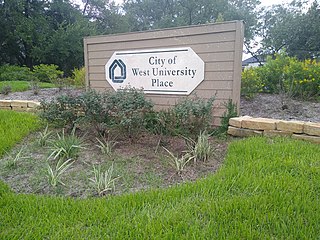
West University Place, often called West University or West U for short, is a city located in the U.S. state of Texas within the Houston–Sugar Land metropolitan area and southwestern Harris County. At the 2020 U.S. census, the population of the city was 14,955. It is nicknamed "The Neighborhood City" and is mainly a bedroom community for upper-class families.
The Houston Museum District is an association of 19 museums, galleries, cultural centers and community organizations located in Houston, Texas, dedicated to promoting art, science, history and culture.
South Park is a broad post-World War II development in the south-central area of Houston, Texas, a few miles south of MacGregor Park and directly south of the 610 Loop. According to the 2000 Census, the community has a population of 22,282. 81% of the South Park population is African American, compared to 25% for the city as a whole. Houston's Martin Luther King Boulevard runs through the area. Reflecting its postwar origins, many streets in South Park are named after World War II battle sites and persons. In the 1980s and 1990s crime became a key issue for South Park. Katharine Shilcutt of the Houston Press said "South Park is an overgrown garden these days, its soil only able to be tilled by the most determined or the most desperate. It shows no sign that it will grow again any time in the near future."
Rice Village is a shopping district in Houston, Texas, United States.
Southampton Place, also known as Southampton, is a neighborhood located in Houston, Texas. The Southampton Civic Club Inc. is the homeowners' association.
Rice Military is a neighborhood in Houston, Texas, United States. The Beer Can House is located in Rice Military.
Old Braeswood is a neighborhood of single family homes in Houston, Texas, United States. It is generally bounded by South Main, North Braeswood, Kirby Drive, and Holcombe. The Texas Medical Center, Rice University, Rice Village, and the NRG Center complex are all within a one-mile radius. Nearby neighborhoods include Southgate, West University Place and Braeswood Place.
Boulevard Oaks is a neighborhood in Houston, Texas, United States, containing 21 subdivisions north of Rice University and south of U.S. Highway 59. Developed primarily during the 1920s and 1930s, Boulevard Oaks contains two National Register historic districts, Broadacres and Boulevard Oaks. The Boulevard Oaks Civic Association (BOCA) is the common civic association for all 21 subdivisions.
Sunnyside is a community in southern Houston, Texas, United States, south of Downtown Houston.
Eastwood is a historic neighborhood in the East End area of Houston, Texas, United States. Eastwood maintains Houston’s largest intact collection of Craftsman, Arts & Crafts, Foursquare and Mission style architecture.
Third Ward is an area of Houston, Texas, United States, that evolved from one of the six historic wards of the same name. It is located in the southeast Houston management district.
Montrose is a neighborhood located in west-central Houston, Texas, United States. Montrose is a 7.5-square-mile (19 km2) area roughly bounded by Interstate 69/U.S. Highway 59 to the south, Allen Parkway to the north, South Shepherd Drive to the west, and Taft to Fairview to Bagby to Highway 59 to Main to the east. The area is also referred to as Neartown or Neartown / Montrose.
Sunset Terrace and Montclair Place are two Inner Loop neighborhoods of Harris County, Texas, United States. The two subdivisions are served by the Sunset Terrace/Montclair Civic Association.
Gulfton is a community in Southwest Houston, Texas, United States3.2 sq mi (8.3 km2). It is located between the 610 Loop and Beltway 8, west of the City of Bellaire, southeast of Interstate 69/U.S. Highway 59, and north of Bellaire Boulevard.
Morningside Place is a group of subdivisions located in Houston, Texas, United States.
The Northside is a district of Houston, Texas, United States. It is within the Greater Northside Management District.
Brays Oaks, formerly known as Fondren Southwest, is an area in Southwest Houston, Texas, United States. The Brays Oaks Management District, also known as the Harris County Improvement District #5, governs the Brays Oaks area as well as other surrounding areas, such as Westbury. The City of Houston also defines the Brays Oaks Super Neighborhood, with separate boundaries.
The Westmoreland Historic District is a neighborhood in Neartown Houston, Texas. It is west of Spur 527, between Westheimer Road and West Alabama Street.
Hiram Clarke is an area in Houston, Texas, United States, southwest of NRG Park.
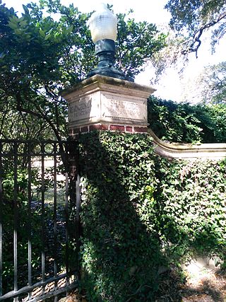
Shadyside is a private, walled subdivision of 16 houses in Houston, Texas. In 2012 Terrence McCoy of the Houston Press said that Shadyside has a "sense of exclusivity, or as Heritage Texas Properties puts it, 'mystique,'" which caused many prominent figures from Houston to settle in Shadyside and continue doing so for a period of almost 100 years.
Conveniently situated in the Southwest part of Houston, St. Vincent de Paul School is near [...]Southgate,[...]