| Clyde Spires | |
|---|---|
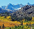
 North aspect | |
| Highest point | |
| Elevation | 13,267 ft (4,044 m) [1] |
| Prominence | 80 ft (24 m) [2] |
| Parent peak | Mount Wallace (13,377 ft) [3] |
| Isolation | 0.50 mi (0.80 km) [3] |
| Coordinates | 37°08′24″N118°38′54″W / 37.1401228°N 118.6483761°W [4] |
| Naming | |
| Etymology | Norman Clyde [5] |
| Geography | |
 Clyde Spires Location in California  Clyde Spires Clyde Spires (the United States) | |
| Location | Kings Canyon National Park Fresno County / Inyo County California, U.S. |
| Parent range | Sierra Nevada |
| Topo map | USGS Mount Darwin |
| Geology | |
| Rock age | Cretaceous |
| Mountain type | Fault block |
| Rock type | Granite [6] |
| Climbing | |
| First ascent | 1933 [6] |
| Easiest route | class 4 [3] |
Clyde Spires is a 13,267-foot-elevation (4,044-meter) mountain summit located on the crest of the Sierra Nevada mountain range in California, United States. [4] It is situated on the boundary shared by Kings Canyon National Park with John Muir Wilderness, and along the common border of Fresno County with Inyo County. It is 20 miles (32 km) west of the community of Big Pine, and 0.5 miles (0.80 km) southeast of Mount Wallace, which is the nearest higher neighbor. [2] The west spire is slightly higher than the east spire. [1] Topographic relief is significant as the spires rise 1,665 feet (507 meters) above Echo Lake in 0.38 miles (0.61 km).