Cold Point Historic District

Last updated

Cold Point Historic District
Cold Point Baptist Montco PA HD.jpg
Cold Point Baptist Church, November 2011
USA Pennsylvania location map.svg
Red pog.svg
Usa edcp location map.svg
Red pog.svg
Nearest cityInterstate 276, Butler Pike, Militia Hill and Narcissa Roads, Plymouth Township and Whitemarsh Township, Pennsylvania
Coordinates 40°06′52″N75°16′06″W / 40.11444°N 75.26833°W / 40.11444; -75.26833
Area157 acres (64 ha)
ArchitectMultiple
Architectural styleGreek Revival, Gothic
NRHP reference No. 83002261 [1]
Added to NRHPSeptember 9, 1983

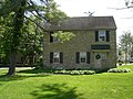
Cold Point Historic District is a national historic district located in Plymouth Township and Whitemarsh Township, Montgomery County, Pennsylvania. It is an eastward extension of the Plymouth Meeting Historic District. It encompasses 62 contributing buildings and 1 contributing site dated from 1745 to 1878 in the Village of Cold Point. It includes predominantly 2+12-story, stuccoed rubble stone structures dated to the early- to mid-19th century. A few reflect the Greek Revival and Gothic Revival styles. Notable buildings include the separately listed Alan West Corson Homestead, Cold Point Baptist Church and burial ground, and Cold Point School. [2]

It was added to the National Register of Historic Places in 1983. [1]

On the line adjoining Plymouth and Whitemarsh townships is an elevation known as Cold Point, where there is a scattered hamlet, containing on the Whitemarsh side more than a dozen houses. The Cold Point Baptist Church, located at this place, was first known as the Plymouth Church, and the locality became a preaching-place about 1842, when the Rev. Robert Young, then pastor of the Chestnut Hill Baptist Church, began service in the school-house, which then stood opposite the present church. The corner-stone of the old stone church edifice was laid in the summer of 1845, and after completion was in use until 1867. The corner-stone of the present stone house, sixty by forty feet, was laid in August of that year and completed and dedicated in 1868 and is still used. It stands a short distance west of the old church.

The membership is about one hundred and fifty. The grounds occupy about two and a half acres and are kept in neat condition. We find on the tombstones the names of Freas, Rodebaugh, Lysinger, Fight, Phipps, Hellings, Williams, White, Sands, Bisbing, Hallet, Rex, Coulson, Moore, Robinson, Fisher, Nagle, Schlater, Yetter, Butler, Kirk, Radcliff, Getman, Wood, Jones, Childs, Wimmer, Roberts, Heller, Gilbert and Dewees.

From these grounds a fine view is obtained of the surrounding country, particularly towards the north and west, embracing the greater portion of Plymouth township. Near this is the residence of the late Alan W. Corson, well known as a teacher, surveyor, nurseryman and botanist, who died June 21, 1882, aged ninety-five years. History of Montgomery County (1884). [3]

Related Research Articles

<span class="mw-page-title-main">Montgomery County, Pennsylvania</span> County in Pennsylvania, United States

Montgomery County, colloquially referred to as Montco, is a county in the Commonwealth of Pennsylvania. As of the 2020 census, the population of the county was 856,553, making it the third-most populous county in Pennsylvania after Philadelphia and Allegheny counties.

<span class="mw-page-title-main">Plymouth Township, Montgomery County, Pennsylvania</span> First Class Township with home rule in Pennsylvania, United States

Plymouth Township is a township with home rule status in Montgomery County, Pennsylvania. The township has been governed by a home rule charter since 1976 and is no longer subject to the Pennsylvania Township Code. The population was 16,525 at the 2010 census. It is serviced by the Colonial School District and is home to the Plymouth Meeting Mall.

<span class="mw-page-title-main">Plymouth Meeting, Pennsylvania</span> Census-designated place in Pennsylvania, United States

Plymouth Meeting is a census-designated place (CDP) that straddles Plymouth and Whitemarsh Townships in Montgomery County, Pennsylvania, United States. The settlement was founded in 1686.

<span class="mw-page-title-main">Springfield Township, Montgomery County, Pennsylvania</span> Township in Pennsylvania, United States

Springfield Township is a township in Montgomery County, Pennsylvania. The population was 20,993 in 2022 according the Census Bureau. It includes the villages of Wyndmoor, Erdenheim, Flourtown, and Oreland. The communities of Lafayette Hill, Fort Washington, Laverock, North Hills, Miquon, and Glenside are also situated partly inside the Township.

<span class="mw-page-title-main">Upper Providence Township, Montgomery County, Pennsylvania</span> Township in Pennsylvania, United States

Upper Providence Township is a township in Montgomery County, Pennsylvania, United States. As of the 2010 census, the township population was 21,219.

<span class="mw-page-title-main">Whitemarsh Township, Pennsylvania</span> Home rule municipality in Pennsylvania, United States

Whitemarsh Township is a Home rule municipality in Montgomery County, Pennsylvania. It retains its former classification of "Township" in its official name despite being a home rule municipality. The population was 19,707 at the 2020 census. Whitemarsh is adjacent to the neighborhood of Andorra in the Roxborough section of Philadelphia, and is bordered in Montgomery County by Springfield, Upper Dublin, Whitpain, and Plymouth townships, Conshohocken, and the Schuylkill River, which separates it from Lower Merion Township.

<span class="mw-page-title-main">Samuel Sloan (architect)</span> American architect

Samuel Sloan was a Philadelphia-based architect and best-selling author of architecture books in the mid-19th century. He specialized in Italianate villas and country houses, churches, and institutional buildings. His most famous building—the octagonal mansion "Longwood" in Natchez, Mississippi—is unfinished; construction was abandoned during the American Civil War.

<span class="mw-page-title-main">Farmar Mill</span> United States historic place

Farmar Mill is a historic mill building. The mill was powered by the Wissahickon Creek and is located on Mather's Lane near Skippack Pike, and just west of the historic Bethlehem Pike in the village of Whitemarsh, Pennsylvania, in the United States.

<span class="mw-page-title-main">Evansburg Historic District</span> Historic district in Pennsylvania, United States

The Evansburg Historic District in Evansburg, Pennsylvania, United States, is a National Historic District designated by Congress with over 50 National Register properties dating from the early 18th through 19th century. Almost all of these properties are privately owned and in active use at this time. The Evansburg Historic District was listed on the National Register of Historic Places in 1972.

<span class="mw-page-title-main">Alan West Corson Homestead</span> Historic house in Pennsylvania, United States

Alan West Corson Homestead is a historic house located in Whitemarsh Township, Montgomery County, Pennsylvania. It was built in three sections between 1734 and 1820. It is a 2+12-story, stuccoed stone dwelling, six bays wide and two bays deep. It has a 2+12-story rear ell. Also on the property is a contributing smoke house. The property was used for one of the earliest area nurseries and a boarding school.

<span class="mw-page-title-main">Hovenden House, Barn and Abolition Hall</span> Historic complex in Pennsylvania, United States

The Hovenden House, Barn and Abolition Hall is a group of historic buildings which are located in Plymouth Meeting, Whitemarsh Township, Montgomery County, Pennsylvania. In the decades prior to the American Civil War, this property served as an important station on the Underground Railroad. Abolition Hall was built to be a meeting place for abolitionists, and later was the studio of artist Thomas Hovenden.

<span class="mw-page-title-main">Plymouth Meeting Historic District</span> Historic district in Pennsylvania, United States

Plymouth Meeting Historic District is a national historic district that straddles Plymouth and Whitemarsh Townships in Montgomery County, Pennsylvania, United States. The adjacent Cold Point Historic District is north of it.

<span class="mw-page-title-main">Upper Roxborough Historic District</span> Historic district in Pennsylvania, United States

Upper Roxborough Historic District is a national historic district located in Philadelphia and Whitemarsh Township, Montgomery County, Pennsylvania. It encompasses 108 contributing buildings, 23 contributing sites, and 18 contributing structures in Upper Roxborough. The district includes a number of small scale farm and industrial workers' housing, estate houses, mill-owners' dwellings, and farm buildings. Notable buildings include the Shawmont Railroad Station (1834), Miquon Station designed by Frank Furness (1910), Riverside Paper Mills, Hagy's Mill ruin, St. Mary's Church, and "Fairview" and other buildings on the grounds of the Schuylkill Center for Environmental Education. The Roxborough Pumping Station was also part of the district, but it was demolished in 2011 after sitting abandoned for over fifty years.

<span class="mw-page-title-main">Miquon, Pennsylvania</span> Unincorporated community in Pennsylvania

Miquon is an unincorporated community in Montgomery County, Pennsylvania, United States. Located partly in Whitemarsh Township and partly in Springfield Township, it lies between the Roxborough section of Philadelphia and the Spring Mill section of Whitemarsh Township. Its borders are, roughly, Barren Hill Road, Ridge Pike, Manor Road, and the Schuylkill River. The sections of Miquon along the river and west of Harts Lane share the 19428 zip code with Conshohocken. The section east of Harts Lane shares the 19444 zip code with Lafayette Hill.

<span class="mw-page-title-main">Point Pleasant Historic District (Point Pleasant, Pennsylvania)</span> Historic district in Pennsylvania, United States

The Point Pleasant Historic District is a national historic district that is located in Point Pleasant, Plumstead Township and Tinicum Township, Bucks County, Pennsylvania.

<span class="mw-page-title-main">Spring Mill, Pennsylvania</span> Unincorporated community in Pennsylvania

Spring Mill is an unincorporated community in Whitemarsh Township, Montgomery County, Pennsylvania, United States.

<span class="mw-page-title-main">Wertsville, New Jersey</span> Populated place in Hunterdon County, New Jersey, US

Wertsville is an unincorporated community located along County Route 602 in East Amwell Township of Hunterdon County, in the U.S. state of New Jersey.

<span class="mw-page-title-main">Plymouth Center Historic District</span> Historic district in Connecticut, United States

The Plymouth Center Historic District encompasses historic early village center of Plymouth, Connecticut. Stretching along Main, North and South Streets from their junction, it flourished in the 19th century with small-scale industries, but declined late in the century with the separation of Thomaston and the more significant industrial development at Terryville. The district features colonial, Federal, and Greek Revival architecture and was added to the National Register of Historic Places in 1999, with a slight enlargement the following year.

The Community Baptist Church and Parsonage are a historic church property at 2 and 10 Mountain Road in the center of Montgomery, Vermont. The church, built in 1866, is a prominently placed example of Greek Revival architecture, while the adjacent parsonage house is a well-preserved example of the Colonial Revival. The church was for many years a center of social activities in the town, prior to its closure in 2011. It was listed on the National Register of Historic Places in 2015.

Butler Pike is a road in Montgomery County, Pennsylvania, that runs northeast from Conshohocken to Horsham Township. For most of its 9.8-mile (15.8 km) length, it is a county road and forms a boundary between townships.

References

  1. 1 2 "National Register Information System". National Register of Historic Places . National Park Service. July 9, 2010.
  2. "National Historic Landmarks & National Register of Historic Places in Pennsylvania". CRGIS: Cultural Resources Geographic Information System. Archived from the original (Searchable database) on July 21, 2007. Retrieved May 26, 2012.Note: This includes Edward T. Addison (1980–1983). "National Register of Historic Places Inventory Nomination Form: Cold Point Historic District" (PDF). Retrieved May 24, 2012.
  3. Theodore Weber Bean, History of Montgomery County, Pennsylvania, Volume 2 (Philadelphia: Everts & Peck, 1884), p. 1146.