The district encompasses 200 acres (81 ha) and includes 56 contributing buildings in the historic core of Plymouth Meeting. Among these are the separately-listed Plymouth Friends Meetinghouse (1708); Hinterleiter House (c.1714); Livezey House and Store (c.1740–1788); Hovenden House, Barn and Abolition Hall (c.1795, 1856); and Plymouth Meeting Country Store and Post Office (c.1827).[2]
Plymouth Meeting House is the name of a village situated at the intersection of the Plymouth and Perkiomen turnpikes, on the township line. On this [Plymouth] side is the meeting house, school house and four houses; and in Whitemarsh two stores, a blacksmith and wheelwright shop, post office and twenty-four houses. The houses in this village are chiefly situated along the Perkiomen or Reading pike, nearly adjoining one another, and being of stone, neatly white washed, with shady yards in front, present to the stranger an agreeable appearance. In the basement of the Library building the Methodists hold worship. This is an ancient settlement, whose history dates back nearly to the arrival of William Penn, and is marked as a village on Lewis Evans' map of 1749. The post office was established here before 1827. In 1832 there were but ten houses here. —History of Montgomery County (1858).[3]
Contributing properties (alphabetical by street)
Separately NRHP-listed properties are shaded in blue.
Name
Image
Address
Built
Notes
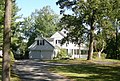
Part of Maple Hill (see 3047 Spring Mill Road, below)
opposite 2070 Butler Pike
c.1794
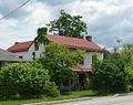
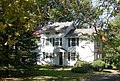
Journey's End[4] Thomas White House Plymouth Friends School
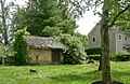
Samuel Maulsby built the stone barn, c.1795. His son-in-law George Corson built Abolition Hall, 1856. 1871 – Estate of George Corson[5] Abolition Hall, left, c.1906.
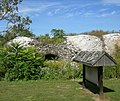
Hiram Blee & Company Lime Kilns
opposite 4044 Butler Pike
Demolished by Danella Companies, Inc., Spring 2019, to make way for additional truck parking.
4066 Butler Pike
G. & W. H. Corson Company offices
opposite 4200 Butler Pike
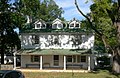
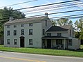
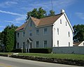
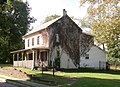
Hovenden House Samuel Maulsby House Maulsby-Corson-Hovenden House
1 E. Germantown Pike NE corner Germantown & Butler Pikes
c.1795
Built by Samuel Maulsby. 1871 – Estate of George Corson[5] The rear ell incorporates the stone walls of an earlier house.[2]
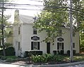
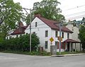
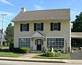
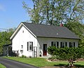
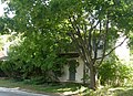
Barrett House
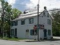
2 E. Germantown Pike SE corner Germantown & Butler Pikes
Built by Samuel Maulsby. His son Jonathan served as Plymouth Meeting's first postmaster.[6] 1871 – Jesse Hall Store/Plymouth Meeting P. O.[5] Hall's Store circa 1900:
1871 – J. Lare[5] Lare was a blacksmith and minister.[13] The 1871 G. W. Hopkins Atlas shows a small building east of his house, possibly his blacksmith shop.[5]
"An Evangelical meeting-house was commenced here in 1876, but not dedicated until July 22, 1883. It is a two-story stone edifice, with a capacity to seat five hundred persons."[15]
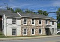
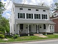
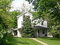
Leedom House[23] Dr. Joseph Leedom Dr. Edwin C. Leedom
2 W. Germantown Pike NW corner Germantown & Butler Pikes
c.1803
1871 – Dr. E. C. Leedom[5] Dr. Joseph Leedom established his practice in Plymouth Meeting in 1803. His son and grandson also became physicians.[24] Leedom Springhouse:
Dr. Hiram Corson shared a medical office with Dr. Joseph Leedom in the Leedom House, at 2 W. Germantown Pike, before establishing a medical office here in his own house.[37] Garden house and carriage house:
This page is based on this Wikipedia article Text is available under the CC BY-SA 4.0 license; additional terms may apply. Images, videos and audio are available under their respective licenses.