Cigar Lake Airport is located 1 nautical mile south-west of Waterbury Lake, Saskatchewan, Canada in the Athabasca Basin. It serves the Cigar Lake Mine.

Wollaston Lake is a lake in north-eastern part of the Canadian province of Saskatchewan. It is about 550 kilometres (340 mi) north-east of Prince Albert. With a surface area of 2,286 square kilometres (883 sq mi), it is the largest bifurcation lake in the world – that is, a lake that drains naturally in two directions.
Highway 995, also known as Welcome Street, is a provincial highway in the far north region of the Canadian province of Saskatchewan. It is one of the few highways in Saskatchewan that is completely isolated from the other highways. Seasonal access is provided to Highway 905 by way of the Wollaston Lake Barge.

Last Mountain Lake, also known as Long Lake, is a prairie lake formed from glaciation 11,000 years ago. It is located in south central Saskatchewan, Canada, about 40 kilometres (25 mi) north-west of the city of Regina. It flows into the Qu'Appelle River via Last Mountain Creek, which flows past Craven. It is approximately 93 km (58 mi) long, and 3 km (1.9 mi) wide at its widest point. It is the largest naturally occurring body of water in southern Saskatchewan. Only Lake Diefenbaker, which is man-made, is larger. The lake is a popular resort area for residents of south-eastern Saskatchewan.

Wascana Creek is a river in the Canadian province of Saskatchewan. It is a tributary of the Qu'Appelle River.
Little Bear Lake is a lake in the boreal forest ecozone in the Canadian province of Saskatchewan. The lake is in a hilly plateau called Cub Hills and the landforms, such as the lakes and streams, of the Cub Hills were formed over 10,000 years ago during the last ice age. Little Bear Lake is accessed from the Hanson Lake Road, which runs along the eastern side of the lake, and by a small airport called Little Bear Lake Airport.

Waterhen River is an east-flowing river in the north-west area of the Canadian province of Saskatchewan in the drainage basin of the Beaver River. It is north of and parallel to the east-flowing part of the Beaver River and joins the north-flowing part of that river. Most of the river and its drainage basin is at the southern edge of the boreal forest belt. While the river's source is Lac des Îles, its drainage basin reaches north into the Mostoos Hills and west well into the neighbouring province of Alberta.

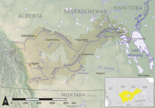
Geikie River is a river in the northern part of the Canadian province of Saskatchewan. The river's source is Costigan Lake, which is near the uranium producing areas around the Key Lake mine in the Athabasca Basin. It flows in a north-easterly direction and flows into Wollaston Lake.

Moose Mountain Creek is a river in the Canadian province of Saskatchewan. Its source is the Chapleau Lakes near Montmartre and it is a tributary of the Souris River, which, in turn, is a tributary of the Assiniboine River. The whole system is part of the Red River watershed, which is part of the Hudson Bay drainage basin and in a region called the Prairie Pothole Region of North America, which extends throughout three Canadian provinces and five U.S. states. It is also within Palliser's Triangle and the Great Plains ecoregion.

Lanigan Creek is a river in the Canadian province of Saskatchewan. It is located in the south central part of the province in a region called the Prairie Pothole Region of North America, which extends throughout three Canadian provinces and five U.S. states. It is also within Palliser's Triangle and the Great Plains ecoregion.

Etomami River is a river in the Canadian province of Saskatchewan. The river originates in the Porcupine Hills and flows northward towards the town of Hudson Bay and into the Red Deer River. "Etomami" is a First Nations word that means "a place that three rivers join". It is in reference to the spot along the Red Deer River where the mouths of the Etomami and Fir Rivers meet the Red Deer River.
First Mustus Lake is a lake in Meadow Lake Provincial Park in the Canadian Province of Saskatchewan in the boreal forest ecozone of Canada. The lake is the first of four lakes in a row named Mustus in the Rusty Creek watershed. The other lakes are Second, Third, and Fourth Mustus. Rusty Creek and the lakes are part of the Waterhen River drainage basin. The Waterhen River is a tributary of the Beaver River, which flows north into Lac Île-à-la-Crosse and the Churchill River, a major tributary in the Hudson Bay drainage basin. Highway 224 provides access to both First and Second Mustus Lakes.
Peitahigan Lake is a lake in Meadow Lake Provincial Park in the Canadian Province of Saskatchewan in the boreal forest ecozone of Canada. The lake is one of six notable lakes in the Rusty Creek watershed. The other lakes include Rusty, First Mustus, Second Mustus, Third Mustus, and Fourth Mustus. Rusty Creek and the lakes are part of the Waterhen River drainage basin. The Waterhen River is a tributary of the Beaver River, which flows north into Lac Île-à-la-Crosse and the Churchill River, a major tributary in the Hudson Bay drainage basin.
Mistohay Lake is a lake in Meadow Lake Provincial Park in the Canadian Province of Saskatchewan in the boreal forest ecozone of Canada. The lake is part of the Waterhen River drainage basin. The Waterhen River is a tributary of the Beaver River, which flows north into Lac Île-à-la-Crosse and the Churchill River, a major tributary in the Hudson Bay drainage basin.
McDougal Creek is a river in the Canadian province of Saskatchewan. The river's source is at the southern end of Divide Lake at the northern end of Narrow Hills Provincial Park in a hilly plateau called Cub Hills. The landforms of the Cub Hills, such as the lakes, streams, steeply rolling hills, and flat lowlands, were formed over 10,000 years ago during the last ice age. The entire course of the river is in the boreal forest ecozone of Canada.
Nipekamew River is a river in the Canadian province of Saskatchewan. The river's source is Nipekamew Lake at the north-western edge of the Cub Hills and its mouth is in Nipekamew Bay at the southern shore of Lac la Ronge. From the northern tip of Nipekamew Lake, the river travels from south to north through muskeg and boreal forest en route to Lac la Ronge. Lake la Ronge empties north into the Churchill River through Rapid River.
Nipekamew Creek is a creek in the boreal forest ecozone in the Canadian province of Saskatchewan. Its source is in muskeg approximately 20 kilometres west of Piprell Lake, near Highway 913. From the muskeg, the creek flows in a northerly direction through forests, rolling hills, glacier formed valleys, first into Stuart Lake, then Nipekamew Lake. The creek can be accessed from Highways 927, 913, and 912. After the creek leaves Stuart Lake, it follows the course of Highway 912 from there until it empties into Nipekamew Lake.
Lost Echo Lake is a lake in the east-central part of the Canadian province of Saskatchewan in Narrow Hills Provincial Park. It is situated in a glacier-formed valley in the Cub Hills and the boreal forest ecozone of Canada. It is south of Summit Lake and is accessed from secondary roads that branch off of Highway 913. While there are no communities nor settlements on the lake, there is the Lost Echo Wilderness Campsite on the western shore.
Pepaw River, also spelt Peepaw, is a river in the east-central part of the Canadian province of Saskatchewan in the boreal forest ecozone of Canada. It begins in the Porcupine Hills and flows northward and meets up with the Etomami River south of the town of Hudson Bay. Much of the river is within Saskatchewan's Porcupine Provincial Forest and as such has various recreational opportunities along its course.
Piwei River is a river in the east-central part of the Canadian province of Saskatchewan in the boreal forest ecozone of Canada. It begins at the western end of the Porcupine Hills at Piwei Lakes and heads in an easterly direction through a glacier-formed valley and into the Etomami River, which is a tributary of the Red Deer River.

