Seal of the Local Government Unit of Concepcion, Tarlac, Philippines
Concepcion, officially the Municipality of Concepcion (Kapampangan: Balen ning Concepcion; Filipino: Bayan ng Concepcion), is a municipality in the province of Tarlac, Philippines. According to the 2024 census, it has a population of 178,549 people.[5]
In 1860, the towns of Concepcion and Magalang comprised a single town named San Bartolome (presently a barangay of Concepcion), which was a military Commandancia of Pampanga under the Spanish regime.
In 1863, a catastrophic flood devastated the whole town of San Bartolome, giving birth to the towns of Concepcion and Magalang. The residents were left with no other choice but to abandon the place. Divided as to where they were to resettle, some went north and others went south. The first group, headed by Don Pablo Luciano, the Governadorcillo, organized a new settlement on the slopes of Mt. Arayat further south and named the settlement after him. Eventually, the place was renamed Magalang. The second group who took refuge in the north comprised the Santoses, Laxamanas, Salvadors, Yumuls, Castros, Dizons, Pinedas, Felicianos, Aquinos, Corteses, Bermudezes, Perezes, Punsalangs and many others, and settled in a place (now called Santo Nino) then occupied by the Lindos and the Amuraos (Don Esquolastiquo Amurao and Don Gaston Amurao).
Most of the settlers became dissatisfied with the place, as it abounded with snakes and was scarce in water. They moved further south to a place now known as Concepcion. The settlers began clearing the land and built huts and roads. After several years, they named the place Concepcion after the Immaculate Conception, who was believed to possess power over the snakes that abound in the area.[6]
By 1897, the Katipunan was organized under General Servillano Aquino, and in 1898–1900, Moises Castro was elected as the first municipal president under the short-lived Philippine Republic led by General Emilio Aguinaldo. In 1900, General Servillano Aquino was captured by the Americans and sentenced to hang, but in 1904, he was pardoned by order of the President of the United States, Theodore Roosevelt. The First American government in town was established in 1902 by Captain Smith, who appointed Don Marciano Barrera as the first Filipino President.
American colonial era
The town saw progress with the construction of the Gabaldon School building in 1911, costing fifty thousand pesos, but in 1918 an influenza epidemic killed people by the hundreds. By 1929, the municipal building and two bandstands were constructed, and in 1935 the Commonwealth government was installed with Don Gregorio Palma as municipal president. The town plaza, costing twenty thousand pesos, was fenced and named Don Benigno Q. Aquino Sr. Memorial Park in 1939.
Japanese occupation
During World War II, Japanese occupation began in 1942 with military garrisons stationed in the town, marked by brutalities and killings. From 1942–1944, guerrillas and Hukbalahap communist fighters aided the Philippine Commonwealth Army in battles against the Japanese. On December 27, 1944, Japanese forces left the town, with the Hukbalahap taking over until January 1945. Between January and August 1945, Filipino and American ground troops liberated the town, reestablishing the Commonwealth government. On Independence Day 1946, General Servillano Aquino and Reymundo Panlilio hoisted the Philippine flag in a solemn ceremony at Benigno Aquino Memorial Park.
Post-war era
Education and civic institutions followed: Benigno Aquino Memorial High School was established in 1948, a municipal library in 1952, and later, Ninoy Aquino’s political career began in 1955 when he became Concepcion’s youngest mayor at 22. Through the years, school districts expanded (1962–1971), and infrastructure such as the Concepcion Emergency Hospital in 1972 and Lucong Bridge in 1974 was developed. Civic organizations including the Concepcion Jaycees, Concepcion Educational Foundation, and Rotary Club of Southern Tarlac emerged between 1977–1979.
The 1980s marked significant developments: Concepcion Water District was established in 1980, Tarlac II Electric Cooperative in 1981, and Barangay San Nicolas Balas became the first barangay powered by TARELCO II in 1983. But this period was also marked by tragedy, with the assassination of Benigno “Ninoy” Aquino in 1983. The EDSA Revolution of 1986 made Corazon Aquino president, and Concepcion honored Ninoy with a bronze statue in 1987.
Natural calamities struck in 1990 with the Luzon earthquake and again in 1991 with the Mount Pinatubo eruption and devastating lahar flows. Evacuees were resettled in Camp O’Donnell in 1992. Infrastructure and institutions grew through the 1990s with the establishment of Kabalikat Civicom in 1993, the Concepcion Training Center in 1993, and the renaming of Aquino Memorial High School to Benigno S. Aquino National High School in 1994.
Contemporary
Into the 2000s, leadership shifted with mayors Benjamin Lacson, Noel L. Villanueva, and Andres D. Lacson, while infrastructure such as the Concepcion Legislative Building, Parua River Bridge, and renovated public market were completed. Cultural pride was highlighted in 2008 when Concepcion joined the Belenismo ng Tarlac competition, coinciding with its 145th Foundation Day.
From 2010 onward, more schools, malls, and banks marked economic growth: Caluluan High School’s grand alumni homecoming in 2010, SM Savemore and Walter Mart opening in 2017, Puregold in 2017, and BPI in 2018, signaling a commerce and trade boom. Political leadership continued with re-elections and transitions, with Mayor Andres D. Lacson re-elected in 2019 and Mayor Noel L. Villanueva elected in 2022.
Geography
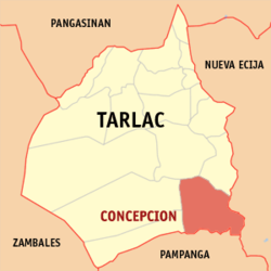
Concepcion is one of the largest municipalities of the province of Tarlac. It lies on the south-eastern tip of Tarlac, bordered to the south by Magalang, to the east by San Antonio, to the north-east by La Paz, to the north-west by Tarlac City, to the west by Capas, and to the south-west by Bamban. It covers an area of 245.7 square kilometres (94.9sqmi). It is 35 kilometres (22mi) from Tarlac City and 159 kilometres (99mi) from Manila.
It has two great rivers, the first being Lucong River which originates from Dingding and Namria creeks in Capas, Tarlac; it is visible from the bridge at Barangay Santiago, and merges with the Rio Chico before joining the Pampanga River. The second is Parua River, which originates from the Sacobia-Bamban river that comes from Mount Pinatubo. Parua River is heavily silted with 7 meters of sand deposits; its bridge was destroyed by lahar and is visible at Barangay San Nicolas Balas. It also merges with the Rio Chico before joining Pampanga River. Both rivers are utilized to irrigate the town's agricultural lands, consisting mainly of rice and sugar crops. Parua River, which at times appears as a bed of sand due to the scarcity of water, is also a quarry site for sand and ash used as construction material.
Barangays
Concepcion is politically subdivided into 45 barangays, as shown below. Each barangay consists of puroks and some have sitios.
In the 2020 census, the population of Concepcion, Tarlac, was 169,953 people,[13] with a density of 700 inhabitants per square kilometre or 1,800 inhabitants per square mile.
Santuario de la Immaculada Concepción[26] (formerly Immaculate Conception Parish Church)[27] belongs to the Roman Catholic Diocese of Tarlac (Latin: Dioecesis Tarlacensis) under the current bishop, Florentino Ferrer Cinense, appointed in 1988,[28] and under the Vicariate of the Immaculate Conception, Vicar Forane: Msgr. Tirso Daquigan, Parish Priest, Titular: Immaculate Conception, Feast day, December 8).[29][30][31][32] Fr. Melvin P. Castro, Chancellor.
Col. Jesus R. Lapus Memorial Sports Complex
Ninoy Aquino Monument (bronze statue)
Concepcion Municipal Hall (depicted on the back of the 500-peso bill)
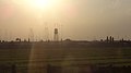
Voice of America relay station at Barangay Tinang, as seen from SCTEX
Education
There are four schools district offices which govern all educational institutions within the municipality. They oversee the management and operations of all private and public, from primary to secondary schools.[33] These are Concepcion East Schools District Office, Concepcion North Schools District Office, Concepcion South Schools District Office, and Concepcion West Schools District Office.
Primary and elementary schools
Alfonso Elementary School
Almendras Elementary School
Aurora Aquino Elementary School
Balutu Elementary School
Cafe Elementary School
Calius-Gueco Elementary School
Castillo Elementary School
Concepcion Bible Baptist Church Academy
Concepcion Catholic School
Concepcion East Central School
Concepcion Ecumenical School
Concepcion Jesus Light Academy
Concepcion Little Angels School
Concepcion North Central Elementary School
Concepcion West Central Elementary School
Concepcion South Elementary School
Concepcion Special Education Center
Coral Cambing Elementary School
Culatingan Elementary School
Dungan Elementary School
Good Shepherd Christian School
Green Village Elementary School
Growing Kids Childminding Center
Jefmin Elementary School
Ligaya Elementary School
Lilibangan Elementary School
Living Stones Christian Academy
Lourdes Elementary School
Mabilog Elementary School
Macabacle Elementary School
Macangcong Elementary School
Magao Elementary School
Magunting Elementary School
Malupa Elementary School
Marimla Elementary School
Minane Elementary School
Montesun School
Panalicsican Elementary School
Pao Elementary School
Parang Elementary School
Parulung Elementary School
Pitabunan Elementary School
San Agustin Elementary School
San Antonio Elementary School
San Bartolome Elementary School
San Francisco Elementary School
San Jose Elementary School
San Juan De Castro Elementary School
San Miguel Elementary School
San Nicolas Balas Elementary School
San Vicente Calius Elementary School
San Vicente Corba Elementary School
Sta. Cruz Elementary School
Sta. Maria Elementary School
Sta. Monica Elementary School
Sto. Cristo Elementary School
Sto. Nino Elementary School
Talimundoc SM Elementary School
Tinang Elementary School
The Rosefield Children's House
Young Believers of Christian Faith School
Secondary schools
Anastacio G. Yumul High School (formerly Balutu National High School)
Benigno S. Aquino National High School
Caluluan National High School
Caluluan National High School (Annex)
Precious High Academy
Santa Rosa National High School
Sta. Rosa Integrated School
Sta. Rosa Integrated School (Steady Ready Street)
Concepcion Catholic School
Higher education institution
Concepcion Holy Cross College
Notable personalities
Ninoy Aquino (from Barangay San Jose Pob.) – the youngest municipal mayor of Concepcion (1955–1959); subsequently the youngest governor of the Tarlac province, a Philippine senator and a leader of the opposition to the autocratic rule of Ferdinand Marcos. He was assassinated at Manila International Airport (now named Ninoy Aquino International Airport in his honor) upon returning home from exile in the United States. His death catapulted his widow, Corazon Aquino, to the limelight and the presidency, subsequently replacing the 20-year-old Marcos regime.
Benigno Aquino Sr. (from Barangay San Agustin Murcia) – a Philippine senator and served as Speaker of the Second Philippine Republic National Assembly from 1943 to 1944. he is the father of Ninoy Aquino.
Eva Estrada-Kalaw (from Barangay San Agustin Murcia) – a Philippine senator and served as a congresswoman in the Congress of the Philippines for 7 years. (1965–1972). Serving in Congress during the presidency of Ferdinand Marcos (Nationalist), she was part of a major transformation in Philippine domestic and foreign policies.
Jesli Aquino Lapus (from Barangay San Nicolas Pob.) – a former Congressman of the 3rd District of Tarlac and former Secretary of Department of Trade and Industry as of 2010. He also served as Secretary of Education from 2006 to 2010.
Lorna Tolentino (from Barangay Minane) – a multi-awarded actress and TV host.
Tyron Perez (from Barangay Alfonso) – a model and actor on GMA Network's reality talent competition show, StarStruck.
This page is based on this Wikipedia article Text is available under the CC BY-SA 4.0 license; additional terms may apply. Images, videos and audio are available under their respective licenses.