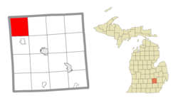
Conway Township, Michigan | |
---|---|
Coordinates: 42°43′31″N84°06′21″W / 42.72528°N 84.10583°W | |
Country | United States |
State | Michigan |
County | Livingston |
Established | 1838 |
Government | |
• Supervisor | Michael Rife |
• Clerk | Elizabeth Whitt |
Area | |
• Civil township | 37.8 sq mi (97.9 km2) |
• Land | 37.8 sq mi (97.8 km2) |
• Water | 0.04 sq mi (0.1 km2) |
Elevation | 899 ft (274 m) |
Population (2010) | |
• Civil township | 3,546 |
• Estimate (2017) | 3,594 [1] |
• Density | 93.8/sq mi (36.2/km2) |
• Metro | 4,296,250 (Metro Detroit) |
Time zone | UTC-5 (Eastern (EST)) |
• Summer (DST) | UTC-4 (EDT) |
ZIP code(s) | |
Area code | 517 |
FIPS code | 26-17920 [2] |
GNIS feature ID | 1626130 [3] |
Website | www |
Conway Township is a civil township of Livingston County in the U.S. state of Michigan. The population was 3,546 at the 2010 census, an increase of 814 from the 2000 census.
According to the United States Census Bureau, the township has a total area of 37.8 square miles (98 km2), of which 37.8 square miles (98 km2) is land and 0.04 square miles (0.10 km2) (0.08%) is water.
As of the 2010 census, [1] there were 3,546 people, 1,199 households, and 968 families residing in the township. The population density was 93.8 inhabitants per square mile (36.2/km2). There were 1,264 housing units at an average density of 33.4 per square mile (12.9/km2). The racial makeup of the village was 96.4% White, 0.3% African American, 0.8% Native American, 0.8% Asian, 0.1% from other races, and 1.6% from two or more races. Hispanic or Latino of any race were 1.7% of the population.
There were 968 households, of which 38.0% had children under the age of 18 living with them, 66.2% were married couples living together, 8.5% had a female householder with no husband present, 6.0% had a male householder with no wife present, and 19.3% were non-families. 15.2% of all households were made up of individuals, and 5.5% had someone living alone who was 65 years of age or older. The average household size was 2.95 and the average family size was 3.28.
The median age in the township was 37 years. 28.9% of residents were under the age of 18; 7.4% were between the ages of 18 and 24; 27.1% were from 25 to 44; 28.3% were from 45 to 64; and 8.5% were 65 years of age or older. The gender makeup of the township was 52.1% male and 47.9% female.
The median income for a household in the township was $68,077, and the median income for a family $76,638. Males had a median income of $63,125 versus $40,469 for females. The per capita income for the township was $25,751. 8.5% of families and 10.9% of the population were below the poverty line, including 13.3% of those under 18 and 6.7% of those 65 or older.
As of the 2000 census, there were 2,732 people, 887 households, and 748 families residing in the township. The population density was 72.3 inhabitants per square mile (27.9/km2). There were 919 housing units at an average density of 24.3 per square mile (9.4/km2). The racial makeup of the township was 95.97% White, 0.26% African American, 1.43% Native American, 0.15% Asian, 0.00% Pacific Islander, 0.55% from other races, and 1.65% from two or more races. 1.32% of the population were Hispanic or Latino of any race.
There were 887 households, out of which 45.7% had children under the age of 18 living with them, 75.3% were married couples living together, 6.2% had a female householder with no husband present, and 15.6% are non-families. 12.6% of all households were made up of individuals, and 4.2% had someone living alone who was 65 years of age or older. The average household size was 3.08 and the average family size was 3.38.
The median age in the township was 35 years. 31.3% of residents were under the age of 18; 7.1% were between the ages of 18 and 24; 32.7% were from 25 to 44; 21.6% were from 45 to 64; and 7.4% were 65 years of age or older. The gender makeup of the township was 51.7% male and 48.3% female.
The median income for a household in the township was $64,306, and the median income for a family was $67,206. Males had a median income of $49,392 versus $27,813 for females. The per capita income for the township was $23,796. 2.3% of families and 4.1% of the population were below the poverty line, including 6.1% of those under 18 and 6.6% of those 65 or older.
Spring Lake is a town in Sugar Creek Township, Hancock County, Indiana, United States, along Sugar Creek. The population was 218 at the 2010 census.
Alcona Township is a civil township of Alcona County in the U.S. state of Michigan. The population was 965 at the 2020 census.
Custer Township is a civil township of Antrim County in the U.S. state of Michigan. The population was 1,136 at the 2010 census.
Bengal Township is a civil township of Clinton County in the U.S. state of Michigan. The population was 1,188 at the 2010 census.
Camden Township is a civil township of Hillsdale County in the U.S. state of Michigan. The population was 2,093 at the 2020 census. The villages of Camden and Montgomery are within the township.
Sand Beach Township is a civil township of Huron County in the U.S. state of Michigan. The population was 1,470 at the 2000 census.
Almont Township is a civil township of Lapeer County in the U.S. state of Michigan. The population was 6,961 at the 2020 Census.
Dryden is a village in Lapeer County in the U.S. state of Michigan. The population was 951 at the 2010 census. The village is located within Dryden Township.
Seneca Township is a civil township of Lenawee County in the U.S. state of Michigan. The population was 1,303 at the 2000 census.
West Branch Township is a civil township of Marquette County in the U.S. state of Michigan. The population was 1,702 at the 2020 census.
Fruitland Township is a civil township of Muskegon County in the U.S. state of Michigan. The population was 5,235 at the 2000 census.
Whitehall Township is a civil township of Muskegon County in the U.S. state of Michigan. The population was 1,648 at the 2000 census. The city of Whitehall is located at the southwest corner of the township, but is administratively autonomous.
Milford Township is a charter township of Oakland County in the U.S. state of Michigan. The population was 15,736 at the 2010 census. The village of Milford is located within the township.
Benona Township is a civil township of Oceana County in the U.S. state of Michigan. As of the 2020 census, the township population was 1,425.
Haight Township is a civil township of Ontonagon County in the U.S. state of Michigan. The population was 203 at the 2020 census.
Hartwick Township is a civil township of Osceola County in the U.S. state of Michigan. The population was 629 at the 2000 census.
James Township is a civil township of Saginaw County in the U.S. state of Michigan. The population was 2,023 at the 2010 Census.
Wheatland Township is a civil township of Sanilac County in the U.S. state of Michigan. The population was 416 at the 2020 census.
Antrim Township is a civil township of Shiawassee County in the U.S. state of Michigan. As of the 2010 census, the township population was 2,161. The township is believed to be named after either Antrim, Northern Ireland or Antrim, New Hampshire.
Lennon is a village in the U.S. state of Michigan. The population was 511 at the 2010 census. The village is located along M-13 within Venice Township in Shiawassee County to the west and Clayton Township in Genesee County to the east.