
Sipaliwini is the largest district of Suriname, located in the south. Sipaliwini is the only district that does not have a regional capital, as it is directly administered by the national government in Paramaribo.

Wageningen is a community resort and an agricultural place in the Republic of Suriname and located in the coastal area of West Suriname in the Nickerie District, at the harbour of the Nickerie River across the right estuary of the Maratakka River. The town was known as the rice centre of Suriname, Wageningen has been founded in 1949 and named after the Dutch city of Wageningen.

Totness is a town in Suriname, located in the Coronie district, of which it is the capital. Totness is the oldest settlement in the district.

Tapanahoni is a resort in Suriname, located in the Sipaliwini District. Its population at the 2012 census was 13,808. Tapanahoni is a part of Sipaliwini which has no capital, but is directly governed from Paramaribo. Tapanahony is an enormous resort which encompasses a quarter of the country of Suriname. The most important town is Diitabiki which is the residence of the granman of the Ndyuka people since 1950, and the location of the oracle.

Kwakoegron is a town and resort in Suriname. It is located inland, due south of Paramaribo. According to the 2012 census it has a population of 263, and is mainly inhabited by Maroons, of the Matawai people. The resort and town are named after Kwakoe, the native word for Wednesday, and grond, the Dutch word for ground. The captain of the resort resides in the village Commisariskondre.

Groot Henar is a resort in Suriname, located in the Nickerie District, near the bridge over the Nickerie River. Its population at the 2012 census was 2,709, most of which are East Indian. The resort has been named after the plantation Henar which was turned into small agricultural plots after the abolition of slavery. The cultivatable area was increased with the Henarpolder created in the 1920s. 1970 the Europolder was created adding 3,700 hectares to the resort.

Oostelijke Polders is a resort in Suriname located in the Nickerie District. Its population at the 2012 census was 7,153. Villages in the resort include Glasgow, Hamptoncourtpolder, and Paradise. Oostelijke Polders is an agricultural area with a focus on rice production. Oostelijke Polder has a clinic and a school.

Noord is a resort in Suriname, located in the Para District. Its population at the 2012 census was 9,703. Noord is mainly an agricultural area, and has a school.

Zuid is a resort in Suriname, located in the Para District. Its population at the 2012 census was 6,113. The main ethnic groups are indigenous, Creoles, and mixed race.

Coeroeni is a resort in Suriname, located in the Sipaliwini District. Its population at the 2012 census was 1,046. The resort is mainly inhabited by indigenous people of the Tiriyó tribe. Kwamalasamutu is the main village of the resort and home to the granman Asongo Alalaparu.

Boven Coppename is a resort in Suriname, located in the Sipaliwini District. Its population at the 2012 census was 539. The resort is mainly inhabited by indigenous people of the Tiriyó, and Maroons of the Kwinti tribe. The main village is Bitagron. Other villages include Corneliskondre and Donderskamp.
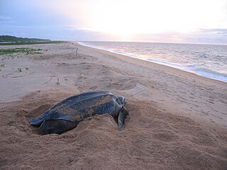
Galibi is a resort in Suriname, located in the Marowijne District. Its population at the 2012 census was 741. Galibi is a tribal area inhabited by an indigenous population of Kalina Amerindians.

The Ndyuka people or Aukan people (Okanisi), are one of six Maroon peoples in the Republic of Suriname and one of the Maroon peoples in French Guiana. The Aukan or Ndyuka speak the Ndyuka language. They are subdivided into the Opu, who live upstream of the Tapanahony River in the Tapanahony resort of southeastern Suriname, and the Bilo, who live downstream of that river in Marowijne District

The Tigri Area is a wooded area that has been disputed since around 1840 by Guyana and Suriname. It involves the area between the Upper Corentyne River, the Coeroeni River and the Kutari River. This triangular area is in Guyana known as the New River Triangle. In 1969 the conflict ran high on and since then the Tigri Area is controlled by Guyana and claimed by Suriname. In 1971 both governments in Trinidad agreed that they continue talks over the border issue and withdraw their military forces from the disputed Triangle. Guyana has never held upon this agreement.

Berg en Dal is a village in the resort of Klaaskreek in the Brokopondo District of Suriname. The village is located on the Suriname River.

Donderskamp is an indigenous village of Kalina Amerindians in the resort of Boven Coppename in the Sipaliwini District in Suriname. The village is located on the Wayambo River.
Witsanti is an indigenous village of Lokono and Kalina Amerindians in the resort of Zuid in the Para District in Suriname. The village is located on the John F. Kennedyweg near the Johan Adolf Pengel International Airport.

Cabendadorp is an indigenous village of Kalina Amerindians in the resort of Zuid in the Para District in Suriname. The village is located on the Afobakaweg south of the Johan Adolf Pengel International Airport.
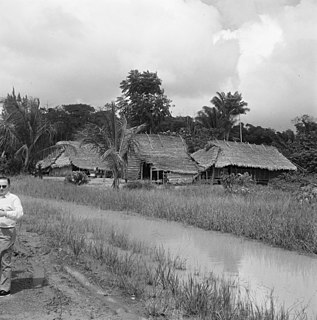
Powakka is an indigenous village of Lokono Amerindians in the resort of Oost in the Para District in Suriname. The village is located on the road to Carolina which connects to the Afobakaweg to Paramaribo.
Pikin Saron is an indigenous village of Kalina Amerindians in the resort of Zuid in the Para District in Suriname. The village can be accessed from the Southern East-West Link, and is located on the Saramacca River.

