Brokopondo is a district of Suriname. Its capital city is Brokopondo; other towns include Brownsweg and Kwakoegron.

Sipaliwini is the largest district of Suriname, located in the south. Sipaliwini is the only district that does not have a regional capital, as it is directly administered by the national government in Paramaribo.
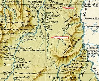
Brokopondo is the capital town of the Brokopondo District, Suriname. It is located on the west shore of the Suriname river, just north of the Afobaka dam. Brokopondo can be reached via the Afobakaweg from Paranam to Afobaka.

Tapanahoni is a resort in Suriname, located in the Sipaliwini District. Its population at the 2012 census was 13,808. Tapanahoni is a part of Sipaliwini which has no capital, but is directly governed from Paramaribo. Tapanahony is an enormous resort which encompasses a quarter of the country of Suriname. The most important town is Diitabiki which is the residence of the granman of the Ndyuka people since 1950, and the location of the oracle.

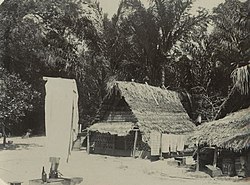
Aurora is a town in the Sipaliwini District of Suriname, located at the Suriname River. Aurora is a tribal village, and has a twin village called Nieuw Aurora which was built as an extension. The village is home to Maroons of the Saramaka tribe.

Benzdorp is a village in the Sipaliwini District of Suriname. It is named after the English consul and bullion dealer H.J.W. Benz.

The Matawai are a tribe of Surinamese Maroons. The Matawai were originally part of the Saramaka, and signed a peace agreement with the Dutch colonists in 1762. The tribe split from the Saramaka, and in 1769, they were recognized as a separate tribe.

Pamacca is a resort in Suriname, located in the Sipaliwini District. The population is estimated between 1,500 and 2,000 people. In 1983, the Sipaliwini District was created, and the eastern part became the resort of Tapanahony. The Pamacca resort is the northern part of Tapanahony, and mainly inhabited by the Paramaccan people, the border of the resorts is the island of Bofoo Tabiki in the Marowijne River.
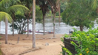
Pikin Slee is a village on the Suriname River in the resort Boven Suriname of the Sipaliwini District. It is home to about 3,000 people, and the second largest village of the Saramaka Maroons, after Aurora.

Bigiston, also Bigi Ston, is a group of settlements of Ndyuka Maroons and indigenous Kalina in the Albina resort of the Marowijne District of Suriname. The villages lie on Marowijne River across from Saint-Jean-du-Maroni in French Guiana.
Jaw Jaw, also Yaw Yaw, is a village of Saamaka Maroons in the Boven Suriname resort of the Sipaliwini District of Suriname. The village is located on the Suriname River.

Antonio do Brinco, also Albina 2, is a garimpeiros village in the Tapanahony resort of the Sipaliwini District of Suriname. The village is located on the Lawa River, and is next to Peruano, and opposite Maripasoula in French Guiana. The village is named after Antonio with the earring who constructed the first commercial building.
Ovia Olo, also Ovillanhollo, is a village of Ndyuka Maroons in the Patamacca resort of the Marowijne District of Suriname.
Boslanti is a village of Matawai Maroons in the resort of Boven Saramacca in the Sipaliwini District of Suriname. Boslanti is located on the Saramacca River.
Nason is a village of Paramacca Maroons in the Sipaliwini District of Suriname. The village is located on an island in the Marowijne River.

Ricanau Mofo, also Ricanaumofo, is a village of Ndyuka Maroons in the Moengo resort of the Marowijne District of Suriname. The village can be accessed from the East-West Link via Moengo. Ricanau Mofo is located on the Cottica River.
Pikin Saron is an indigenous village of Kalina Amerindians in the resort of Zuid in the Para District in Suriname. The village can be accessed from the Southern East-West Link, and is located on the Saramacca River.
Snesiekondre is a village of Paramacca Maroons in the Sipaliwini District of Suriname. The village is located at the end of the road connecting Langatabiki to Patamacca and the rest of Suriname.
Villa Brazil is a garimpeiros village in the Boven Saramacca resort of the Sipaliwini District of Suriname.
Sara Creek is a former tributary of the Suriname River located in the Para District of Suriname. After the completion of the Afobaka Dam in 1964, the Sara Creek flows into the Brokopondo Reservoir. In 1876, gold was discovered along the Sara Creek, and a railway line from Paramaribo to the river was completed in 1911.