The cuisine of the Southern United States developed in the traditionally defined American South, influenced by African, English, Scottish, Irish, French, Spanish, and Native American cuisines. Tidewater, Appalachian, Creole, Lowcountry, and Floribbean are examples of types of Southern cuisine. In recent history, elements of Southern cuisine have spread north, having an effect on the development of other types of American cuisine.

Bowling Green is an incorporated town in Caroline County, Virginia, United States. The population was 1,111 at the 2010 census.

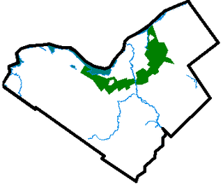
A green belt or greenbelt is a policy and land use zone designation used in land use planning to retain areas of largely undeveloped, wild, or agricultural land surrounding or neighbouring urban areas. Similar concepts are greenways or green wedges which have a linear character and may run through an urban area instead of around it. In essence, a green belt is an invisible line designating a border around a certain area, preventing development of the area and allowing wildlife to return and be established.

Smithfield ham is a specific form of country ham finish-cured in the town of Smithfield in Isle of Wight County in the Hampton Roads region of Virginia, U.S.

The Blue Ridge Mountains are a physiographic province of the larger Appalachian Mountains range. The mountain range is located in the eastern United States, and extends 550 miles southwest from southern Pennsylvania through Maryland, West Virginia, Virginia, North Carolina, South Carolina, Tennessee and Georgia. This province consists of northern and southern physiographic regions, which divide near the Roanoke River gap. To the west of the Blue Ridge, between it and the bulk of the Appalachians, lies the Great Appalachian Valley, bordered on the west by the Ridge and Valley province of the Appalachian range.

Marshall University is a public research university in Huntington, West Virginia. It was founded in 1837 and is named after John Marshall, the fourth Chief Justice of the United States.

Sir William Berkeley was a colonial governor of Virginia, and one of the Lords Proprietors of the Colony of Carolina; he was appointed to these posts by King Charles I, of whom he was a favourite.

"Take Me Home, Country Roads", also known as "Take Me Home" or "Country Roads", is a song written by Bill Danoff, Taffy Nivert, and John Denver about the state of West Virginia. It was released as a single performed by Denver on April 12, 1971, peaking at number 2 on Billboard's US Hot 100 singles for the week ending August 28, 1971. The song was a success on its initial release and was certified Gold by the RIAA on August 18, 1971, and Platinum on April 10, 2017. The song became one of John Denver's most popular and beloved songs. It has continued to sell, with over 1.5 million digital copies sold in the United States. It is considered to be Denver's signature song.
In West Virginia folklore, the Flatwoods monster, also known as the Braxton County Monster or Phantom of Flatwoods, is an entity reported to have been sighted in the town of Flatwoods in Braxton County, West Virginia, United States, on September 12, 1952, following the appearance of a bright object crossing the night sky. Nearly fifty years later, investigators concluded that the light was a meteor and the creature was a barn owl perched in a tree, with shadows making it appear to be a large humanoid.

Southern West Virginia is a culturally and geographically distinct region in the U.S. state of West Virginia. Generally considered the heart of Appalachia, Southern West Virginia is known for its coal mining heritage and Southern affinity. The region is also closely identified with southwestern Virginia and southeastern Kentucky, with close proximity to northwestern North Carolina and East Tennessee. Today, Southern West Virginia continues to grapple with poverty and continuing population loss. Almost the entire region is located in West Virginia's 3rd congressional district, which was represented by Evan Jenkins until he resigned on September 30, 2018 to take a seat as a Justice on the Supreme Court of Appeals of West Virginia.
The Great Eastern Trail is a north-south hiking route that runs roughly 1,600 miles (2,600 km) through the Appalachian Mountains west of the Appalachian Trail in the eastern United States. As of 2019, it is still under development. From south to north, it runs from Flagg Mountain through Alabama, Georgia, Tennessee, Kentucky, West Virginia, Virginia, Maryland, and Pennsylvania, ending in western New York state. A connection from Flagg Mountain south to the Florida-Georgia border is considered "Phase II Development".
Green v. County School Board of New Kent County, 391 U.S. 430 (1968), was an important United States Supreme Court case dealing with the freedom of choice plans created to avoid compliance with the Court's mandate in Brown II. The Court held that New Kent County's freedom of choice plan did not constitute adequate compliance with the school board's responsibility to determine a system of admission to public schools on a non-racial basis. The Supreme Court mandated that the school board must formulate new plans and steps towards realistically converting to a desegregated system. Green v. County School board of New Kent County was a follow up of Brown v. Board of Education.

WAMN is a Classic Country formatted broadcast radio station licensed to Green Valley, West Virginia, serving Bluefield in Virginia and Bluefield and Princeton in West Virginia. WAMN is owned and operated by West Virginia-Virginia Media, LLC.

Freetown is an unincorporated community in Orange County, Virginia.

This is a list of the National Register of Historic Places listings in Charles City County, Virginia.

This is a list of the National Register of Historic Places listings in Henrico County, Virginia.

This is a list of the National Register of Historic Places listings in James City County, Virginia.

The 2016 United States presidential election in Virginia was held on November 8, 2016, as part of the 2016 General Election in which all 50 states plus The District of Columbia participated. Virginia voters chose electors to represent them in the Electoral College via a popular vote pitting the Republican Party's nominee, businessman Donald Trump, and running mate Indiana Governor Mike Pence against Democratic Party nominee, former Secretary of State Hillary Clinton and her running mate, Virginia Senator Tim Kaine.

The 2016 United States presidential election in West Virginia was held on November 8, 2016, as part of the 2016 General Election in which all 50 states plus the District of Columbia participated. West Virginia voters chose electors to represent them in the Electoral College via a popular vote pitting the Republican Party's nominee, businessman Donald Trump, and running mate Indiana Governor Mike Pence against Democratic Party nominee, former Secretary of State Hillary Clinton and her running mate, Virginia Senator Tim Kaine.


