County of Cavendish

Last updated

Map all coordinates using: OpenStreetMap
Cavendish
Queensland
Cavendish-county-queensland.png
Location within Queensland
Lands administrative divisions around Cavendish:
Fitzroy Fitzroy Canning
Aubigny Cavendish Canning
Aubigny Churchill Stanley

The County of Cavendish is a county (a cadastral division) in Queensland, Australia. [1] Like all counties in Queensland, it is a non-functional administrative unit, that is used mainly for the purpose of registering land titles. The county includes the northern part of the Toowoomba Region and the western part of the Somerset Region. [2] The county was officially named and bounded by the Governor in Council on 7 March 1901 under the Land Act 1897. [1]

Contents

Parishes

Cavendish is divided into parishes, listed as follows:

Parish LGA CoordinatesTownsParish map
Anduramba Somerset 27°12′S152°10′E / 27.200°S 152.167°E / -27.200; 152.167 (Anduramba Parish)
Avoca Somerset 26°37′S152°12′E / 26.617°S 152.200°E / -26.617; 152.200 (Avoca Parish)
Biarra Somerset 27°06′S152°19′E / 27.100°S 152.317°E / -27.100; 152.317 (Biarra Parish) Toogoolawah
Buaraba Somerset 27°22′S152°18′E / 27.367°S 152.300°E / -27.367; 152.300 (Buaraba Parish)
Clarendon Lockyer Valley 27°29′S152°22′E / 27.483°S 152.367°E / -27.483; 152.367 (Clarendon Parish)
Colinton Somerset 26°52′S152°15′E / 26.867°S 152.250°E / -26.867; 152.250 (Colinton Parish) Moore
Cooyar Toowoomba 26°55′S151°55′E / 26.917°S 151.917°E / -26.917; 151.917 (Cooyar Parish) Cooyar, Yarraman
Cressbrook Somerset 27°07′S152°26′E / 27.117°S 152.433°E / -27.117; 152.433 (Cressbrook Parish)
Crows Nest Toowoomba 27°15′S152°03′E / 27.250°S 152.050°E / -27.250; 152.050 (Crows Nest Parish) Crows Nest
Deongwar Somerset 27°15′S152°11′E / 27.250°S 152.183°E / -27.250; 152.183 (Deongwar Parish)
Djuan Toowoomba 27°08′S151°56′E / 27.133°S 151.933°E / -27.133; 151.933 (Djuan Parish) Haden
Emu Creek Toowoomba 27°00′S152°02′E / 27.000°S 152.033°E / -27.000; 152.033 (Emu Creek Parish)
England Somerset 27°25′S152°27′E / 27.417°S 152.450°E / -27.417; 152.450 (England Parish) Coominya, Mount Tarampa
Esk Somerset 27°14′S152°25′E / 27.233°S 152.417°E / -27.233; 152.417 (Esk Parish) Esk
Eskdale Toowoomba 27°06′S152°10′E / 27.100°S 152.167°E / -27.100; 152.167 (Eskdale Parish)
Helidon Lockyer Valley 27°30′S152°07′E / 27.500°S 152.117°E / -27.500; 152.117 (Helidon Parish) Helidon
Lockyer Lockyer Valley 27°30′S152°14′E / 27.500°S 152.233°E / -27.500; 152.233 (Lockyer Parish) Grantham
Murphy Lockyer Valley 27°27′S152°06′E / 27.450°S 152.100°E / -27.450; 152.100 (Murphy Parish)
Nukinenda Somerset 27°01′S152°11′E / 27.017°S 152.183°E / -27.017; 152.183 (Nukinenda Parish)
Ravensbourne Toowoomba 27°21′S152°08′E / 27.350°S 152.133°E / -27.350; 152.133 (Ravensbourne Parish) Ravensbourne
Taromeo South Burnett 26°49′S152°07′E / 26.817°S 152.117°E / -26.817; 152.117 (Taromeo Parish) Benarkin, Blackbutt 1976
Wivenhoe Somerset 27°21′S152°32′E / 27.350°S 152.533°E / -27.350; 152.533 (Wivenhoe Parish) Lake Wivenhoe

Related Research Articles

Elimbah is a rural town and locality in the City of Moreton Bay, Queensland, Australia. In the 2021 census, the locality of Elimbah had a population of 4,290 people.

<span class="mw-page-title-main">County of Churchill, Queensland</span> Cadastral in Queensland, Australia

The County of Churchill is a county in Queensland, Australia. Like all counties in Queensland, it is a non-functional administrative unit, that is used mainly for the purpose of registering land titles. The county lies between 152°E and 153°E longitude, and is centred on the West Moreton region, extending east to the suburbs of Ipswich. The county was named for Lord Randolph Churchill, who was born in 1849, by the Surveyor-General of New South Wales the following year; the area was officially named and bounded by the Governor in Council on 7 March 1901 under the Land Act 1897.

<span class="mw-page-title-main">County of Aubigny</span> Cadastral in Queensland, Australia

The County of Aubigny is a county in Queensland, Australia. Like all counties in Queensland, it is a non-functional administrative unit, that is used mainly for the purpose of registering land titles. The county lies between 151°E and 152°E longitude, and it covers the Toowoomba Region and the Dalby part of the Western Downs Region, The county was named by the Surveyor-General of New South Wales in 1850, possibly to honour the Earl of Arundel who had a long association with the name Aubigny. The area was officially named and bounded by the Governor in Council on 7 March 1901 under the Land Act 1897.

<span class="mw-page-title-main">Curra, Queensland</span> Suburb of Gympie Region, Queensland, Australia

Curra is a rural residential locality in the Gympie Region, Queensland, Australia. In the 2016 census, Curra had a population of 1,920 people.

<span class="mw-page-title-main">Crohamhurst, Queensland</span> Suburb of Sunshine Coast Region, Queensland, Australia

Crohamhurst is a rural locality in the Sunshine Coast Region, Queensland, Australia. In the 2021 census, Crohamhurst had a population of 219 people.

<span class="mw-page-title-main">Rocksberg</span> Suburb of City of Moreton Bay, Queensland, Australia

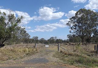
Rocksberg is a rural locality in the City of Moreton Bay, Queensland, Australia. In the 2016 census, Rocksberg had a population of 300 people.

<span class="mw-page-title-main">Whichello, Queensland</span> Suburb of Toowoomba Region, Queensland, Australia

Whichello is a rural locality in the Toowoomba Region, Queensland, Australia. In the 2016 census, Whichello had a population of 31 people.

<span class="mw-page-title-main">Hazeldean, Queensland</span> Suburb of Somerset Region, Queensland, Australia

Hazeldean is a rural locality in the Somerset Region, Queensland, Australia. In the 2016 census, Hazeldean had a population of 262 people.

<span class="mw-page-title-main">Spring Creek, Queensland (Darling Downs)</span> Suburb of Toowoomba Region, Queensland, Australia

Spring Creek is a rural locality split between the Toowoomba Region and the Southern Downs Region, Queensland, Australia. In the 2016 census, Spring Creek had a population of 194 people.

<span class="mw-page-title-main">Coulson, Queensland</span> Suburb of Scenic Rim Region, Queensland, Australia

Coulson is a rural locality in the Scenic Rim Region, Queensland, Australia. In the 2016 census, Coulson had a population of 195 people.

Gooburrum is a rural locality in the Bundaberg Region, Queensland, Australia. In the 2016 census, Gooburrum had a population of 1,442 people. The neighbourhood of Tantitha is within the locality.

Coal Creek is a rural locality in the Somerset Region, Queensland, Australia. In the 2021 census, Coal Creek had a population of 50 people.

Cooeeimbardi is a rural locality in the Somerset Region, Queensland, Australia. In the 2016 census Cooeeimbardi had a population of 7 people.

Morton Vale is a rural locality in the Lockyer Valley Region, Queensland, Australia. In the 2016 census Morton Vale had a population of 143 people.

Townson is a rural locality in the Lockyer Valley Region, Queensland, Australia. In the 2016 census, Townson had a population of 38 people.

<span class="mw-page-title-main">Fairymead, Queensland</span> Suburb of Bundaberg Region, Queensland, Australia

Fairymead is a coastal locality in the Bundaberg Region, Queensland, Australia. In the 2021 census, Fairymead had a population of 28 people.

Doongul is a rural locality in the Fraser Coast Region, Queensland, Australia. In the 2021 census, Doongul had a population of 35 people.

<span class="mw-page-title-main">East Nanango, Queensland</span> Suburb of South Burnett Region, Queensland, Australia

East Nanango is a rural locality in the South Burnett Region, Queensland, Australia. In the 2021 census, East Nanango had a population of 273 people.

Sugarloaf is a rural locality in the Southern Downs Region, Queensland, Australia. In the 2016 census, Sugarloaf had a population of 113 people.

Emu Creek is a rural locality in the Toowoomba Region, Queensland, Australia. In the 2021 census, Emu Creek had a population of 113 people.

References

  1. 1 2 "Cavendish (entry 6681)". Queensland Place Names. Queensland Government . Retrieved 1 September 2015.
  2. Moreton District, County of Cavendish Maps - A4 Series at Queensland Archives.

27°25′S152°10′E / 27.417°S 152.167°E / -27.417; 152.167