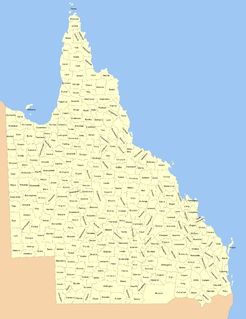
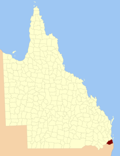
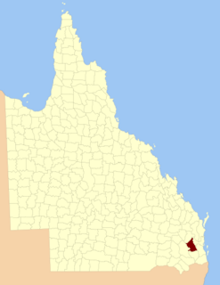
The Division of Longman is an Australian Electoral Division in Queensland. The division was first proclaimed in 1994. The division is named after Irene Longman, the first female member of the Parliament of Queensland and the third woman elected to a parliament in Australia.
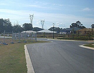
Warner is a suburb north of Brisbane, Queensland, Australia. Its local government area is the Moreton Bay Region 22 kilometres north of the Brisbane central business district. Warner is situated east of Lake Samsonvale and west of the urban localities of Strathpine, Brendale, Bray Park and Lawnton.

The County of Stanley is a cadastral division centred on the city of Brisbane in Queensland, Australia, that is used mainly for the purpose of registering land titles. It was named after Edward Stanley, who was three times British prime minister in the 1850s and 1860s. It is bounded by the Logan River in the south, the Brisbane River at what is now Lake Wivenhoe in the west, the Stanley River at what is now Lake Somerset in the north-west, and Caboolture River in the north. It includes Moreton Island and Stradbroke Island, and extends west to Ipswich's CBD, south to Loganlea and north to Morayfield.
The County of Ward is a county in the south-eastern corner of Queensland, Australia. The main urban area within the county is the city of the Gold Coast, and it also extends to include the southern parts of the West Moreton region centred on Beaudesert and Boonah.

The County of Canning is a county in Queensland, Australia. The county consists of almost all of the former Shires of Caboolture, Maroochy and Kilcoy and the former City of Caloundra. Its main urbanised areas are centred on the Sunshine Coast and the areas surrounding Caboolture.

The Shire of Boonah was a local government area in South East Queensland, Australia, about 80 kilometres (50 mi) southwest of Brisbane. The shire covered an area of 1,921.6 square kilometres (741.9 sq mi), and existed from 1880 until its merger with parts of the Shire of Beaudesert and City of Ipswich to form the Scenic Rim Region on 15 March 2008.
The Shire of Caboolture was a local government area located in the Australian state of Queensland on the northern urban fringe of the capital, Brisbane, and south of the Sunshine Coast. The Shire covered an area of 1,224.4 square kilometres (472.7 sq mi), of which approximately one-quarter was urban, and existed as a local government entity from 1879 until 2008, when it amalgamated with the City of Redcliffe and Shire of Pine Rivers to form the Moreton Bay Region.

Lawnton is a suburb in the Moreton Bay Region, Queensland, Australia.

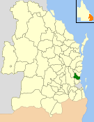
The Moreton Bay Region is a local government area in the north of the Brisbane metropolitan area in South East Queensland, Australia. Established in 2008, it replaced three established local government areas, the City of Redcliffe and the Shires of Pine Rivers and Caboolture.

Dinmore is a suburb of the City of Ipswich, Queensland, Australia. In the 2016 census, Dinmore had a population of 875 people. According to the 2016 Australian Census the Dinmore unemployment rate was 16.7%, in comparison to the Australian unemployment rate of 6.9%.
Brassall is a suburb in the City of Ipswich, Queensland, Australia. In the 2011 census, Brassall had a population of 9,245 people.
The Shire of Moreton was a local government area in South East Queensland, Australia, located about 50 kilometres (31 mi) southwest of Queensland's capital, Brisbane. It represented an area surrounding but not including Ipswich, and existed from 1917 until 1995, when it merged into the City of Ipswich, City of Brisbane, and Shire of Esk.

D'Aguilar is a rural township and locality in the Moreton Bay Region, Queensland, Australia. It is located northwest of the larger centre of Caboolture. In the 2011 census, the locality recorded a population of 830 persons, living in 255 inhabited dwellings, all of which were detached houses.
Bellthorpe is a locality in Moreton Bay Region, Queensland, Australia. Much of the area is protected within the Bellthorpe National Park.

The County of Aubigny is a county in Queensland, Australia. Like all counties in Queensland, it is a non-functional administrative unit, that is used mainly for the purpose of registering land titles. The county lies between 151°E and 152°E longitude, and it covers the Toowoomba Region and the Dalby part of the Western Downs Region, The county was named by the Surveyor-General of New South Wales in 1850, possibly to honour the Earl of Arundel who had a long association with the name Aubigny. The area was officially named and bounded by the Governor in Council on 7 March 1901 under the Land Act 1897.
The County of Cavendish is a county in Queensland, Australia. Like all counties in Queensland, it is a non-functional administrative unit, that is used mainly for the purpose of registering land titles. The county includes the northern part of the Toowoomba Region and the western part of the Somerset Region. The county was officially named and bounded by the Governor in Council on 7 March 1901 under the Land Act 1897.

The County of March is a county in Queensland, Australia. The county consists of the Noosa area, plus the eastern parts of the Gympie and Fraser Coast regions.
The county of Cook is a cadastral division of Queensland, centred on the city of Bundaberg, and its name honours Captain James Cook. It was officially named and bounded by the Governor in Council on 7 March 1901 under the Land Act 1897.

The Shire of Normanby is a former local government area in the south-east of Queensland, Australia. Its administrative centre was in Harrisville.
Rush Creek is a gazetted locality of the Moreton Bay Region in Queensland, Australia. At the 2011 Australian Census the locality and surrounds recorded a population of 497. The North Pine River marks the southern boundary of Rush Creek.