Churchill, Queensland

Last updated

Churchill
Ipswich,  Queensland
Mary Evans Reserve at Churchill, Queensland.jpg
Mary Evans Reserve, 2016
Australia Queensland location map.svg
Red pog.svg
Churchill
Churchill, Queensland
Coordinates 27°38′08″S152°45′05″E / 27.6355°S 152.7513°E / -27.6355; 152.7513
Population1,860 (2016 census) [1]
 • Density1,090/km2 (2,830/sq mi)
Postcode(s) 4305
Area1.7 km2 (0.7 sq mi)
Time zone AEST (UTC+10:00)
Location
LGA(s) City of Ipswich
State electorate(s) Ipswich
Federal division(s) Blair
Suburbs around Churchill:
Leichhardt West Ipswich Ipswich
One Mile Churchill Raceview
Yamanto Yamanto Flinders View

Churchill is a suburb of Ipswich in the City of Ipswich, Queensland, Australia. [2] In the 2016 census, Churchill had a population of 1,860 people. [1]

Contents

Geography

The western boundary is marked by the Bremer River, while the eastern boundary follows Deebing Creek.

History

Residents in the Fassifern Valley petitioned the Queensland Government to build a railway line to their district, and the first section of the Dugandan railway line was opened on 10 July 1882 as far as Harrisville. This is considered to be Queensland's first branch railway. Churchill was served by the Churchill railway station at Lobb Street ( 27°38′08″S152°44′55″E / 27.6356°S 152.7486°E / -27.6356; 152.7486 (Churchill railway station) ). [3] [4] The branch was extended to Dugandan on 12 September 1887. [5] [6] The line from Churchill to Dugandan closed in 1964 with the remaining line being known as the Churchill branch railway. [5]

In 1913 a Baptist Church opened in Churchill. [7] [8] A stump-capping ceremony was held on Saturday 28 March 1913. [9] [10] On Saturday 9 August 1913, volunteers erected the church in four-and-a-quarter hours using the rapid building technique (with prefabricated parts). The work commenced at 2pm and was finished at 6:15pm for the official opening. [11] [12] [13]

Churchill State School opened on 29 January 1923. [14]

In the 2016 census, Churchill had a population of 1,860 people. [1]

Education

Churchill State School is a government primary (Prep-6) school for boys and girls on Warwick Road ( 27°38′33″S152°45′02″E / 27.6426°S 152.7506°E / -27.6426; 152.7506 (Churchill State School) ). [15] [16] In 2017, the school had an enrolment of 376 students with 29 teachers (24 full-time equivalent) and 22 support staff (14 full-time equivalent). [17] It includes a special education program. [15]

There are no secondary schools in Churchill. The nearest secondary school is Bremer State High School in the neighbouring suburb of Ipswich. [18]

Related Research Articles

<span class="mw-page-title-main">Boonah, Queensland</span> Town in Queensland, Australia

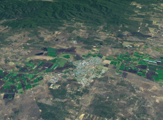
Boonah is a rural town and locality in the Scenic Rim Region, Queensland, Australia. In the 2016 census, the locality of Boonah had a population of 2,484 people.

<span class="mw-page-title-main">Gatton, Queensland</span> Town in Queensland, Australia

Gatton is a rural town and locality in the Lockyer Valley Region, Queensland, Australia. In the 2016 census, the locality of Gatton had a population of 7,101 people.

<span class="mw-page-title-main">Laidley, Queensland</span> Town in Queensland, Australia

Laidley is a rural town and locality in the Lockyer Valley Region, Queensland, Australia. In the 2016 census, the locality of Laidley had a population of 3,808 people.

<span class="mw-page-title-main">Aratula</span> Town in Queensland, Australia

Aratula is a rural town and locality in the Scenic Rim Region, Queensland, Australia. In the 2016 census, the locality of Aratula had a population of 532 people.

<span class="mw-page-title-main">Woodford, Queensland</span> Town in Queensland, Australia

Woodford is a rural town and locality in the City of Moreton Bay, Queensland, Australia. In the 2016 census, the locality of Woodford had a population of 3,458 people.

<span class="mw-page-title-main">Graceville, Queensland</span> Suburb of Brisbane, Queensland, Australia

Graceville is a suburb in the City of Brisbane, Queensland, Australia. In the 2021 census, Graceville had a population of 4,764 people.

<span class="mw-page-title-main">Rosewood, Queensland</span> Town in Queensland, Australia

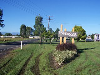
Rosewood is a rural town and locality in the City of Ipswich, Queensland, Australia. In the 2016 census, the locality of Rosewood had a population of 2,834 people.

<span class="mw-page-title-main">Grandchester, Queensland</span> Town in Queensland, Australia

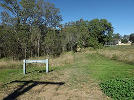
Grandchester is a rural town and locality in the City of Ipswich, Queensland, Australia. In the 2021 census, the locality of Grandchester had a population of 467 people.

<span class="mw-page-title-main">North Ipswich, Queensland</span> Suburb of Ipswich, Queensland, Australia

North Ipswich is a suburb of Ipswich in the City of Ipswich, Queensland, Australia. In the 2016 census, North Ipswich had a population of 4,515 people.

<span class="mw-page-title-main">Booval, Queensland</span> Suburb of Ipswich, Queensland, Australia

Booval is a suburb of Ipswich in the City of Ipswich, Queensland, Australia. In the 2016 census Booval had a population of 2,622 people.

<span class="mw-page-title-main">Silkstone, Queensland</span> Suburb of Ipswich, Queensland, Australia

Silkstone is a suburb in the City of Ipswich, Queensland, Australia. In the 2016 census, Silkstone had a population of 3,480 people.

<span class="mw-page-title-main">Dinmore, Queensland</span> Suburb of Ipswich, Queensland, Australia

Dinmore is a suburb of Ipswich in the City of Ipswich, Queensland, Australia. In the 2016 census, Dinmore had a population of 875 people with an unemployment rate of 16.7%, in comparison to the Australian unemployment rate of 6.9%.

<span class="mw-page-title-main">West Ipswich, Queensland</span> Suburb of Ipswich, Queensland, Australia

West Ipswich is a suburb of Ipswich in the City of Ipswich, Queensland, Australia. In the 2016 census, West Ipswich had a population of 494 people.

<span class="mw-page-title-main">Torquay, Queensland</span> Suburb of Hervey Bay, Queensland, Australia

Torquay is a coastal suburb in Hervey Bay in the Fraser Coast Region, Queensland, Australia. In the 2016 census, Torquay had a population of 6,316 people.

<span class="mw-page-title-main">Ipswich (suburb), Queensland</span> Suburb of Ipswich, Queensland, Australia

Ipswich Central Business District is the central suburb and central business district of Ipswich in the City of Ipswich, Queensland, Australia. It is also known as Ipswich CBD. In the 2016 census, the suburb had a population of 2,459 people.

<span class="mw-page-title-main">Dugandan railway line</span> Railway line in Queensland, Australia

The Dugandan railway line was a branch railway in the Scenic Rim region of South East Queensland, Australia. It was also known as the Fassifern railway line. It operated from 1882 to 1964.

<span class="mw-page-title-main">Kalbar, Queensland</span> Town in Queensland, Australia

Kalbar is a rural town and locality in the Scenic Rim Region, Queensland, Australia. In the 2016 census, the locality of Kalbar had a population of 1,093 people.

<span class="mw-page-title-main">Dugandan, Queensland</span> Suburb of Boonah, Queensland, Australia

Dugandan is a rural town and locality in the Scenic Rim Region, Queensland, Australia. In the 2016 census, Dugandan had a population of 593 people.

<span class="mw-page-title-main">Purga, Queensland</span> Suburb of City of Ipswich, Queensland, Australia

Purga is a rural locality in the City of Ipswich, Queensland, Australia. In the 2021 census, Purga had a population of 561 people.

<span class="mw-page-title-main">Lanefield, Queensland</span> Locality in Queensland australia

Lanefield is a rural locality in the City of Ipswich, Queensland, Australia. In the 2016 census, Lanefield had a population of 107 people.

References

  1. 1 2 3 Australian Bureau of Statistics (27 June 2017). "Churchill (SSC)". 2016 Census QuickStats. Retrieved 20 October 2018. OOjs UI icon edit-ltr-progressive.svg
  2. "Churchill – suburb in City of Ipswich (entry 45036)". Queensland Place Names. Queensland Government . Retrieved 26 January 2020.
  3. "Map 40: Two-mile series" (Map). Queensland Government. 1952. Archived from the original on 8 June 2020. Retrieved 9 June 2020.
  4. "Churchill – railway station in City of Ipswich (entry 7229)". Queensland Place Names. Queensland Government . Retrieved 9 June 2020.
  5. 1 2 Kerr, John (1990). Triumph of narrow gauge : a history of Queensland Railways. Boolarong Publications. pp. 57–58, 224. ISBN   978-0-86439-102-5.
  6. Johnson, M.; Saunders, K. (2007). "Working The Land: An historical overview of Boonah and its northern district" (PDF). State of Queensland. Archived (PDF) from the original on 29 September 2009. Retrieved 24 October 2009.
  7. "Queensland Baptist churches by date of erection/opening". Baptist Church Archives Queensland. Archived from the original on 26 November 2021. Retrieved 29 November 2021.
  8. "1913 Churchill". Baptist Church Archives Queensland. Archived from the original on 26 November 2021. Retrieved 29 November 2021.
  9. "STUMP-CAPPING CEREMONY". Queensland Times . Vol. LIV, no. 8718. Queensland, Australia. 27 March 1913. p. 4 (Daily). Retrieved 29 November 2021 via National Library of Australia.
  10. "Baptist Church". Queensland Times . Vol. LIV, no. 8721. Queensland, Australia. 31 March 1913. p. 2 (Daily). Retrieved 29 November 2021 via National Library of Australia.
  11. "Rapid Church Building". The Brisbane Courier . No. 17, 340. Queensland, Australia. 11 August 1913. p. 4. Retrieved 29 November 2021 via National Library of Australia.
  12. "Churchill Baptist Church". Queensland Times . Vol. LV, no. 8835. Queensland, Australia. 11 August 1913. p. 6 (Daily). Retrieved 29 November 2021 via National Library of Australia.
  13. "The Brisbane Courier. MONDAY, AUGUST 11, 1918". The Brisbane Courier . No. 17, 340. Queensland, Australia. 11 August 1913. p. 4. Retrieved 29 November 2021 via National Library of Australia.
  14. Queensland Family History Society (2010), Queensland schools past and present (Version 1.01 ed.), Queensland Family History Society, ISBN   978-1-921171-26-0
  15. 1 2 "State and non-state school details". Queensland Government. 9 July 2018. Archived from the original on 21 November 2018. Retrieved 21 November 2018.
  16. "Churchill State School" . Retrieved 21 November 2018.
  17. cite web|url=http://www.acara.edu.au/docs/default-source/default-document-library/school-profile-20172c7b12404c94637ead88ff00003e0139.xlsx?sfvrsn=0%7Ctitle=ACARA School Profile 2017|archive-url=https://web.archive.org/web/20181122010027/http://www.acara.edu.au/docs/default-source/default-document-library/school-profile-20172c7b12404c94637ead88ff00003e0139.xlsx?sfvrsn=0%7Carchive-date=22 November 2018|url-status=live|access-date=22 November 2018
  18. "Queensland Globe". State of Queensland . Retrieved 5 March 2020.