Rathdowney is a rural town and locality in the Scenic Rim Region, Queensland, Australia. In the 2021 census, the locality of Rathdowney had a population of 320 people.

Beaudesert is a rural town and locality in the Scenic Rim Region of Queensland, Australia. In the 2021 census, the locality of Beaudesert had a population of 6,752 people.

Moorooka is a southern suburb in the City of Brisbane, Queensland, Australia. In the 2021 census, Moorooka had a population of 10,783 people.

Goodna is a suburb on the eastern edge of the City of Ipswich in Queensland, Australia. In the 2021 census, Goodna had a population of 10,391 people.

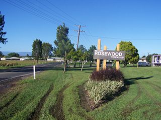
Rosewood is a rural town and locality in the City of Ipswich, Queensland, Australia. In the 2021 census, the locality of Rosewood had a population of 3,263 people.

Pine Mountain is a semi-rural locality in the City of Ipswich, Queensland, Australia. In the 2021 census, Pine Mountain had a population of 1,695 people.

Redbank Plains is a suburb in the City of Ipswich, Queensland, Australia. In the 2021 census, Redbank Plains had a population of 24,349 people.

Bundamba is a suburb of Ipswich in the City of Ipswich, Queensland, Australia. In the 2021 census, Bundamba had a population of 6,542 people.

Eastern Heights is a suburb of Ipswich in the City of Ipswich, Queensland, Australia. In the 2021 census, Eastern Heights had a population of 3,631 people.

Dinmore is a suburb of Ipswich in the City of Ipswich, Queensland, Australia. In the 2021 census, Dinmore had a population of 1,109 people.

Riverview is a suburb of Ipswich in the City of Ipswich, Queensland, Australia. In the 2021 census, Riverview had a population of 3,067 people.

Woodend is an inner suburb of Ipswich in the City of Ipswich, Queensland, Australia. In the 2021 census, Woodend had a population of 1,483 people.

Collingwood Park is a suburb of Ipswich in the City of Ipswich, Queensland, Australia. In the 2021 census, Collingwood Park had a population of 9,246 people.

Redbank is a suburb in the City of Ipswich, Queensland, Australia. In the 2021 census, Redbank had a population of 2,931 people.

Gailes is a suburb of Ipswich in the City of Ipswich, Queensland, Australia. In the 2021 census, Gailes had a population of 1,831 people.

Springfield Lakes is a suburb in the City of Ipswich, Queensland, Australia. It is one of the suburbs created within Greater Springfield. In the 2021 census, Springfield Lakes had a population of 17,211 people.

Brookwater is a suburb in the City of Ipswich, Queensland, Australia. It is one of the suburbs of the Greater Springfield Development. In the 2021 census, Brookwater had a population of 2,902 people.

Ipswich Central is the central suburb of Ipswich in the City of Ipswich, Queensland, Australia. In the 2021 census, Ipswich had a population of 2,468 people.

Kalbar is a rural town and locality in the Scenic Rim Region, Queensland, Australia. In the 2021 census, the locality of Kalbar had a population of 1,246 people.

Laravale is a rural locality in the Scenic Rim Region, Queensland, Australia. In the 2021 census, the locality of Laravale had a population of 185 people.


