Mount Forbes, Queensland

Last updated

Map all coordinates using: OpenStreetMap  
Download coordinates as: KML
Mount Forbes
City of Ipswich,  Queensland
StateLibQld 1 183271 Opening of the Mount Forbes Methodist Church, ca. 1911.jpg
Opening of the Mount Forbes Methodist Church, 1911
Australia Queensland location map.svg
Red pog.svg
Mount Forbes
Coordinates 27°44′15″S152°36′42″E / 27.7375°S 152.6117°E / -27.7375; 152.6117 (Mount Forbes (centre of locality)) Coordinates: 27°44′15″S152°36′42″E / 27.7375°S 152.6117°E / -27.7375; 152.6117 (Mount Forbes (centre of locality))
Population263 (2016 census) [1]
 • Density6.641/km2 (17.20/sq mi)
Postcode(s) 4340
Area39.6 km2 (15.3 sq mi)
Time zone AEST (UTC+10:00)
Location
LGA(s)
State electorate(s) Scenic Rim
Federal division(s)
Suburbs around Mount Forbes:
Lower Mount Walker Ebenezer Willowbank
Lower Mount Walker Mount Forbes Mutdapilly
Mount Walker Coleyville Mutdapilly

Mount Forbes is a rural locality split between the City of Ipswich and the Scenic Rim Region, Queensland, Australia. [2] [3] In the 2016 census, Mount Forbes had a population of 263 people. [1]

Contents

Geography

There is a mountain in the south-east of the locality, known as The Sugarloaf ( 27°44′50″S152°38′06″E / 27.7473°S 152.6351°E / -27.7473; 152.6351 (The Sugarloaf) ), rising to 74 metres (243 ft). [4] [5] [6]

The land use is predominantly grazing on native vegetation. [6]

History

Francis Forbes Francis Forbes colour.jpg
Francis Forbes

John Oxley chose the name Mount Forbes in 1824, after Sir Francis Forbes (1784-1841) the then Chief Justice of New South Wales to name the mountain now known as Mount Walker. [7]

Mount Forbes Post Office opened on 1 July 1927 (a receiving office had been open from 1897) and closed in 1953. [8]

Mount Forbes Provisional School opened on 10 November 1896. On 1 January 1909, it became Mount Forbes State School. It closed in 1948. [9] [10] It was at 222 Mount Forbes School Road ( 27°44′20″S152°36′55″E / 27.7388°S 152.6152°E / -27.7388; 152.6152 (Mount Forbes State School (former)) ). [11] [6]

Tenders were called in September 1910 to build a Methodist church. [12] [13] The stump-capping ceremony was held on Saturday 18 February 1911. [14] [15] Mount Forbes Methodist Church was officially opened on Sunday 7 May 1911 by Dr Henry Youngman, the President of the Methodist Church of Australasia; about 200 people attended. [16] The timber church was 24 by 16 feet (7.3 by 4.9 m) and 11 feet (3.4 m) high with an iron roof; it could seat 100 people. It was designed by Thomas Freeman Theaker and built by Jacob Hoffman for £ 89/18/9. [17] The church was at 211-215 Mount Forbes School Road ( 27°44′17″S152°36′55″E / 27.7380°S 152.6154°E / -27.7380; 152.6154 (Mount Forbes Methodist Church) ). [11] [6]

In October 1994, the Woogaroo Koala Protection Society was established, being renamed Ipswich Koala Protection Society in 2000 as the group expanded its services to a wider area. A dedicated koala rehabilitation cline was established in Mount Forbes in 2010. [18]

In the 2016 census, Mount Forbes had a population of 263 people. The locality contains 93 households, in which 50.0% of the population are males and 50.0% of the population are females with a median age of 35, 3 years below the national average. The average weekly household income is $1,520, $83 above the national average. 3.0% of Mount Forbes's population is either of Aboriginal or Torres Strait Islander descent. 70.5% of the population aged 15 or over is either registered or de facto married, while 29.5% of the population is not married. 34.3% of the population is currently attending some form of a compulsory education. The most common nominated ancestries were Australian (35.7%), English (27.5%) and German (9.9%), while the most common country of birth was Australia (78.7%), and the most commonly spoken language at home was English (83.3%). The most common nominated religions were No religion (24.3%), Not stated (20.6%) and Anglican (14.7%). The most common occupation was a technician/trades worker (17.6%) and the majority/plurality of residents worked 40 or more hours per week (46.3%). [1]

Education

There are no schools in Mount Forbes. The nearest government primary schools are Mutdapilly State School in neighbouring Mutdapilly to the south-east and Rosewood State School in Rosewood to the north. The nearest government secondary school is Rosewood State High School in Rosewood to the north. [6]

Amenities

The Ipswich Koala Protection Society is at 110 Brass Road ( 27°42′34″S152°36′52″E / 27.7095°S 152.6145°E / -27.7095; 152.6145 (Ipswich Koala Protection Society) ). It has two ambulances designed for koalas and rescues over 180 koalas each year. It provides care for sick, injured or orphaned koalas with the aim of rehabilitating them and returning them to the wild. [18]

Related Research Articles

Boonah, Queensland Town in Queensland, Australia

Boonah is a rural town and locality in the Scenic Rim Region, Queensland, Australia. In the 2016 census the locality of Boonah had a population of 2,484 people.

Esk, Queensland Town in Queensland, Australia

Esk is a town and locality in the Somerset Region in South East Queensland, Australia. In the 2016 census, Esk had a population of 1,698 people.

Marburg, Queensland Town in Queensland, Australia

Marburg is a rural town in the City of Ipswich and a locality split between the City of Ipswich and the Somerset Region, both in Queensland, Australia. In the 2016 census, Marburg had a population of 873 people.

Grandchester, Queensland Town in Queensland, Australia

Grandchester is a rural town and locality in the City of Ipswich, Queensland, Australia. In the 2016 census, Grandchester had a population of 444 people.

Shire of Boonah Local government area in Queensland, Australia

The Shire of Boonah was a local government area in South East Queensland, Australia, about 80 kilometres (50 mi) southwest of Brisbane. The shire covered an area of 1,921.6 square kilometres (741.9 sq mi), and existed from 1880 until its merger with parts of the Shire of Beaudesert and City of Ipswich to form the Scenic Rim Region on 15 March 2008.

Thagoona, Queensland Suburb of Ipswich, Queensland, Australia

Thagoona is a mixed-use locality in the City of Ipswich, Queensland, Australia. In the 2016 census Thagoona had a population of 1,025 people.

Walloon, Queensland Suburb of Ipswich, Queensland, Australia

Walloon is a town and rural residential locality in the City of Ipswich, Queensland, Australia. In the 2016 census the locality of Walloon had a population of 1,588 people.

Haigslea, Queensland Suburb of Ipswich, Queensland, Australia

Haigslea is a locality split between the City of Ipswich and the Somerset Region in South East Queensland, Australia. In the 2016 census Haigslea had a population of 468 people.

Ebenezer, Queensland Suburb of Ipswich, Queensland, Australia

Ebenezer is a rural locality in the City of Ipswich, Queensland, Australia. In the 2016 census Ebenezer had a population of 315 people.

The Shire of Moreton was a local government area in South East Queensland, Australia, located about 50 kilometres (31 mi) southwest of Queensland's capital, Brisbane. It represented an area surrounding but not including Ipswich, and existed from 1917 until 1995, when it merged into the City of Ipswich, City of Brisbane, and Shire of Esk.

Ashwell, Queensland Suburb of Ipswich, Queensland, Australia

Ashwell is a rural locality in the City of Ipswich, Queensland, Australia. In the 2016 census, Ashwell had a population of 85 people.

Dugandan, Queensland Suburb of Boonah, Queensland, Australia

Dugandan is a rural town and locality in the Scenic Rim Region, Queensland, Australia. In the 2016 census, Dugandan had a population of 593 people.

Shire of Mutdapilly

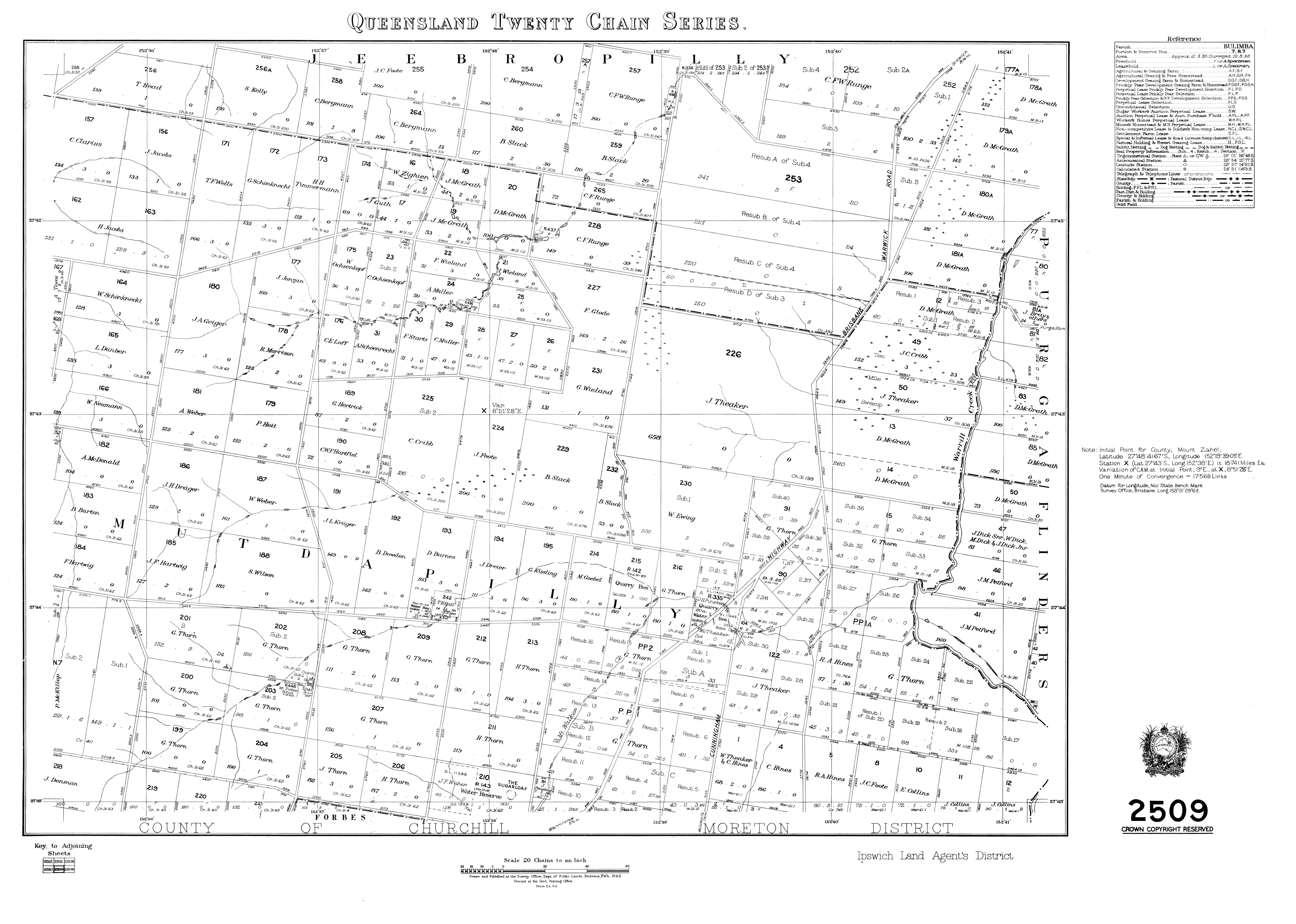
The Shire of Mutdapilly is a former local government area in the south-east of Queensland, Australia. The name comes from the Mutdapilly locality, but the locality was never the administrative centre of the shire.

Shire of Normanby

The Shire of Normanby is a former local government area in the south-east of Queensland, Australia. Its administrative centre was in Harrisville.

Mount Walker, Queensland Suburb of Scenic Rim Region, Queensland, Australia

Mount Walker is a mountain and locality in the Scenic Rim Region of Queensland, Australia. The western boundary of Mount Walker is marked by the Bremer River. The central eastern parts of the locality rise to elevations above 400 m around Mount Walker. At the 2016 census Mount Walker and surrounds recorded a population of 134.

Harrisville, Queensland Town in Queensland, Australia

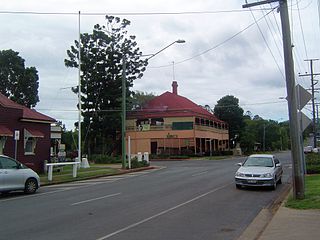
Harrisville is a rural town and locality in the Scenic Rim Region, Queensland, Australia. In the 2016 census the locality of Harrisville had a population of 613 people.

Mutdapilly, Queensland Suburb of City of Ipswich, Queensland, Australia

Mutdapilly is a rural locality in south-east Queensland, Australia. It is split between the local government areas of Scenic Rim Region and City of Ipswich. In the 2016 census Mutdapilly had a population of 308 people.

Lanefield, Queensland Suburb of Ipswich, Queensland, Australia

Lanefield is a rural locality in the City of Ipswich, Queensland, Australia. In the 2016 census, Lanefield had a population of 107 people.

Milora, Queensland Suburb of Scenic Rim Region, Queensland, Australia

Milora is a rural locality in the Scenic Rim Region, Queensland, Australia. In the 2016 census, Milora had a population of 108 people.

Croftby, Queensland Suburb of Scenic Rim Region, Queensland, Australia

Croftby is a rural locality in the Scenic Rim Region, Queensland, Australia. In the 2016 census, Croftby had a population of 133 people. The town of Teviot is within the locality.

References

  1. 1 2 3 Australian Bureau of Statistics (27 June 2017). "Mount Forbes (SSC)". 2016 Census QuickStats. Retrieved 20 October 2018. OOjs UI icon edit-ltr-progressive.svg
  2. "Mount Forbes – locality in City of Ipswich (entry 46552)". Queensland Place Names. Queensland Government . Retrieved 27 December 2020.
  3. "Mount Forbes – locality in Scenic Rim Region (entry 45215)". Queensland Place Names. Queensland Government . Retrieved 29 December 2020.
  4. "Mountain peaks and capes - Queensland". Queensland Open Data. Queensland Government. 12 November 2020. Archived from the original on 25 November 2020. Retrieved 25 November 2020.
  5. "The Sugarloaf – mountain in Scenic Rim Region (entry 34146)". Queensland Place Names. Queensland Government . Retrieved 25 November 2020.
  6. 1 2 3 4 5 "Queensland Globe". State of Queensland . Retrieved 12 January 2022.
  7. "Mount Walker (entry 45216)". Queensland Place Names. Queensland Government . Retrieved 27 February 2014.
  8. Premier Postal History. "Post Office List". Premier Postal Auctions. Archived from the original on 15 May 2014. Retrieved 10 May 2014.
  9. Queensland Family History Society (2010), Queensland schools past and present (Version 1.01 ed.), Queensland Family History Society, ISBN   978-1-921171-26-0
  10. "Agency ID 9135, Mount Forbes State School". Queensland State Archives . Retrieved 13 January 2022.
  11. 1 2 "Queensland Twenty Chain series sheet 2509" (Map). Queensland Government. 1948. Archived from the original on 12 January 2022. Retrieved 13 January 2022.
  12. "Advertising". Queensland Times . LII (7917). Queensland, Australia. 10 September 1910. p. 14 (DAILY). Archived from the original on 13 January 2022. Retrieved 13 January 2022 via National Library of Australia.
  13. "Mount Forbes Letter". Queensland Times . LII (8027). Queensland, Australia. 19 January 1911. p. 3 (DAILY). Archived from the original on 13 January 2022. Retrieved 13 January 2022 via National Library of Australia.
  14. "Forthcoming Events". Queensland Times . LII (8053). Queensland, Australia. 18 February 1911. p. 4 (DAILY). Archived from the original on 13 January 2022. Retrieved 13 January 2022 via National Library of Australia.
  15. "Stump-Capping Ceremony". Queensland Times . LII (8058). Queensland, Australia. 24 February 1911. p. 7 (DAILY). Archived from the original on 13 January 2022. Retrieved 13 January 2022 via National Library of Australia.
  16. "Methodist Church at Mt. Forbes". The Brisbane Courier (16, 638). Queensland, Australia. 10 May 1911. p. 12. Archived from the original on 13 January 2022. Retrieved 13 January 2022 via National Library of Australia.
  17. "Mount Forbes Methodist Church". Queensland Times . LII (8118). Queensland, Australia. 13 May 1911. p. 3 (DAILY). Archived from the original on 13 January 2022. Retrieved 13 January 2022 via National Library of Australia.
  18. 1 2 "About Ipswich Koala Protection Society". Ipswich Koala Protection Society. Archived from the original on 9 May 2021. Retrieved 13 January 2022.