Coulson, Queensland

Last updated

Coulson
Queensland
Paddocks at Coulson, Queensland.jpg
Paddocks along Old Beaudesert Road, 2016
Australia Queensland location map.svg
Red pog.svg
Coulson
Coordinates 27°57′57″S152°44′41″E / 27.9658°S 152.7447°E / -27.9658; 152.7447 (Coulson (centre of locality))
Population168 (2021 census) [1]
 • Density5.138/km2 (13.31/sq mi)
Postcode(s) 4310
Area32.7 km2 (12.6 sq mi)
Time zone AEST (UTC+10:00)
Location
LGA(s) Scenic Rim Region
State electorate(s) Scenic Rim
Federal division(s) Blair
Suburbs around Coulson:
Roadvale Wyaralong Wyaralong
Teviotville
Hoya
Coulson Bromelton
Boonah Allandale Allandale

Coulson is a rural locality in the Scenic Rim Region, Queensland, Australia. [2] In the 2021 census, Coulson had a population of 168 people. [1]

Contents

Geography

Ipswich – Boonah Road (State Route 93) runs through from north-west to south-west. Beaudesert–Boonah Road (State Route 90) runs east from an intersection with this road, exiting to the north-east. [3]

Coulson is crossed by Teviot Brook, a tributary of the Logan River, at the southern end of the Flinders Peak Group. Part of the southern boundary follows Sandy Creek and includes the elevated slopes of Goans Hill ( 27°58′04″S152°45′02″E / 27.9678°S 152.7506°E / -27.9678; 152.7506 (Goans Hill) ) which rises to 200 metres (660 ft). [4] [5]

Much of the land is used for agricultural purposes.

History

Teviotville Provisional School opened on 3 October 1881 and became Teviotville State School on 18 January 1886. In 1903, it was renamed Coulson State School. It closed in 1993. [6] It was at 3522 Ipswich Boonah Road ( 27°57′12″S152°43′16″E / 27.9533°S 152.7210°E / -27.9533; 152.7210 (Coulson State School (former)) ). [7] [8] [9]

Demographics

At the 2011 census, Roadvale and the surrounding area had a population of 254. [10]

In the 2016 census, Coulson had a population of 195 people. The locality contained 71 households, in which 51.3% of the population were males and 48.7% of the population were females, with a median age of 43, 5 years above the national average. The average weekly household income was $1,531, $93 above the national average. 1.5% of Coulson's population were either of Aborigional or Torres Strait Islander descent. 67.1% of the population aged 15 or over were either registered or de facto married, while 32.9% of the population were not married. 33.0% of the population were currently attending some form of a compulsory education. The most common nominated ancestries were Australian (33.5%), English (31.5%) and German (12.7%), while the most common country of birth was Australia (92.4%), and the most commonly spoken language at home was English (94.3%). The most common nominated religions were Anglican (22.6%), Anglican (15.3%) and the Uniting Church (14.4%). The most common occupation was a technician/trades worker (22.7%) and the majority/plurality of residents worked 40 or more hours per week (54.0%). [11]

In the 2021 census, Coulson had a population of 168 people. [1]

Education

There are no schools in Coulson. The nearest government primary schools are Roadvale State School in neighbouring Roadvale to the north-west and Boonah State School in neighbouring Boonah to the south-west. The nearest government secondary school is Boonah State High School, also in Boonah. [9]

Facilities

Coulson (formerly Teviotville) Cemetery, 2008 Coulson (formerly Teviotville) Cemetery, 2008.jpg
Coulson (formerly Teviotville) Cemetery, 2008

Coulson-Teviotville Cemetery is on the Ipswich Boonah Road ( 27°57′30″S152°43′08″E / 27.9584°S 152.7188°E / -27.9584; 152.7188 (Coulson-Teviotville Cemetery) ). [12] It is managed by the Scenic Rim Regional Council, but no further burials are permitted. [13]

Related Research Articles

<span class="mw-page-title-main">Roadvale, Queensland</span> Town in Queensland, Australia

Roadvale is a rural locality in the Scenic Rim Region, Queensland, Australia. In the 2021 census, the locality of Roadvale had a population of 303 people.

<span class="mw-page-title-main">Aratula</span> Town in Queensland, Australia

Aratula is a rural town and locality in the Scenic Rim Region, Queensland, Australia. In the 2021 census, the locality of Aratula had a population of 609 people.

<span class="mw-page-title-main">Kalbar, Queensland</span> Town in Queensland, Australia

Kalbar is a rural town and locality in the Scenic Rim Region, Queensland, Australia. In the 2021 census, the locality of Kalbar had a population of 1,246 people.

<span class="mw-page-title-main">Dugandan, Queensland</span> Town in Queensland, Australia

Dugandan is a rural town and locality in the Scenic Rim Region, Queensland, Australia. In the 2021 census, the locality of Dugandan had a population of 602 people.

<span class="mw-page-title-main">Maroon, Queensland</span> Suburb of Scenic Rim Region, Queensland, Australia

Maroon is a rural locality in the Scenic Rim Region, Queensland, Australia. In the 2021 census, Maroon had a population of 152 people.

<span class="mw-page-title-main">Warrill View, Queensland</span> Town in Queensland, Australia

Warrill View is a rural town and locality in the Scenic Rim Region, Queensland, Australia. In the 2021 census, the locality of Warrill View had a population of 203 people.

<span class="mw-page-title-main">Peak Crossing, Queensland</span> Suburb of City of Ipswich, Queensland, Australia

Peak Crossing is a rural locality split between the City of Ipswich and the Scenic Rim Region of Queensland, Australia. In the 2021 census, Peak Crossing had a population of 1,016 people.
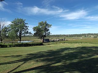
<span class="mw-page-title-main">Munbilla, Queensland</span> Town in Queensland, Australia

Munbilla is a rural town and locality in the Scenic Rim Region, Queensland, Australia. In the 2021 census, the locality of Munbilla had a population of 93 people.
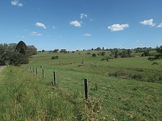
<span class="mw-page-title-main">Templin, Queensland</span> Suburb of Scenic Rim Region, Queensland, Australia

Templin is a rural locality in the Scenic Rim Region, Queensland, Australia. In the 2021 census, Templin had a population of 89 people.

<span class="mw-page-title-main">Wyaralong, Queensland</span> Suburb of Scenic Rim Region, Queensland, Australia

Wyaralong is a rural locality in the Scenic Rim Region, Queensland, Australia. In the 2021 census, Wyaralong had "no people or a very low population".

<span class="mw-page-title-main">Coochin, Queensland</span> Suburb of Scenic Rim Region, Queensland, Australia

Coochin is a rural locality in the Scenic Rim Region, Queensland, Australia. In the 2021 census, Coochin had a population of 115 people.
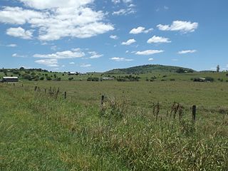
<span class="mw-page-title-main">Milford, Queensland</span> Suburb of Scenic Rim Region, Queensland, Australia

Milford is a rural locality in the Scenic Rim Region, Queensland, Australia. In the 2021 census, Milford had a population of 190 people.

<span class="mw-page-title-main">Mount French, Queensland</span> Suburb of Scenic Rim Region, Queensland, Australia

Mount French is a rural locality in the Scenic Rim Region, Queensland, Australia. In the 2021 census, Mount French had a population of 105 people.

Cannon Creek is a rural locality in the Scenic Rim Region, Queensland, Australia. In the 2021 census, Cannon Creek had a population of 75 people.
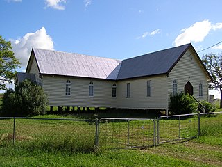
<span class="mw-page-title-main">Milbong, Queensland</span> Suburb of Scenic Rim Region, Queensland, Australia

Milbong is a rural locality in the Scenic Rim Region, Queensland, Australia. In the 2021 census, Milbong had a population of 190 people.

Croftby is a rural locality in the Scenic Rim Region, Queensland, Australia. The town of Teviot is within the locality. In the 2021 census, Croftby had a population of 129 people.

<span class="mw-page-title-main">Mount Edwards, Queensland</span> Suburb of Scenic Rim Region, Queensland, Australia

Mount Edwards is a rural locality in the Scenic Rim Region, Queensland, Australia. In the 2021 census, Mount Edwards had a population of 60 people.

Anthony is a rural locality in the Scenic Rim Region, Queensland, Australia. In the 2021 census, Anthony had a population of 133 people.

Kulgun is a locality in the Scenic Rim Region, Queensland, Australia. In the 2021 census, Kulgun had a population of 104 people.

Radford is a rural locality in the Scenic Rim Region, Queensland, Australia. In the 2021 census, Radford had a population of 31 people.

References

  1. 1 2 3 Australian Bureau of Statistics (28 June 2022). "Coulson (SAL)". 2021 Census QuickStats. Retrieved 28 February 2023. OOjs UI icon edit-ltr-progressive.svg
  2. "Coulson – locality in Scenic Rim Region (entry 48974)". Queensland Place Names. Queensland Government . Retrieved 7 March 2022.
  3. Coulson, Queensland (Map). Google Maps. Archived from the original on 6 April 2022. Retrieved 4 October 2021.
  4. "Mountain peaks and capes - Queensland". Queensland Open Data. Queensland Government. 12 November 2020. Archived from the original on 25 November 2020. Retrieved 25 November 2020.
  5. "Goans Hill – mountain in Scenic Rim Region (entry 14093)". Queensland Place Names. Queensland Government . Retrieved 25 November 2020.
  6. Queensland Family History Society (2010), Queensland schools past and present (Version 1.01 ed.), Queensland Family History Society, ISBN   978-1-921171-26-0
  7. "Parish of Dugandan" (Map). Queensland Government. 1971. Archived from the original on 6 April 2022. Retrieved 6 April 2022.
  8. "Flinders" (Map). Queensland Government. 1954. Archived from the original on 29 April 2020. Retrieved 6 April 2022.
  9. 1 2 "Queensland Globe". State of Queensland . Retrieved 6 April 2022.
  10. Australian Bureau of Statistics (31 October 2012). "Coulson (Gazetted Locality)". 2011 Census QuickStats. Retrieved 19 December 2016. OOjs UI icon edit-ltr-progressive.svg
  11. Australian Bureau of Statistics (27 June 2017). "Coulson (SSC)". 2016 Census QuickStats. Retrieved 20 October 2018. OOjs UI icon edit-ltr-progressive.svg
  12. "Cemetery Areas - Queensland". Queensland Open Data. Queensland Government. 12 November 2020. Archived from the original on 15 November 2020. Retrieved 12 November 2020.
  13. "Cemetery Locations". Scenic Rim Regional Council . Archived from the original on 6 April 2022. Retrieved 6 April 2022.