Morwincha, Queensland

Last updated

Morwincha
Queensland
Australia Queensland location map.svg
Red pog.svg
Morwincha
Coordinates 27°58′12″S152°34′41″E / 27.9700°S 152.5780°E / -27.9700; 152.5780 (Morwincha (centre of locality))
Population35 (2021 census) [1]
 • Density9.21/km2 (23.9/sq mi)
Postcode(s) 4309
Area3.8 km2 (1.5 sq mi)
Time zone AEST (UTC+10:00)
Location
LGA(s) Scenic Rim Region
State electorate(s) Scenic Rim
Federal division(s) Wright
Suburbs around Morwincha:
Frazerview Fassifern Fassifern Valley
Aratula Morwincha Fassifern Valley
Aratula Charlwood Charlwood

Morwincha is a rural locality in the Scenic Rim Region, Queensland, Australia. [2] In the 2021 census, Morwincha had a population of 35 people. [1]

Contents

Geography

Reynolds Creek, a tributary of Warrill Creek, forms the eastern boundary, while Washpool Gully, another tributary, flows through the north-western corner. [3] [4]

The Cunningham Highway runs along the western boundary, while the Boonah–Fassifern Road (State Route 90) runs along the northern. [4]

History

The locality takes its name from the former Morwincha railway station on the Mount Edwards railway line, which was named by the Queensland Railways Department on 5 February 1915. Morwincha is thought to be an Aboriginal word; its meaning is unknown. [2] [5]

The Mount Edwards line opened in 1922 as part of the Via Recta railway from Brisbane to Sydney. It was to connected to the Maryvale railway line on the Darling Downs, which was also built for the Via Recta. The final stage between Maryvale and Mount Edwards was never built. The Mount Edwards line closed on 1 November 1960. [6] [7] The Morwincha railway station was on Morwincha Road ( 27°58′23″S152°34′38″E / 27.97299°S 152.57734°E / -27.97299; 152.57734 (Morwincha railway station (former)) ). [8] [9] [4]

Demographics

In the 2016 census, Morwincha had a population of 30 people. The locality contained 14 households, in which 51.6% of the population were males and 48.4% of the population were females with a median age of 50, 12 years above the national average. The average weekly household income was $899, $539 below the national average. [10]

In the 2021 census, Morwincha had a population of 35 people. [1]

Education

There are no schools in Morwincha. The nearest government primary schools are Aratula State School in neighbouring Aratula to the south-west and Kalbar State School in Kalbar to the north-east. The nearest government secondary school is Boonah State High School in Boonah to the east. [4]

Related Research Articles

<span class="mw-page-title-main">Boonah, Queensland</span> Town in Queensland, Australia

Boonah is a rural town and locality in the Scenic Rim Region, Queensland, Australia. In the 2021 census, the locality of Boonah had a population of 2,557 people.

<span class="mw-page-title-main">Roadvale, Queensland</span> Town in Queensland, Australia

Roadvale is a rural locality in the Scenic Rim Region, Queensland, Australia. In the 2021 census, the locality of Roadvale had a population of 303 people.

<span class="mw-page-title-main">Aratula</span> Town in Queensland, Australia

Aratula is a rural town and locality in the Scenic Rim Region, Queensland, Australia. In the 2021 census, the locality of Aratula had a population of 609 people.

<span class="mw-page-title-main">Maryvale, Queensland (Southern Downs Region)</span> Town in Queensland, Australia

Maryvale is a rural town and locality in the Southern Downs Region, Queensland, Australia. In the 2021 census, the locality of Maryvale had a population of 392 people.

<span class="mw-page-title-main">Dugandan railway line</span> Railway line in Queensland, Australia

The Dugandan railway line was a branch railway in the Scenic Rim region of South East Queensland, Australia. It was also known as the Fassifern railway line. It operated from 1882 to 1964.

The Mount Edwards railway line was a branch railway in the Scenic Rim region of South East Queensland, Australia. The lines serves a number of small towns in the Fassifern Valley. The first stage of the Mount Edwards line opened from Munbilla to Engelsburg on 17 April 1916, but the next stage to Mount Edwards was not completed until 7 October 1922. The line closed on 1 November 1960.

<span class="mw-page-title-main">Kalbar, Queensland</span> Town in Queensland, Australia

Kalbar is a rural town and locality in the Scenic Rim Region, Queensland, Australia. In the 2021 census, the locality of Kalbar had a population of 1,246 people.

<span class="mw-page-title-main">Dugandan, Queensland</span> Town in Queensland, Australia

Dugandan is a rural town and locality in the Scenic Rim Region, Queensland, Australia. In the 2021 census, the locality of Dugandan had a population of 602 people.
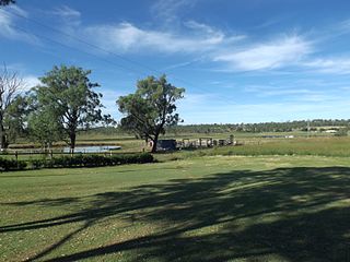
<span class="mw-page-title-main">Munbilla, Queensland</span> Town in Queensland, Australia

Munbilla is a rural town and locality in the Scenic Rim Region, Queensland, Australia. In the 2021 census, the locality of Munbilla had a population of 93 people.
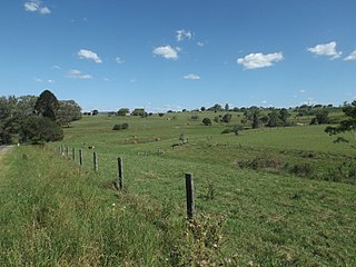
<span class="mw-page-title-main">Templin, Queensland</span> Suburb of Scenic Rim Region, Queensland, Australia

Templin is a rural locality in the Scenic Rim Region, Queensland, Australia. In the 2021 census, Templin had a population of 89 people.

<span class="mw-page-title-main">Silverdale, Queensland</span> Suburb of Scenic Rim Region, Queensland, Australia

Silverdale is a rural locality in the Scenic Rim Region, Queensland, Australia. In the 2021 census, Silverdale had a population of 112 people.

<span class="mw-page-title-main">Kents Lagoon, Queensland</span> Suburb of Scenic Rim Region, Queensland, Australia

Kents Lagoon is a rural locality in the Scenic Rim Region, Queensland, Australia. In the 2021 census, Kents Lagoon had a population of 60 people.

<span class="mw-page-title-main">Teviotville, Queensland</span> Town in Queensland, Australia

Teviotville is a rural locality in the Scenic Rim Region, Queensland, Australia. In the 2021 census, the locality of Teviotville had a population of 114 people.

<span class="mw-page-title-main">Charlwood, Queensland</span> Suburb of Scenic Rim Region, Queensland, Australia

Charlwood is a rural locality in the Scenic Rim Region, Queensland, Australia. In the 2021 census, Charlwood had a population of 146 people.

<span class="mw-page-title-main">Fassifern, Queensland</span> Suburb of Scenic Rim Region, Queensland, Australia

Fassifern is a rural locality in the Scenic Rim Region, Queensland, Australia. In the 2021 census, Fassifern had a population of 18 people.

<span class="mw-page-title-main">Fassifern Valley, Queensland</span> Suburb of Scenic Rim Region, Queensland, Australia

Fassifern Valley is a rural locality in the Scenic Rim Region, Queensland, Australia. In the 2021 census, Fassifern Valley had a population of 112 people.
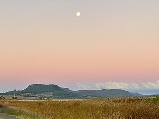
<span class="mw-page-title-main">Clintonvale, Queensland</span> Suburb of Southern Downs Region, Queensland, Australia

Clintonvale is a rural locality in the Southern Downs Region, Queensland, Australia. In the 2021 census, Clintonvale had a population of 72 people.

<span class="mw-page-title-main">Clumber, Queensland</span> Suburb of Scenic Rim Region, Queensland, Australia

Clumber is a rural locality in the Scenic Rim Region, Queensland, Australia. In the 2021 census, Clumber had a population of 91 people.

<span class="mw-page-title-main">Mount Edwards, Queensland</span> Suburb of Scenic Rim Region, Queensland, Australia

Mount Edwards is a rural locality in the Scenic Rim Region, Queensland, Australia. In the 2021 census, Mount Edwards had a population of 60 people.

Kulgun is a locality in the Scenic Rim Region, Queensland, Australia. In the 2021 census, Kulgun had a population of 104 people.

References

  1. 1 2 3 Australian Bureau of Statistics (28 June 2022). "Morwincha (SAL)". 2021 Census QuickStats. Retrieved 28 February 2023. OOjs UI icon edit-ltr-progressive.svg
  2. 1 2 "Morwincha – locality in Scenic Rim Region (entry 45167)". Queensland Place Names. Queensland Government . Retrieved 20 July 2021.
  3. Google (15 September 2021). "Morwincha, Queensland" (Map). Google Maps . Google. Retrieved 15 September 2021.
  4. 1 2 3 4 "Queensland Globe". State of Queensland . Retrieved 2 January 2022.
  5. "Naming Railway Stations". The Brisbane Courier . No. 17, 810. Queensland, Australia. 13 February 1915. p. 3. Archived from the original on 4 January 2022. Retrieved 2 January 2022 via National Library of Australia.
  6. Southern Downs Steam Railway (2009). "'Via recta' - The line that never was". Archived from the original on 12 September 2009. Retrieved 25 October 2009.
  7. QR Limited. "Rail as foremost mode of travel". Archived from the original on 12 September 2009. Retrieved 25 October 2009.
  8. "Flinders" (Map). Queensland Government. 1927. Archived from the original on 29 May 2020. Retrieved 2 January 2021.
  9. "Queensland Two Mile series sheet 2m38" (Map). Queensland Government. 1955. Archived from the original on 21 June 2021. Retrieved 2 January 2022.
  10. Australian Bureau of Statistics (27 June 2017). "Morwincha (SSC)". 2016 Census QuickStats. Retrieved 20 October 2018. OOjs UI icon edit-ltr-progressive.svg