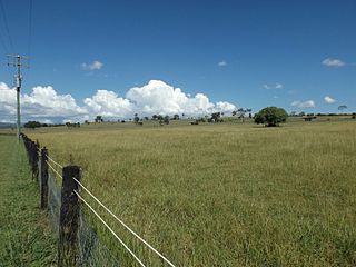
Rathdowney is a rural town and locality in the Scenic Rim Region, Queensland, Australia. In the 2021 census, the locality of Rathdowney had a population of 320 people.

Beaudesert is a rural town and locality in the Scenic Rim Region of Queensland, Australia. In the 2021 census, the locality of Beaudesert had a population of 6,752 people.

Boonah is a rural town and locality in the Scenic Rim Region, Queensland, Australia. In the 2021 census, the locality of Boonah had a population of 2,557 people.

Roadvale is a rural locality in the Scenic Rim Region, Queensland, Australia. In the 2021 census, the locality of Roadvale had a population of 303 people.

The Wyaralong Dam is a mass concrete gravity dam with an un-gated spillway across the Teviot Brook that is located in the South East region of Queensland, Australia. The main purpose of the dam is for supply of potable water for the Scenic Rim region. The dam was initiated by the Queensland Government in 2006 as a result of the prolonged Millennium drought which saw the catchment areas of South East Queensland's dams receive record low rain. It was completed in 2011.

Bromelton is a rural locality in the Scenic Rim Region, Queensland, Australia. In the 2021 census, the locality of Bromelton had a population of 129 people.

Kalbar is a rural town and locality in the Scenic Rim Region, Queensland, Australia. In the 2021 census, the locality of Kalbar had a population of 1,246 people.

Maroon is a rural locality in the Scenic Rim Region, Queensland, Australia. In the 2021 census, Maroon had a population of 152 people.

Rosevale is a rural locality in the Scenic Rim Region, Queensland, Australia. In the 2021 census, the locality of Rosevale had a population of 212 people.

Tamrookum is a rural locality in the Scenic Rim Region, Queensland, Australia. In the 2021 census, Tamrookum had a population of 94 people.

Barney View is a rural locality in the Scenic Rim Region, Queensland, Australia. In the 2021 census, Barney View had a population of 38 people.

Allenview is a rural locality in the Scenic Rim Region, Queensland, Australia. In the 2021 census, Allenview had a population of 209 people.

Josephville is a rural locality in the Scenic Rim Region, Queensland, Australia. In the 2021 census, the locality of Josephville had a population of 172 people.

Palen Creek is a rural locality in the Scenic Rim Region, Queensland, Australia. It borders New South Wales. In the 2021 census, Palen Creek had a population of 368 people.

Innisplain is a rural locality in the Scenic Rim Region, Queensland, Australia. In the 2021 census, Innisplain had a population of 79 people.

Gleneagle is a rural locality in the Scenic Rim Region, Queensland, Australia. In the 2021 census, Gleneagle had a population of 2,106 people.

Coulson is a rural locality in the Scenic Rim Region, Queensland, Australia. In the 2021 census, Coulson had a population of 168 people.
Cannon Creek is a rural locality in the Scenic Rim Region, Queensland, Australia. In the 2021 census, Cannon Creek had a population of 75 people.
Kulgun is a locality in the Scenic Rim Region, Queensland, Australia. In the 2021 census, Kulgun had a population of 104 people.
Beaudesert–Boonah–Fassifern Road is a non-continuous 49.9 kilometres (31.0 mi) road route in the Scenic Rim region of Queensland, Australia. It has two official names, Beaudesert–Boonah Road and Boonah–Fassifern Road. The route is signed as State Route 90. These roads are joined by a 6.8 kilometres (4.2 mi) section of Ipswich-Boonah Road. Beaudesert–Boonah Road is a state-controlled regional road, and Boonah–Fassifern Road is also a state-controlled regional road. As part of State Route 90 it provides an alternate route between the Cunningham Highway and the Gold Coast.


