Milora, Queensland

Last updated

Milora
Queensland
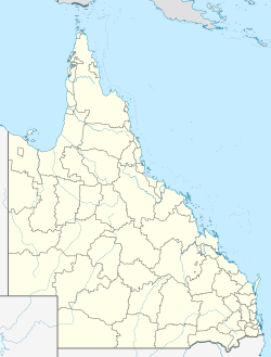
Australia Queensland location map.svg
Red pog.svg
Milora
Coordinates 27°50′51″S152°41′03″E / 27.8475°S 152.6841°E / -27.8475; 152.6841 (Milora (centre of locality))
Population136 (2021 census) [1]
 • Density10.15/km2 (26.29/sq mi)
Postcode(s) 4309
Area13.4 km2 (5.2 sq mi)
Time zone AEST (UTC+10:00)
Location
LGA(s) Scenic Rim Region
State electorate(s) Scenic Rim
Federal division(s) Wright
Suburbs around Milora:
Harrisville Harrisville Limestone Ridges
Wilsons Plains Milora Milbong
Radford Munbilla Anthony

Milora is a rural locality in the Scenic Rim Region, Queensland, Australia. [2] In the 2021 census, Milora had a population of 136 people. [1]

Contents

History

Milora Wesleyan Methodist Church opened in 1869. [3] Tenders were called in October 1869. [4] [5] It was opened circa January 1870, celebrating its anniversary on 21 January 1871. [6]

Milora State School opened on 20 April 1873 and closed on 27 July 1962. [7] It was near the north-west corner of Munbilla Road and Goames Road (approx 27°51′09″S152°40′33″E / 27.8526°S 152.6759°E / -27.8526; 152.6759 (Milora State School (former)) ). [8] [9]

Demographics

In the 2016 census, Milora had a population of 108 people. The locality contains 38 households, in which 48.6% of the population are males and 51.4% of the population are females with a median age of 51, 13 years above the national average. The average weekly household income is $1,218, $220 below the national average. [10]

In the 2021 census, Milora had a population of 136 people. [1]

Education

There are no schools in Milora. The nearest government primary school is Harrisville State School in neighbouring Harrisville to the north-west, Peak Crossing State School in Peak Crossing to the north-east, and Roadvale State School in Roadvale to the south-east. The nearest government secondary school is Boonah State High School in Boonah to the south. [11]

References

  1. 1 2 3 Australian Bureau of Statistics (28 June 2022). "Milora (SAL)". 2021 Census QuickStats. Retrieved 28 February 2023. OOjs UI icon edit-ltr-progressive.svg
  2. ↑ "Milora – locality in Scenic Rim Region (entry 45164)". Queensland Place Names. Queensland Government . Retrieved 20 July 2021.
  3. ↑ Blake, Thom. "Milora Wesleyan Methodist Church". Queensland religious places database. Archived from the original on 31 December 2021. Retrieved 31 December 2021.
  4. ↑ "Advertising". Queensland Times, Ipswich Herald and General Advertiser . Vol. IX, no. 1149. Queensland, Australia. 9 October 1869. p. 2. Archived from the original on 31 December 2021. Retrieved 31 December 2021– via National Library of Australia.
  5. ↑ "THE WESLEYAN CHURCH ON THE IPSWICH AGRICULTURAL RESERVE". Queensland Times, Ipswich Herald and General Advertiser . Vol. X, no. 1445. Queensland, Australia. 2 September 1871. p. 2. Archived from the original on 31 December 2021. Retrieved 31 December 2021– via National Library of Australia.
  6. ↑ "Week ending January 7". Queensland Times, Ipswich Herald and General Advertiser . Vol. X, no. 1350. Queensland, Australia. 21 January 1871. p. 6. Archived from the original on 31 December 2021. Retrieved 31 December 2021– via National Library of Australia.
  7. ↑ Queensland Family History Society (2010), Queensland schools past and present (Version 1.01 ed.), Queensland Family History Society, ISBN   978-1-921171-26-0
  8. ↑ "Queensland Two Mile series sheet 2m38" (Map). Queensland Government. 1946. Archived from the original on 8 June 2020. Retrieved 31 December 2021.
  9. ↑ "Queensland Globe". State of Queensland . Retrieved 31 December 2021.
  10. ↑ Australian Bureau of Statistics (27 June 2017). "Milora (SSC)". 2016 Census QuickStats. Retrieved 20 October 2018. OOjs UI icon edit-ltr-progressive.svg
  11. ↑ "Layers: Locality; Schools and school catchments". Queensland Globe. Queensland Government. Archived from the original on 19 December 2017. Retrieved 14 September 2024.

Further reading