Radford, Queensland

Last updated

Radford
Queensland
Australia Queensland location map.svg
Red pog.svg
Radford
Coordinates 27°51′01″S152°38′24″E / 27.8502°S 152.6399°E / -27.8502; 152.6399 (Radford (centre of locality))
Population31 (2021 census) [1]
 • Density4.25/km2 (11.00/sq mi)
Postcode(s) 4307
Area7.3 km2 (2.8 sq mi)
Time zone AEST (UTC+10:00)
Location
LGA(s) Scenic Rim Region
State electorate(s) Scenic Rim
Federal division(s) Wright
Suburbs around Radford:
Warrill View Warrill View Wilsons Plains
Warrill View Radford Wilsons Plains
Silverdale Silverdale Munbilla

Radford is a rural locality in the Scenic Rim Region, Queensland, Australia. [2] In the 2021 census, Radford had a population of 31 people. [1]

Contents

Geography

Warrill Creek forms the western and south-western boundaries. [3]

History

The Fassifern railway line (Queensland's first branch railway line) opened from Ipswich to Harrisville on 10 July 1882. On 12 September 1887 the line was extended to Dugundan with Radford being served by Radford railway station on Radford Road ( 27°51′15″S152°38′37″E / 27.8541°S 152.6437°E / -27.8541; 152.6437 (Radford railway station (former)) ). The line closed in 1964. [4] [5]

The locality takes its name from the railway station, which was named after the town of Radford in Nottinghamshire, England. [2]

Radford State School opened on 3 April 1933 and closed in 1946. [6] It was on Radford Road (approx 27°51′15″S152°38′27″E / 27.8543°S 152.6407°E / -27.8543; 152.6407 (Radford State School (former)) ). [7] [8]

Demographics

In the 2016 census, Radford had a population of 41 people. The locality contained 15 households, in which 46.9% of the population was males and 53.1% of the population was females with a median age of 50, 12 years above the national average. The average weekly household income is $1,624, $186 above the national average. [9]

In the 2021 census, Radford had a population of 31 people. [1]

Education

There are no schools in Radford. The nearest government primary schools are Warrill View State School in neighbouring Warrill View to the north-west and Harrisville State School in Harrisville to the north-east. The nearest government secondary school is Boonah State High School in Boonah to the south. [8]

Related Research Articles

<span class="mw-page-title-main">Roadvale, Queensland</span> Town in Queensland, Australia

Roadvale is a rural locality in the Scenic Rim Region, Queensland, Australia. In the 2021 census, the locality of Roadvale had a population of 303 people.

<span class="mw-page-title-main">Aratula</span> Town in Queensland, Australia

Aratula is a rural town and locality in the Scenic Rim Region, Queensland, Australia. In the 2021 census, the locality of Aratula had a population of 609 people.

<span class="mw-page-title-main">Dugandan railway line</span> Railway line in Queensland, Australia

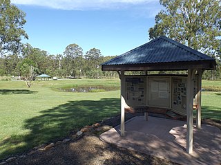
The Dugandan railway line was a branch railway in the Scenic Rim region of South East Queensland, Australia. It was also known as the Fassifern railway line. It operated from 1882 to 1964.

<span class="mw-page-title-main">Dugandan, Queensland</span> Town in Queensland, Australia

Dugandan is a rural town and locality in the Scenic Rim Region, Queensland, Australia. In the 2021 census, the locality of Dugandan had a population of 602 people.

<span class="mw-page-title-main">Purga, Queensland</span> Suburb of City of Ipswich, Queensland, Australia

Purga is a rural locality in the City of Ipswich, Queensland, Australia. In the 2021 census, Purga had a population of 561 people.

<span class="mw-page-title-main">Rosevale, Queensland</span> Town in Queensland, Australia

Rosevale is a rural locality in the Scenic Rim Region, Queensland, Australia. In the 2021 census, the locality of Rosevale had a population of 212 people.

<span class="mw-page-title-main">Warrill View, Queensland</span> Town in Queensland, Australia

Warrill View is a rural town and locality in the Scenic Rim Region, Queensland, Australia. In the 2021 census, the locality of Warrill View had a population of 203 people.

<span class="mw-page-title-main">Harrisville, Queensland</span> Town in Queensland, Australia

Harrisville is a rural town and locality in the Scenic Rim Region, Queensland, Australia. In the 2021 census, the locality of Harrisville had a population of 667 people.

<span class="mw-page-title-main">Peak Crossing, Queensland</span> Suburb of City of Ipswich, Queensland, Australia

Peak Crossing is a rural locality split between the City of Ipswich and the Scenic Rim Region of Queensland, Australia. In the 2021 census, Peak Crossing had a population of 1,016 people.

<span class="mw-page-title-main">Munbilla, Queensland</span> Town in Queensland, Australia

Munbilla is a rural town and locality in the Scenic Rim Region, Queensland, Australia. In the 2021 census, the locality of Munbilla had a population of 93 people.

<span class="mw-page-title-main">Goolman, Queensland</span> Suburb of City of Ipswich, Queensland, Australia

Goolman is a rural locality in the City of Ipswich, Queensland, Australia. In the 2021 census, Goolman had a population of 47 people.

<span class="mw-page-title-main">Undullah, Queensland</span> Suburb of City of Logan, Queensland, Australia

Undullah is a rural locality split between the City of Logan and the Scenic Rim Region, Queensland, Australia. In the 2021 census, Undullah had a population of 24 people.

Wilsons Plains is a rural locality in the Scenic Rim Region, Queensland, Australia. In the 2021 census, Wilsons Plains had a population of 62 people.

<span class="mw-page-title-main">Teviotville, Queensland</span> Town in Queensland, Australia

Teviotville is a rural locality in the Scenic Rim Region, Queensland, Australia. In the 2021 census, the locality of Teviotville had a population of 114 people.

<span class="mw-page-title-main">Coulson, Queensland</span> Suburb of Scenic Rim Region, Queensland, Australia

Coulson is a rural locality in the Scenic Rim Region, Queensland, Australia. In the 2021 census, Coulson had a population of 168 people.

<span class="mw-page-title-main">Hoya, Queensland</span> Suburb of Scenic Rim Region, Queensland, Australia

Hoya is a rural locality in the Scenic Rim Region, Queensland, Australia. In the 2021 census, Hoya had a population of 251 people.

<span class="mw-page-title-main">Fassifern Valley, Queensland</span> Suburb of Scenic Rim Region, Queensland, Australia

Fassifern Valley is a rural locality in the Scenic Rim Region, Queensland, Australia. In the 2021 census, Fassifern Valley had a population of 112 people.

Anthony is a rural locality in the Scenic Rim Region, Queensland, Australia. In the 2021 census, Anthony had a population of 133 people.

Kulgun is a locality in the Scenic Rim Region, Queensland, Australia. In the 2021 census, Kulgun had a population of 104 people.

<span class="mw-page-title-main">Moorang, Queensland</span> Suburb of Scenic Rim Region, Queensland, Australia

Moorang is a rural locality in the Scenic Rim Region, Queensland, Australia. In the 2021 census, Moorang had a population of 47 people.

References

  1. 1 2 3 Australian Bureau of Statistics (28 June 2022). "Radford (SAL)". 2021 Census QuickStats. Retrieved 28 February 2023. OOjs UI icon edit-ltr-progressive.svg
  2. 1 2 "Radford – locality in Scenic Rim Region (entry 45181)". Queensland Place Names. Queensland Government . Retrieved 13 February 2022.
  3. Google (15 September 2021). "Radford, Queensland" (Map). Google Maps . Google. Retrieved 15 September 2021.
  4. Kerr, John (1990). Triumph of narrow gauge : a history of Queensland Railways. Boolarong Publications. pp. 57–58, 224. ISBN   978-0-86439-102-5.
  5. "Flinders" (Map). Queensland Government. 1927. Archived from the original on 29 May 2020. Retrieved 29 May 2020.
  6. Queensland Family History Society (2010), Queensland schools past and present (Version 1.01 ed.), Queensland Family History Society, ISBN   978-1-921171-26-0
  7. "Queensland Two Mile series sheet 2m38" (Map). Queensland Government. 1946. Archived from the original on 8 June 2020. Retrieved 18 February 2022.
  8. 1 2 "Queensland Globe". State of Queensland . Retrieved 18 February 2022.
  9. Australian Bureau of Statistics (27 June 2017). "Radford (SSC)". 2016 Census QuickStats. Retrieved 20 October 2018. OOjs UI icon edit-ltr-progressive.svg

Further reading