Mount Walker West, Queensland

Last updated

Mount Walker West
Queensland
Fields along Mount Walker West Road Mount Walker West.jpg
Fields along Mount Walker West Road, 2015
Australia Queensland location map.svg
Red pog.svg
Mount Walker West
Coordinates 27°46′55″S152°30′47″E / 27.7819°S 152.5130°E / -27.7819; 152.5130 Coordinates: 27°46′55″S152°30′47″E / 27.7819°S 152.5130°E / -27.7819; 152.5130
Population19 (2016 census) [1]
 • Density1.027/km2 (2.66/sq mi)
Postcode(s) 4340
Area18.5 km2 (7.1 sq mi)
Time zone AEST (UTC+10:00)
LGA(s)
State electorate(s) Scenic Rim
Federal Division(s)
Suburbs around Mount Walker West:
Mount Mort Lower Mount Walker Lower Mount Walker
Mount Mort Mount Walker West Mount Walker
Mount Mort Merryvale Rosevale

Mount Walker West is a locality split between the Scenic Rim Region and City of Ipswich local government areas of Queensland, Australia. [2] [3] In the 2016 census, Mount Walker West had a population of 19 people. [1]

Contents

Geography

Mount Walker West is in South East Queensland.

Along the eastern extent of Mount Walker West the Bremer River marks the boundary. In the west elevations rise to around 250 metres (820 ft) above sea level.

History

The locality takes its name from the mountain Mount Walker, which was originally named Mount Forbes by John Oxley on 22 September 1824 after Sir Francis Forbes, the Chief Justice of New South Wales. The name was subsequently altered to Mount Walker, a shepherd called Walker on the Franklyn Vale pastoral run. [2] [3]

At the 2011 census the locality and surrounds recorded a population of 392. [4]

Related Research Articles

Roadvale, Queensland Town in Queensland, Australia

Roadvale is a rural locality in the Scenic Rim Region, Queensland, Australia. In the 2016 census, Roadvale had a population of 286 people.

Warrill View, Queensland Town in Queensland, Australia

Warrill View is a rural town and locality in the Scenic Rim Region, Queensland, Australia. In the 2016 census, Warrill View had a population of 240 people.

Mount Walker, Queensland Suburb of Scenic Rim Region, Queensland, Australia

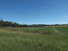
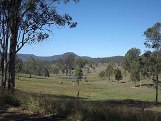
Mount Walker is a mountain and locality in the Scenic Rim Region of Queensland, Australia. The western boundary of Mount Walker is marked by the Bremer River. The central eastern parts of the locality rise to elevations above 400 m around Mount Walker. At the 2016 census Mount Walker and surrounds recorded a population of 134.

Mount Forbes, Queensland Suburb of City of Ipswich, Queensland, Australia

Mount Forbes is a locality in south-east Queensland, Australia. It is split between the local government areas of City of Ipswich and Scenic Rim Region.

Biddaddaba, Queensland Town in Queensland, Australia

Biddaddaba is a locality of the Scenic Rim Region, Queensland, Australia.

Munbilla, Queensland Town in Queensland, Australia

Munbilla is a rural town and locality in the Scenic Rim Region, Queensland, Australia. In the 2016 census, Munbilla had a population of 100 people.

Mutdapilly, Queensland Suburb of City of Ipswich, Queensland, Australia

Mutdapilly is a rural locality in south-east Queensland, Australia. It is split between the local government areas of Scenic Rim Region and City of Ipswich. In the 2016 census Mutdapilly had a population of 308 people.

Limestone Ridges, Queensland Suburb of Scenic Rim Region, Queensland, Australia

Limestone Ridges is a locality in the Scenic Rim Region, Queensland, Australia. The Ipswich Boonah Road marks the eastern boundary of the locality.

Birnam, Queensland (Scenic Rim Region) Suburb of Logan City, Queensland, Australia

Birnam is a locality in the Scenic Rim Region, Queensland, Australia. It is not to be confused with Birnam in the Toowoomba Region.

Coleyville, Queensland Suburb of Scenic Rim Region, Queensland, Australia

Coleyville is a rural locality in the Scenic Rim Region, Queensland, Australia. In the 2016 census, Coleyville had a population of 185 people.

Lower Mount Walker, Queensland Suburb of City of Ipswich, Queensland, Australia

Lower Mount Walker is a locality split between the Scenic Rim Region and City of Ipswich local government areas of South East Queensland, Australia. In the 2016 census, Lower Mount Walker had a population of 185 people.

Merryvale, Queensland Suburb of Scenic Rim Region, Queensland, Australia

Merryvale is a rural locality in the Scenic Rim Region, Queensland, Australia. In the 2016 census, Merryvale had a population of 22 people.

Teviotville, Queensland Town in Queensland, Australia

Teviotville is a rural locality in the Scenic Rim Region, Queensland, Australia. In the 2016 census, Teviotville had a population of 125 people.

Coulson, Queensland Suburb of Scenic Rim Region, Queensland, Australia

Coulson is a rural locality in the Scenic Rim Region, Queensland, Australia. In the 2016 census, Coulson had a population of 195 people.

Croftby, Queensland Suburb of Scenic Rim Region, Queensland, Australia

Croftby is the locality in the Scenic Rim Region, Queensland, Australia. In the 2016 census, Croftby had a population of 133. The town of Teviot is within the locality.

Mount Edwards, Queensland Suburb of Scenic Rim Region, Queensland, Australia

Mount Edwards is a locality in the Scenic Rim Region, Queensland, Australia. In the 2016 census, Mount Edwards had a population of 63 people.

Anthony, Queensland Suburb of Scenic Rim Region, Queensland, Australia

Anthony is a rural locality in the Scenic Rim Region, Queensland, Australia. In the 2016 census, Anthony had a population of 111 people.

Kulgun, Queensland Suburb of Scenic Rim Region, Queensland, Australia

Kulgun is a locality in the Scenic Rim Region, Queensland, Australia. In the 2016 census, Kulgun had a population of 67 people.

Radford, Queensland Suburb of Scenic Rim Region, Queensland, Australia

Radford is a locality in the Scenic Rim Region, Queensland, Australia.

Southern Lamington, Queensland Suburb of Scenic Rim Region, Queensland, Australia

Southern Lamington is a rural locality in the Scenic Rim Region, Queensland, Australia. It borders New South Wales. In the 2016 census, Southern Lamington had no population.

References

  1. 1 2 Australian Bureau of Statistics (27 June 2017). "Mount Walker West (SSC)". 2016 Census QuickStats. Retrieved 20 October 2018. OOjs UI icon edit-ltr-progressive.svg
  2. 1 2 "Mount Walker West - locality in Scenic Rim Region (entry 45217)". Queensland Place Names. Queensland Government . Retrieved 17 November 2019.
  3. 1 2 "Mount Walker West - locality in City of Ipswich (entry 45099)". Queensland Place Names. Queensland Government . Retrieved 16 November 2019.
  4. Australian Bureau of Statistics (31 October 2012). "Coleyville (State Suburb)". 2011 Census QuickStats. Retrieved 27 March 2015. OOjs UI icon edit-ltr-progressive.svg