One Mile, Queensland

Last updated

One Mile
Ipswich,  Queensland
Philip Street at One Mile, Queensland.jpg
Philip Street, 2016
Australia Queensland location map.svg
Red pog.svg
One Mile
Coordinates 27°38′05″S152°44′17″E / 27.6347°S 152.7380°E / -27.6347; 152.7380 (One Mile (centre of suburb)) Coordinates: 27°38′05″S152°44′17″E / 27.6347°S 152.7380°E / -27.6347; 152.7380 (One Mile (centre of suburb))
Population2,077 (2016 census) [1]
 • Density1,093/km2 (2,830/sq mi)
Postcode(s) 4305
Area1.9 km2 (0.7 sq mi)
Time zone AEST (UTC+10:00)
Location
LGA(s) City of Ipswich
State electorate(s) Ipswich West
Federal division(s) Blair
Suburbs around One Mile:
Leichhardt Leichhardt West Ipswich
Amberley One Mile Churchill
Yamanto Yamanto Churchill

One Mile is a suburb of Ipswich in the City of Ipswich, Queensland, Australia. [2] In the 2016 census One Mile had a population of 2,077 people. [1]

Contents

History

One Mile was known as Moopi Moopi Pa by the Quandamooka people. [3]

The origin of the suburb name is from its approximate distance from the Ipswich CBD. [4] It was one mile from the centre of Ipswich to the crossing of the Bremer River on the road to Toowoomba (now the Old Toowoomba Road). [5] The bridge at this crossing was known as the One Mile Bridge until it was renamed the Don Livingstone One Mile Bridge in 2015 after Don Livingstone, a former Member of the Queensland Legislative Assembly for the local area. [6]

In 1943, after the closure of the Myora Mission, some of the residents were moved to One Mile; others went to Dunwich. [3]

Leichhardt Methodist Church was officially opened on Saturday 5 September 1953 by Reverend John Egerton Jacob. The church building was not new but the relocated Methodist Church from Birkwood (now within Coleyville / Warrill View) which opened 77 years earlier in 1876 but the congregation had subsequently declined. [7] [8] With the amalgamation of the Methodist Church into the Uniting Church in Australia in 1977, it became Leichhardt Uniting Church. [9] It was demolished in 2018. It was at 13 Chubb Street ( 27°37′50″S152°44′18″E / 27.6305°S 152.7384°E / -27.6305; 152.7384 (Leichhardt Uniting Church (former)) ), now within the suburb boundaries of One Mile. [9]

Immaculate Heart of Mary Catholic Church opened in 1958 at 22 Old Toowoomba Road. [10] Immaculate Heart of Mary Catholic Primary School opened on 23 January 1967 adjacent to the church. [11] It was the first Catholic school in the Archdiocese of Brisbane to be opened without full-time religious staff as none of the teaching orders of Catholic nuns was able to provide staff. It was opened with two lay women teachers, Mrs Frances Elmore and Mrs Ellen Payne, with nursing sisters from the Sisters of Perpetual Adoration at Villa Maria Nursing Home in Ipswich attending part-time to provide religious instruction. In 1982 the new brick Immaculate Heart of Mary Catholic church was built and the old church was re-purposed for school classrooms. [12] [13] [14]

In the 2016 census, One Mile had a population of 2,077 people. At that time, One Mile had an unemployment rate of 12.2%, nearly double that of the Australian unemployment rate of 6.9%. [1]

Education

Immaculate Heart Catholic Primary School is a Catholic primary (Prep-6) school for boys and girls at 22 Old Toowoomba Road ( 27°37′43″S152°44′19″E / 27.6287°S 152.7386°E / -27.6287; 152.7386 (Immaculate Heart School) ). [15] [16] In 2018, the school had an enrolment of 186 students with 16 teachers (14 full-time equivalent) and 10 non-teaching staff (6 full-time equivalent). [17]

Amenities

Immaculate Heart of Mary Catholic Church is at 22 Old Toowoomba Road ( 27°37′45″S152°44′19″E / 27.6291°S 152.7385°E / -27.6291; 152.7385 (Immaculate Heart of Mary Catholic Church) ). [13] [18]

Related Research Articles

Geebung, Queensland Suburb of Brisbane, Australia

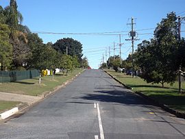
Geebung is a suburb in the City of Brisbane, Queensland, Australia. In the 2016 census, Geebung had a population of 4,626 people.

Inala, Queensland Suburb of Brisbane, Queensland, Australia

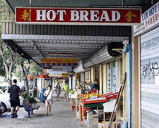
Inala is a suburb in the City of Brisbane, Queensland, Australia. In the 2016 census, Inala had a population of 14,849 people.

Annerley, Queensland Suburb of Brisbane, Queensland, Australia

Annerley is a suburb in the City of Brisbane, Queensland, Australia. In the 2016 census, Annerley had a population of 11,336 people.

Oxley, Queensland Suburb of Brisbane, Queensland, Australia

Oxley is a south-western suburb in the City of Brisbane, Queensland, Australia. It is located approximately 10.8 kilometres (6.7 mi) from the Brisbane CBD. It was named after the early Australian explorer John Oxley. The suburb supports a mix of residential, retail and industrial land.

Darra, Queensland Suburb of Brisbane, Queensland, Australia

Darra is a suburb in the City of Brisbane, Queensland, Australia. In the 2016 census, Darra had a population of 4,343 people.

Gatton, Queensland Town in Queensland, Australia

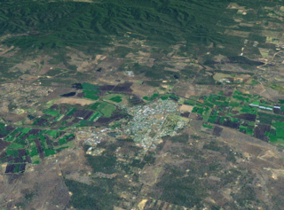
Gatton is a rural town and locality in the Lockyer Valley Region, Queensland, Australia. In the 2016 census, the locality of Gatton had a population of 7,101 people.

Laidley, Queensland Town in Queensland, Australia

Laidley is a rural town and locality in the Lockyer Valley Region, Queensland, Australia. In the 2016 census, the locality of Laidley had a population of 3,808 people.

Goodna, Queensland Suburb of Ipswich, Queensland, Australia

Goodna is a suburb on the eastern edge of the City of Ipswich in Queensland, Australia. In the 2016 census, Goodna had a population of 10,461 people.

Chatsworth, Queensland Suburb of Gympie, Queensland, Australia

Chatsworth is a rural locality in the Gympie Region, Queensland, Australia. In the 2016 census Chatsworth had a population of 1,055 people.

Amberley, Queensland Suburb of Ipswich, Queensland, Australia

Amberley is a suburb in the City of Ipswich, Queensland, Australia. In the 2016 census, Amberley had a population of 253 people.

Crows Nest, Queensland Town in Queensland, Australia

Crows Nest is a rural town and locality in the Toowoomba Region, Queensland, Australia. The town is located in the Darling Downs on the New England Highway, 158 kilometres (98 mi) from the state capital, Brisbane and 43 kilometres (27 mi) from the nearby city of Toowoomba. In the 2016 census, Crows Nest had a population of 2160 people.

Pine Mountain, Queensland Suburb of Ipswich, Queensland, Australia

Pine Mountain is a semi-rural locality in the City of Ipswich, Queensland, Australia. In the 2016 census Pine Mountain had a population of 1,667 people.

Redbank Plains, Queensland Suburb of Ipswich, Queensland, Australia

Redbank Plains is a suburb in the City of Ipswich, Queensland, Australia. In the 2016 census, Redbank Plains had a population of 19,299 people.

Eastern Heights, Queensland Suburb of Ipswich, Queensland, Australia

Eastern Heights is a suburb of Ipswich in the City of Ipswich, Queensland, Australia. In the 2016 census, Eastern Heights had a population of 3,709 people.

Booval, Queensland Suburb of Ipswich, Queensland, Australia

Booval is a suburb of Ipswich in the City of Ipswich, Queensland, Australia. In the 2016 census Booval had a population of 2,622 people.

Blackstone, Queensland Suburb of Ipswich, Queensland, Australia

Blackstone is a suburb of Ipswich in the City of Ipswich, Queensland, Australia. In the 2016 census, Blackstone had a population of 1,024 people.

Leichhardt, Queensland Suburb of Ipswich, Queensland, Australia

Leichhardt is a suburb of Ipswich in the City of Ipswich, Queensland, Australia. In the 2016 census, Leichhardt had a population of 3,912 people.

Augustine Heights, Queensland Suburb of Ipswich, Queensland, Australia

Augustine Heights is a suburb in the City of Ipswich, Queensland, Australia. In the 2016 census, Augustine Heights had a population of 4,880 people.

Ipswich (suburb), Queensland Suburb of Ipswich, Queensland, Australia

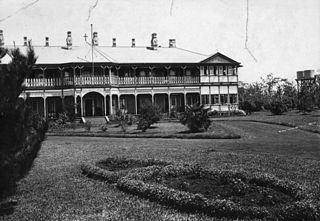
Ipswich is the central suburb and central business district in Ipswich in the City of Ipswich, Queensland, Australia. It is also known as Ipswich CBD. In the 2016 census, the suburb had a population of 2,459 people.

Newtown, Queensland (Toowoomba) Suburb of Toowoomba, Queensland, Australia

Newtown is a residential locality in Toowoomba in the Toowoomba Region, Queensland, Australia. In the 2016 census, Newtown had a population of 9,596 people.

References

  1. 1 2 3 Australian Bureau of Statistics (27 June 2017). "One Mile (SSC)". 2016 Census QuickStats. Retrieved 20 October 2018. OOjs UI icon edit-ltr-progressive.svg
  2. "One Mile – suburb in City of Ipswich (entry 45067)". Queensland Place Names. Queensland Government . Retrieved 20 July 2021.
  3. 1 2 Anderson, Robert V. (2001). "History, Life And Times of Robert Anderson: Gheebelum, Ngugi, Mulgumpin". doczz.net. Uniikup Productions. Archived from the original on 27 February 2020. Retrieved 27 February 2020. Community and personal history of a Ngugi Elder of Mulgumpin in Quandamooka, South East Queensland, Australia.
  4. "One Mile – suburb (entry 45067)". Queensland Place Names. Queensland Government . Retrieved 22 June 2017.
  5. "Suburb and Place Names". Ipswich City Council. Archived from the original on 28 August 2018. Retrieved 4 November 2018.
  6. Bennion, Brian (19 February 2015). "Bridge honour for Livingstone". Queensland Times . Archived from the original on 1 May 2016. Retrieved 4 November 2018.
  7. "Dedication Service METHODIST CHURCH AT LEICHHARDT". Queensland Times (20, 801). Queensland, Australia. 7 September 1953. p. 2 (Daily). Archived from the original on 23 December 2021. Retrieved 23 December 2021 via National Library of Australia.
  8. Blake, Thom. "Birkwood Wesleyan Methodist Church". Queensland religious places database. Archived from the original on 23 December 2021. Retrieved 22 December 2021.
  9. 1 2 Blake, Thom. "Leichhardt Methodist Church". Queensland religious places database. Archived from the original on 23 December 2021. Retrieved 22 December 2021.
  10. Blake, Thom. "Immaculate Heart of Mary Catholic Church (1958)". Queensland religious places database. Archived from the original on 23 December 2021. Retrieved 22 December 2021.
  11. Queensland Family History Society (2010), Queensland schools past and present (Version 1.01 ed.), Queensland Family History Society, ISBN   978-1-921171-26-0
  12. "History of Parish and School". Immaculate Heart Catholic Primary School. Archived from the original on 16 May 2021. Retrieved 22 December 2021.
  13. 1 2 Blake, Thom. "Immaculate Heart of Mary Catholic Church (1982)". Queensland religious places database. Archived from the original on 23 December 2021. Retrieved 22 December 2021.
  14. "Our Churches". Ipswich Catholic Community. 14 December 2016. Archived from the original on 23 December 2021. Retrieved 22 December 2021.
  15. "State and non-state school details". Queensland Government. 9 July 2018. Archived from the original on 21 November 2018. Retrieved 21 November 2018.
  16. "Welcome to Immaculate Heart Catholic Primary School". Immaculate Heart Catholic Primary School. Archived from the original on 18 December 2021. Retrieved 22 December 2021.
  17. "ACARA School Profile 2018". Australian Curriculum, Assessment and Reporting Authority. Archived from the original on 27 August 2020. Retrieved 28 January 2020.
  18. "Home". Ipswich Catholic Community. Archived from the original on 26 February 2019. Retrieved 22 December 2021.