
Oxley is a south-western suburb in the City of Brisbane, Queensland, Australia. In the 2021 census, Oxley had a population of 9,100 people.

Aratula is a rural town and locality in the Scenic Rim Region, Queensland, Australia. In the 2021 census, the locality of Aratula had a population of 609 people.

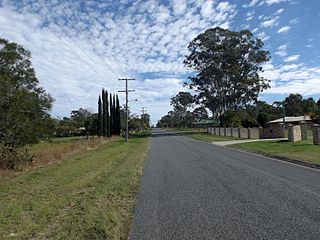
Karana Downs is a residential locality in the City of Brisbane, Queensland, Australia. In the 2021 census, Karana Downs had a population of 3,800 people.

Mount Crosby is a semi-rural outer western locality in the City of Brisbane, Queensland, Australia. In the 2021 census, Mount Crosby had a population of 1,860 people.

Kholo is a rural locality in the City of Brisbane, Queensland, Australia. In the 2021 census, Kholo had a population of 374 people.

Chuwar is a town and suburb of Ipswich in the City of Ipswich and a locality of the City of Brisbane in South East Queensland, Australia. In the 2021 census, Chuwar had a population of 2,178 people.

Grandchester is a rural town and locality in the City of Ipswich, Queensland, Australia. In the 2021 census, the locality of Grandchester had a population of 467 people.

North Ipswich is a suburb of Ipswich in the City of Ipswich, Queensland, Australia. In the 2016 census, North Ipswich had a population of 4,515 people.

Bundamba is a suburb of Ipswich in the City of Ipswich, Queensland, Australia. In the 2021 census, Bundamba had a population of 6,542 people.

Brassall is a suburb in the City of Ipswich, Queensland, Australia. As of the 2021 census, Brassall had a population of 12,115 people.

Sadliers Crossing is a suburb of Ipswich in the City of Ipswich, Queensland, Australia. In the 2016 census, Sadliers Crossing had a population of 1,366 people.

Wulkuraka is a western suburb of Ipswich in the City of Ipswich, Queensland, Australia. In the 2021 census, Wulkuraka had a population of 1,325 people.

Redbank is a suburb in the City of Ipswich, Queensland, Australia. In the 2021 census, Redbank had a population of 2,931 people.

Karrabin is a rural locality in the City of Ipswich, Queensland, Australia. In the 2021 census, Karrabin had a population of 416 people.

Gailes is a suburb of Ipswich in the City of Ipswich, Queensland, Australia. In the 2021 census, Gailes had a population of 1,831 people.
Walloon is a town and rural residential locality in the City of Ipswich, Queensland, Australia. In the 2021 census, the locality of Walloon had a population of 2,305 people.

Tallegalla is a rural locality in the City of Ipswich, Queensland, Australia. In the 2021 census, Tallegalla had a population of 351 people.
Jeebropilly is a rural locality in the City of Ipswich, Queensland, Australia. In the 2021 census, Jeebropilly had "no people or a very low population".

Teviotville is a rural locality in the Scenic Rim Region, Queensland, Australia. In the 2021 census, Teviotville had a population of 114 people.

Biarra is a rural locality in the Somerset Region, Queensland, Australia. In the 2021 census, Biarra had a population of 270 people.


