White Rock, Queensland (Ipswich)

Last updated

White Rock
Ipswich,  Queensland
White Rock - panoramio.jpg
White Rock Spring Mountain Conservation Reserve
Australia Queensland location map.svg
Red pog.svg
White Rock
Coordinates 27°41′42″S152°50′56″E / 27.695°S 152.8488°E / -27.695; 152.8488 (White Rock (centre of locality))
Population3 (2016 census) [1]
 • Density0.172/km2 (0.45/sq mi)
Postcode(s) 4306
Area17.4 km2 (6.7 sq mi)
Time zone AEST (UTC+10:00)
LGA(s) City of Ipswich
State electorate(s) Bundamba
Federal division(s) Blair
Suburbs around White Rock:
Swanbank Redbank Plains Redbank Plains
South Ripley White Rock Spring Mountain
South Ripley South Ripley Spring Mountain

White Rock is a locality in the City of Ipswich, Queensland, Australia. [2] In the 2016 census White Rock had a population of 3 people. [1]

Contents

Geography

The majority of land in White Rock remains covered in natural vegetation. In the far north west, the Centenary Motorway links Springfield with the Cunningham Highway to the west. The western half of White Rock lies with the catchment of the Bremer River and the eastern half within the Brisbane River catchment.

History

White Rock is situated in the Yugarabul traditional Aboriginal country of the Brisbane and surrounding regions. [3]

In the 2016 census White Rock had a population of 3 people. [1]

Attractions

Bushland surrounding White Rock, 2010 Atop White Rock, looking northwest - panoramio.jpg
Bushland surrounding White Rock, 2010

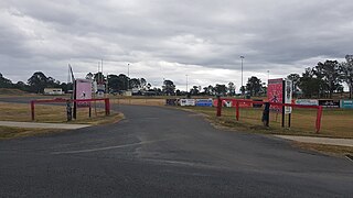
The White Rock Conservation Park, now known as the White Rock – Spring Mountain Conservation Estate, is accessed by White Rock Drive from Redbank Plains. It is used for bushwalking and horse riding during the day. No camping or pets are permitted. [4]

Related Research Articles

<span class="mw-page-title-main">Ipswich, Queensland</span> City in Queensland, Australia

Ipswich is a city in South East Queensland, Australia. Situated on the Bremer River, it is approximately 40 kilometres (25 mi) west of the Brisbane central business district. The city is renowned for its architectural, natural and cultural heritage. Ipswich preserves and operates from many of its historical buildings, with more than 6000 heritage-listed sites and over 500 parks. Ipswich was founded in 1827 as a mining settlement.

<span class="mw-page-title-main">Bald Hills, Queensland</span> Suburb of Brisbane, Queensland, Australia

Bald Hills is the northernmost suburb in the City of Brisbane, Queensland, Australia. In the 2016 census Bald Hills had a population of 6,502 people.

<span class="mw-page-title-main">Esk, Queensland</span> Town in Queensland, Australia

Esk is a town and locality in the Somerset Region in South East Queensland, Australia. In the 2016 census, Esk had a population of 1,698 people.

<span class="mw-page-title-main">Albert River (South East Queensland)</span> River in Queensland, Australia

The Albert River is a perennial river located in the South East region of Queensland, Australia. Its catchment lies within the Gold Coast and Scenic Rim Region local government areas and covers an area of 782 square kilometres (302 sq mi). The river provides potable water for the town of Beaudesert.

<span class="mw-page-title-main">Greenbank, Queensland</span> Suburb of Logan City, Queensland, Australia

Greenbank is a rural residential suburb in the City of Logan, Queensland, Australia. In the 2016 census, Greenbank had a population of 7,694 people.

<span class="mw-page-title-main">Scenic Rim</span> Mountain ranges in Australia

The Scenic Rim is a group of forested mountain ranges of the Great Dividing Range, located south of Brisbane agglomeration, straddling the border between south-eastern Queensland and north-eastern New South Wales, Australia. In 2021, the Scenic Rim was named as a Lonely Planet top destination for 2022.

<span class="mw-page-title-main">Yeerongpilly, Queensland</span> Suburb of Brisbane, Queensland, Australia

Yeerongpilly is a southern suburb in the City of Brisbane, Queensland, Australia. In the 2016 census, Yeerongpilly had a population of 1,934 people.

<span class="mw-page-title-main">Chuwar, Queensland</span> Town in Queensland, Australia

Chuwar is a town and suburb of Ipswich in the City of Ipswich and a locality of the City of Brisbane in South East Queensland, Australia. In the 2016 census, the suburb of Chuwar had a population of 2,244 people.

<span class="mw-page-title-main">Brisbane Airport (suburb)</span> Suburb of Brisbane, Queensland, Australia

Brisbane Airport is a coastal suburb in the City of Brisbane, Queensland, Australia. In the 2016 census, Brisbane Airport had a population of 0 people.

<span class="mw-page-title-main">Pine Mountain, Queensland</span> Suburb of Ipswich, Queensland, Australia

Pine Mountain is a semi-rural locality in the City of Ipswich, Queensland, Australia. In the 2016 census Pine Mountain had a population of 1,667 people.

<span class="mw-page-title-main">Ripley, Queensland</span> Suburb of Ipswich, Queensland, Australia

Ripley is a suburb in the City of Ipswich, Queensland, Australia. In the 2016 census, Ripley had a population of 1,405 people.

<span class="mw-page-title-main">Deebing Heights, Queensland</span> Suburb of Ipswich, Queensland, Australia

Deebing Heights is a residential and semi-rural southern suburb of Ipswich in the City of Ipswich, Queensland, Australia. In the 2016 census, Deebing Heights had a population of 2,039 people.

<span class="mw-page-title-main">Flinders Peak Group</span>

The Flinders Peak Group is an unnamed range of hills located on the northern edge of the Scenic Rim Region, south west of Logan City and south east of the City of Ipswich in South East Queensland, Australia. The summit in the Range is Flinders Peak reaching 680 metres (2,230 ft) above sea level.

<span class="mw-page-title-main">South Ripley, Queensland</span> Suburb of Ipswich, Queensland, Australia

South Ripley is a rural locality and suburb of Ipswich in the City of Ipswich, Queensland, Australia. South Ripley is part of the Ecco Ripley urban development area. In the 2016 census, South Ripley had a population of 712 people.

Mount Rascal is a rural locality in the Toowoomba Region, Queensland, Australia. In the 2016 census, Mount Rascal had a population of 462 people.

<span class="mw-page-title-main">Peak Crossing, Queensland</span> Suburb of City of Ipswich, Queensland, Australia

Peak Crossing is a rural locality split between the City of Ipswich and the Scenic Rim Region of Queensland, Australia. In the 2016 census, Peak Crossing had a population of 965 people.

Upper Flagstone is a rural locality in the Lockyer Valley Region, Queensland, Australia. In the 2016 census Upper Flagstone had a population of 171 people.

Lockyer is a rural locality in the Lockyer Valley Region, Queensland, Australia. In the 2016 census, Lockyer had a population of 95 people.

<span class="mw-page-title-main">Riverbend, Queensland</span> Suburb of Logan City, Queensland, Australia

Riverbend is a rural locality in the City of Logan, Queensland, Australia. Designated as a separate locality in 2017, it will be progressively developed for residential use as the population of the city grows.
<span class="mw-page-title-main">Glenlogan, Queensland</span> Suburb of Logan City, Queensland, Australia

Glenlogan is a rural locality in the City of Logan, Queensland, Australia. It is part of the suburban development corridor south of Brisbane in the Greater Flagstone development area.

References

  1. 1 2 3 Australian Bureau of Statistics (27 June 2017). "White Rock (SSC)". 2016 Census QuickStats. Retrieved 20 October 2018. OOjs UI icon edit-ltr-progressive.svg
  2. "White Rock – locality in City of Ipswich (entry 49527)". Queensland Place Names. Queensland Government . Retrieved 27 December 2020.
  3. "AIATSIS code E66: Yugarabul". Federal government. Australian Institute of Aboriginal and Torres Strait Islander Studies. Retrieved 31 July 2020.
  4. "Parks and Reserves: White Rock – Spring Mountain Conservation Estate – Including Paperbark Flats Picnic Area". Ipswich City Council. Archived from the original on 17 August 2017. Retrieved 19 September 2017.