Tivoli, Queensland

Last updated

Tivoli
Ipswich,  Queensland
Tivoli Sporting Complex 2023.jpg
Tivoli Sporting Complex, 2023
Australia Queensland location map.svg
Red pog.svg
Tivoli
Coordinates 27°35′11″S152°46′29″E / 27.5863°S 152.7747°E / -27.5863; 152.7747 (Tivoli (centre of suburb))
Population1,460 (2021 census) [1]
 • Density406/km2 (1,050/sq mi)
Postcode(s) 4305
Area3.6 km2 (1.4 sq mi)
Time zone AEST (UTC+10:00)
Location
LGA(s) City of Ipswich
State electorate(s) Ipswich West
Federal division(s) Blair
Suburbs around Tivoli:
North Ipswich Chuwar North Tivoli
North Ipswich Tivoli North Booval
Basin Pocket Moores Pocket North Booval

Tivoli is a suburb in the City of Ipswich, Queensland, Australia. [2] In the 2021 census, Tivoli had a population of 1,460 people. [1]

Contents

Tivoli is home to one of six remaining drive-in cinemas in Queensland. [3]

Geography

The Warrego Highway passes from east (North Tivoli) to west (North Ipswich) through the north of the locality. [4] Mount Crosby Road runs through from southwest to northeast. [5]

Tivoli Hill is a neighbourhood with the suburb ( 27°35′39″S152°46′04″E / 27.5941°S 152.7677°E / -27.5941; 152.7677 (Tivoli Hill) ). Prior to 1991 it was a separate suburb. The neighbourhood is near the hill of the same name( 27°35′36″S152°46′17″E / 27.5933°S 152.7713°E / -27.5933; 152.7713 (Tivoli Hill) ). [6] [7]

Situated north of the Bremer River, Tivoli is 4.8 kilometres (3.0 mi) by road north-east of the Ipswich CBD and north-east of the North Ipswich railway workshops.

History

The Tivoli area had been subdivided and sold as farmland in 1861–63, and the observant purchasers went in for coal mining.

Harry Hooper and his partner John Robinson called their mine, and one of the coal seams on it, the Tivoli, and the locality took its name from the mine. [4]

Houses and communities formed around the irregular subdivisions and mining areas.

On 9 September 1873 a Congregational church opened near the Tivoli mine . [8] The church at 42 Church Street ( 27°34′57″S152°46′41″E / 27.5824°S 152.7780°E / -27.5824; 152.7780 (Tivoli Christian Reformed Church) ) has had continuous use. It is currently the Tivoli Christian Reformed Church. [9]

The church hall was used as a school room for children and adults (night classes) from 1 July 1875. It had over 100 pupils by 1877 and opened as Tivoli Provisional School on 26 Jan 1877. On 17 January 1881 it became Tivoli State School. In 1937 it was renamed Tivoli Lower State School but in 1977 was renamed Tivoli State School again. [10]

Whilst many houses were built for workmen, mine owners built close to their work sites. Next to the school in Mount Crosby Road the family of John Wright, proprietor of the Eclipse mine, built three houses on large allotments. The grandest, Oaklands is the central one; all have spacious gardens and are listed on the Queensland Heritage Register. [11]

On the other side of Mount Crosby Road, the Abermain Colliery (1880s) was a large operation with a spur line from the Tivoli railway line and several coke ovens.

In another direction, a tramway was opened from the Tivoli mines to the pumping station at the Mount Crosby weir, transporting coal from 1913 until about 1932.

After lying idle for several years the Abermain Colliery was used for sewerage treatment. It adjoins a sports complex and the Ipswich Caravan Village. A short distance south there is the Abermain electricity substation which was enlarged in 2009.

Financed and named by John Robinson (Ipswich soda-water manufacturer) and Harry Hooper, it seems that Tivoli was a Hooper family name. [12]

Demographics

In the 2016 census, Tivoli had a population of 1,487 people. [13]

In the 2021 census, Tivoli had a population of 1,460 people. [1]

Heritage listings

98 Mt Crosby Road is part of the Wright Family Houses 98 Mt Crosby Road 2 Tivoli, Queensland.jpg
98 Mt Crosby Road is part of the Wright Family Houses

Tivoli has a number of heritage-listed sites, including:

Education

Tivoli State School is a government primary (Prep-6) school for boys and girls at 108 Mount Crosby Road ( 27°35′02″S152°46′39″E / 27.5839°S 152.7775°E / -27.5839; 152.7775 (Tivoli State School) ). [14] [15] In 2018, the school had an enrolment of 133 students with 13 teachers (11 full-time equivalent) and 12 non-teaching staff (6 full-time equivalent). [16]

There is no secondary school in Tivoli. The nearest secondary school is Ipswich State High School in Brassall to the west. [4]

Related Research Articles

<span class="mw-page-title-main">Wacol, Queensland</span> Suburb of Brisbane, Queensland, Australia

Wacol is a suburb in the City of Brisbane, Queensland, Australia. In the 2021 census, Wacol had a population of 4,253 people.

<span class="mw-page-title-main">Karana Downs, Queensland</span> Suburb of Brisbane, Queensland, Australia

Karana Downs is a residential locality in the City of Brisbane, Queensland, Australia. In the 2021 census, Karana Downs had a population of 3,800 people.

<span class="mw-page-title-main">Mount Crosby, Queensland</span> Suburb of Brisbane, Queensland, Australia

Mount Crosby is a semi-rural outer western locality in the City of Brisbane, Queensland, Australia. In the 2021 census, Mount Crosby had a population of 1,860 people.

<span class="mw-page-title-main">Lake Manchester, Queensland</span> Suburb of Brisbane, Queensland, Australia

Lake Manchester is both a lake in the City of Brisbane and the surrounding locality which is split between the City of Brisbane and Somerset Region in Queensland, Australia. It is 30 kilometres (19 mi) west of the CBD. In the 2021 census, Lake Manchester had a population of 17 people.

<span class="mw-page-title-main">Kholo, Queensland</span> Suburb of Brisbane, Queensland, Australia

Kholo is a rural locality in the City of Brisbane, Queensland, Australia. In the 2021 census, Kholo had a population of 374 people.

<span class="mw-page-title-main">Chuwar, Queensland</span> Town in Queensland, Australia

Chuwar is a town and suburb of Ipswich in the City of Ipswich and a locality of the City of Brisbane in South East Queensland, Australia. In the 2021 census, the suburb of Chuwar had a population of 2,178 people.

<span class="mw-page-title-main">Rosewood, Queensland</span> Town in Queensland, Australia

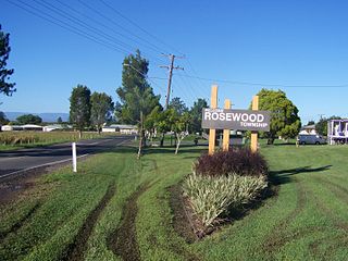
Rosewood is a rural town and locality in the City of Ipswich, Queensland, Australia. In the 2021 census, the locality of Rosewood had a population of 3,263 people.

<span class="mw-page-title-main">North Ipswich, Queensland</span> Suburb of Ipswich, Queensland, Australia

North Ipswich is a suburb of Ipswich in the City of Ipswich, Queensland, Australia. In the 2021 census, North Ipswich had a population of 4,527 people.

<span class="mw-page-title-main">North Tivoli, Queensland</span> Suburb of Ipswich, Queensland, Australia

North Tivoli is a suburb of Ipswich in the City of Ipswich, Queensland, Australia. In the 2021 census, North Tivoli had a population of 84 people.

<span class="mw-page-title-main">Bundamba, Queensland</span> Suburb of Ipswich, Queensland, Australia

Bundamba is a suburb of Ipswich in the City of Ipswich, Queensland, Australia. In the 2021 census, Bundamba had a population of 6,542 people.

<span class="mw-page-title-main">Blackstone, Queensland</span> Suburb of Ipswich, Queensland, Australia

Blackstone is a suburb of Ipswich in the City of Ipswich, Queensland, Australia. In the 2021 census, Blackstone had a population of 1,144 people.

<span class="mw-page-title-main">Dinmore, Queensland</span> Suburb of Ipswich, Queensland, Australia

Dinmore is a suburb of Ipswich in the City of Ipswich, Queensland, Australia. In the 2021 census, Dinmore had a population of 1,109 people.

<span class="mw-page-title-main">Woodend, Queensland</span> Suburb of Ipswich, Queensland, Australia

Woodend is an inner suburb of Ipswich in the City of Ipswich, Queensland, Australia. In the 2021 census, Woodend had a population of 1,483 people.

<span class="mw-page-title-main">Ebenezer, Queensland</span> Suburb of Ipswich, Queensland, Australia

Ebenezer is a rural locality in the City of Ipswich, Queensland, Australia. In the 2021 census, Ebenezer had a population of 301 people.

Jeebropilly is a rural locality in the City of Ipswich, Queensland, Australia. In the 2021 census, Jeebropilly had "no people or a very low population".

<span class="mw-page-title-main">Ripley, Queensland</span> Suburb of Ipswich, Queensland, Australia

Ripley is a suburb in the City of Ipswich, Queensland, Australia. In the 2021 census, Ripley had a population of 4,288 people.

<span class="mw-page-title-main">Ipswich (suburb), Queensland</span> Suburb of Ipswich, Queensland, Australia

Ipswich Central is the central suburb of Ipswich in the City of Ipswich, Queensland, Australia. In the 2021 census, Ipswich had a population of 2,468 people.

Blanchview is a rural locality in the Lockyer Valley Region, Queensland, Australia. In the 2021 census, Blanchview had a population of 202 people.

<span class="mw-page-title-main">Wright Family Houses</span> Historic site in Queensland, Australia

The Wright Family Houses area heritage-listed group of detached houses at 98/100/106 Mt Crosby Road, Tivoli, City of Ipswich, Queensland, Australia. It was built from c. 1898 onwards. No. 100 is also known as Oaklands and No. 106 is also known as Wrightlands. It was added to the Queensland Heritage Register on 30 January 2004.

<span class="mw-page-title-main">Lanefield, Queensland</span> Locality in Queensland australia

Lanefield is a rural locality in the City of Ipswich, Queensland, Australia. In the 2021 census, Lanefield had a population of 97 people.

References

  1. 1 2 3 Australian Bureau of Statistics (28 June 2022). "Tivoli (SAL)". 2021 Census QuickStats. Retrieved 28 February 2023. OOjs UI icon edit-ltr-progressive.svg
  2. "Tivoli – suburb in City of Ipswich (entry 45085)". Queensland Place Names. Queensland Government . Retrieved 18 September 2020.
  3. Leonie Thorne (8 November 2015). "Million dollar boost to brings Tivoli Drive-in back to life". Brisbane Times. Fairfax Media. Archived from the original on 8 November 2015. Retrieved 9 November 2015.
  4. 1 2 3 "Queensland Globe". State of Queensland . Retrieved 11 October 2020.
  5. "Tivoli Queensland" (Map). Google Maps . Retrieved 7 January 2024.
  6. "Tivoli Hill – neighbourhood in City of Ipswich (entry 34700)". Queensland Place Names. Queensland Government . Retrieved 18 September 2020.
  7. "Tivoli Hill – hill in City of Ipswich (entry 42505)". Queensland Place Names. Queensland Government . Retrieved 18 September 2020.
  8. "RELIGIOUS". Queensland Times, Ipswich Herald and General Advertiser . Vol. XIII, no. 1770. Queensland, Australia. 2 October 1873. p. 3. Retrieved 11 October 2020 via National Library of Australia.
  9. "A Church for the Community". Tivoli Christian Reformed Church. Archived from the original on 11 October 2020. Retrieved 11 October 2020.
  10. Queensland Family History Society (2010), Queensland schools past and present (Version 1.01 ed.), Queensland Family History Society, ISBN   978-1-921171-26-0
  11. 1 2 "Wright Family Houses (entry 601898)". Queensland Heritage Register . Queensland Heritage Council. Retrieved 9 July 2013.
  12. "Centre for the Government of Queensland". Archived from the original on 9 August 2016.
  13. Australian Bureau of Statistics (27 June 2017). "Tivoli (SSC)". 2016 Census QuickStats. Retrieved 20 October 2018. OOjs UI icon edit-ltr-progressive.svg
  14. "State and non-state school details". Queensland Government. 9 July 2018. Archived from the original on 21 November 2018. Retrieved 21 November 2018.
  15. "Tivoli State School". Archived from the original on 22 March 2020. Retrieved 21 November 2018.
  16. "ACARA School Profile 2018". Australian Curriculum, Assessment and Reporting Authority. Archived from the original on 27 August 2020. Retrieved 28 January 2020.

Further reading