Ipswich is an urban centre within the City of Ipswich in South East Queensland, Australia. Situated on the Bremer River, it is approximately 40 km west of the Brisbane central business district. Ipswich is renowned for its architectural, natural and cultural heritage, and the city preserves and operates from many of its historical buildings, with more than 6000 heritage-listed sites and over 500 parks. Ipswich was founded in 1827 as a mining settlement, and soon developed into a major commercial and population centre. The suburb of the same name serves as the city’s central business district. In the 2021 census, the population of the urban area of Ipswich was 115,913 people.

Boonah is a rural town and locality in the Scenic Rim Region, Queensland, Australia. In the 2021 census, the locality of Boonah had a population of 2,557 people.

Gatton is a rural town and locality in the Lockyer Valley Region, Queensland, Australia. It is the administrative centre of the Lockyer Valley Region, situated in the Lockyer Valley of South East Queensland.

Laidley is a rural town and locality in the Lockyer Valley Region, Queensland, Australia. In the 2021 census, the locality of Laidley had a population of 3,809 people.

Aratula is a rural town and locality in the Scenic Rim Region, Queensland, Australia. In the 2021 census, the locality of Aratula had a population of 609 people.

Woodford is a rural town and locality in the City of Moreton Bay, Queensland, Australia. In the 2021 census, the locality of Woodford had a population of 4,022 people.

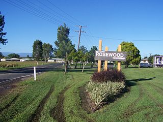
Rosewood is a rural town and locality in the City of Ipswich, Queensland, Australia. In the 2021 census, the locality of Rosewood had a population of 3,263 people.

Grandchester is a rural town and locality in the City of Ipswich, Queensland, Australia. In the 2021 census, the locality of Grandchester had a population of 467 people.

Pine Mountain is a semi-rural locality in the City of Ipswich, Queensland, Australia. In the 2021 census, Pine Mountain had a population of 1,695 people.

Basin Pocket is a suburb of Ipswich in the City of Ipswich, Queensland, Australia. In the 2021 census, Basin Pocket had a population of 931 people.

Bundamba is a suburb of Ipswich in the City of Ipswich, Queensland, Australia. In the 2021 census, Bundamba had a population of 6,542 people.

East Ipswich is a residential inner-city suburb of Ipswich in the City of Ipswich, Queensland, Australia. In the 2021 census, East Ipswich had a population of 2,321 people.

Eastern Heights is a suburb of Ipswich in the City of Ipswich, Queensland, Australia. In the 2021 census, Eastern Heights had a population of 3,631 people.

Booval is a suburb of Ipswich in the City of Ipswich, Queensland, Australia. In the 2021 census, Booval had a population of 2,723 people.

Dinmore is a suburb of Ipswich in the City of Ipswich, Queensland, Australia. In the 2021 census, Dinmore had a population of 1,109 people.

Churchill is a suburb of Ipswich in the City of Ipswich, Queensland, Australia. In the 2021 census, Churchill had a population of 1,842 people.

Ipswich Central is the central suburb of Ipswich in the City of Ipswich, Queensland, Australia. In the 2021 census, Ipswich had a population of 2,468 people.

The Shire of Bundanba is a former local government area in the south-east of Queensland, Australia. It existed from 1879 to 1916.

Lanefield is a rural locality in the City of Ipswich, Queensland, Australia. In the 2021 census, Lanefield had a population of 97 people.

Upper Tenthill is a rural locality in the Lockyer Valley Region, Queensland, Australia. In the 2021 census, Upper Tenthill had a population of 273 people.


