Calvert, Queensland

Last updated

Calvert
Ipswich,  Queensland
Paddocks at Calvert, Queensland.jpg
Houses and paddocks along Waters Road, 2015
Australia Queensland location map.svg
Red pog.svg
Calvert
Coordinates 27°39′54″S152°31′07″E / 27.665°S 152.5186°E / -27.665; 152.5186 (Calvert (town centre))
Population374 (2021 census) [1]
 • Density8.462/km2 (21.92/sq mi)
Postcode(s) 4340
Area44.2 km2 (17.1 sq mi)
Time zone AEST (UTC+10:00)
Location
LGA(s) City of Ipswich
State electorate(s)
Federal division(s) Blair
Localities around Calvert:
Grandchester Woolshed The Bluff
Grandchester Calvert Lanefield
Grandchester Lower Mount Walker Lower Mount Walker

Calvert is a rural town and locality in the City of Ipswich, Queensland, Australia. [2] [3] In the 2021 census, the locality of Calvert had a population of 374 people. [1]

Contents

Geography

The Main Line railway passes through Calvert as does Western Creek, a tributary of the Bremer River. A 2014 flood mapping study of the Western Creek catchment has provided more reliable flood information to residents and landowners. [4] In the northern extents elevations rise to 340 metres above sea level around Mount Grandchester No. 2. which is part of the Little Liverpool Range. The landscape in the southern parts of Calvert is mostly used for agriculture.

History

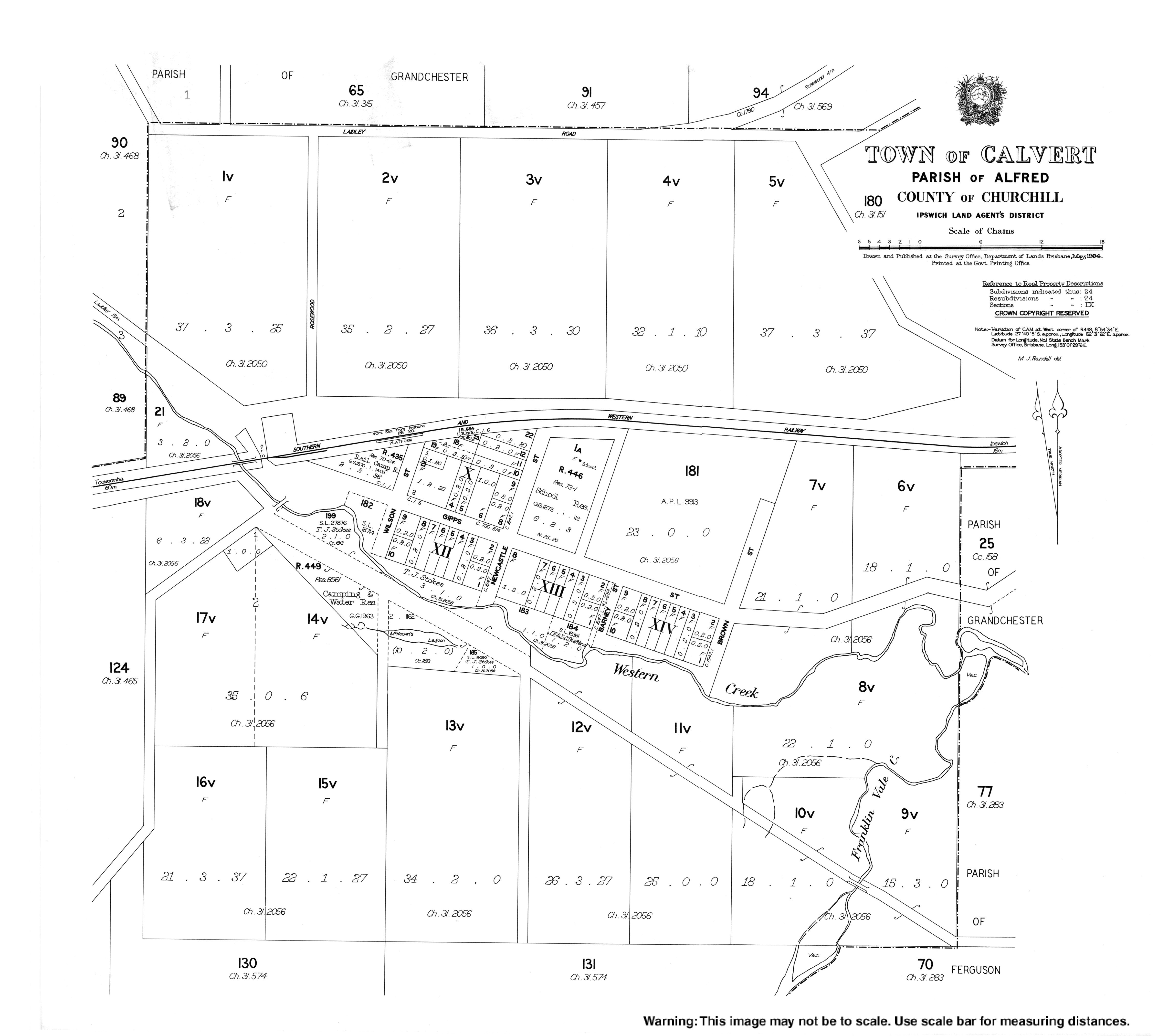
The district originally contained an inn opened in 1843 by Owens, later sold to McKeon, and was surveyed in 1854 as the village of Alfred, becoming a stopping place on the coach route the same year. On the 9 March 1931, the district was renamed to Calvert. [5] [6]

Calvert was not one of the original stations on the Main Line railway passing through the district, however in 1865 residents petitioned for a station. In 1866 Western Creek station opened, renamed Calvert in 1884. [5] [6]

Alfred State School opened on 11 March 1872. In 1910 it was renamed Calvert State School. It closed in 1972. [7] [8] It was at 29-35 Newcastle Street ( 27°39′53″S152°31′16″E / 27.6647°S 152.5212°E / -27.6647; 152.5212 (Calvert State School (former)) ). [9] [10] [11]

Demographics

In the 2011 census, the locality of Calvert had a population of 281 people. [12]

In the 2016 census, the locality of Calvert had a population of 313 people. [13]

In the 2021 census, the locality of Calvert had a population of 374 people. [1]

Education

There are no schools in Cavert. The nearest government primary schools are Grandchester State School in neighbouring Grandchester to the west and Ashwell State School in Ashwell to the north-east. The nearest government secondary schools are Rosewood State High School in Rosewood to the east and Laidley State High School in Laidley to the west. [14]

Sport

A paintball centre was established at Cummings Road in 2014. It hosts scenario paintball events and a tournament Speedball paintball series. The centre changed names from Tac Ops Paintball to Valhalla Paintball in 2021. [15]

Related Research Articles

<span class="mw-page-title-main">Laidley, Queensland</span> Town in Queensland, Australia

Laidley is a rural town and locality in the Lockyer Valley Region, Queensland, Australia. In the 2021 census, the locality of Laidley had a population of 3,809 people.

<span class="mw-page-title-main">Marburg, Queensland</span> Town in Queensland, Australia

Marburg is a rural town in the City of Ipswich and a locality split between the City of Ipswich and the Somerset Region, both in Queensland, Australia. In the 2021 census, the locality of Marburg had a population of 1,013 people.

<span class="mw-page-title-main">Rosewood, Queensland</span> Town in Queensland, Australia

Rosewood is a rural town and locality in the City of Ipswich, Queensland, Australia. In the 2021 census, the locality of Rosewood had a population of 3,263 people.

<span class="mw-page-title-main">Grandchester, Queensland</span> Town in Queensland, Australia

Grandchester is a rural town and locality in the City of Ipswich, Queensland, Australia. In the 2021 census, the locality of Grandchester had a population of 467 people.

<span class="mw-page-title-main">Gailes, Queensland</span> Suburb of Ipswich, Queensland, Australia

Gailes is a suburb of Ipswich in the City of Ipswich, Queensland, Australia. In the 2021 census, Gailes had a population of 1,831 people.

<span class="mw-page-title-main">Thagoona, Queensland</span> Suburb of Ipswich, Queensland, Australia

Thagoona is a mixed-use locality in the City of Ipswich, Queensland, Australia. In the 2021 census, Thagoona had a population of 1,077 people.

<span class="mw-page-title-main">Walloon, Queensland</span> Town in Queensland, Australia

Walloon is a town and rural residential locality in the City of Ipswich, Queensland, Australia. In the 2021 census, the locality of Walloon had a population of 2,305 people.

<span class="mw-page-title-main">Ebenezer, Queensland</span> Suburb of Ipswich, Queensland, Australia

Ebenezer is a rural locality in the City of Ipswich, Queensland, Australia. In the 2021 census, Ebenezer had a population of 301 people.

<span class="mw-page-title-main">Ashwell, Queensland</span> Suburb of Ipswich, Queensland, Australia

Ashwell is a rural locality in the City of Ipswich, Queensland, Australia. In the 2021 census, Ashwell had a population of 97 people.

<span class="mw-page-title-main">Warrill View, Queensland</span> Town in Queensland, Australia

Warrill View is a rural town and locality in the Scenic Rim Region, Queensland, Australia. In the 2021 census, the locality of Warrill View had a population of 203 people.

<span class="mw-page-title-main">Lower Mount Walker, Queensland</span> Suburb of City of Ipswich, Queensland, Australia

Lower Mount Walker is a locality split between the Scenic Rim Region and City of Ipswich local government areas of South East Queensland, Australia. In the 2021 census, Lower Mount Walker had a population of 192 people.

<span class="mw-page-title-main">Lanefield, Queensland</span> Locality in Queensland australia

Lanefield is a rural locality in the City of Ipswich, Queensland, Australia. In the 2021 census, Lanefield had a population of 97 people.

<span class="mw-page-title-main">Mount Mort, Queensland</span> Suburb of Ipswich, Queensland, Australia

Mount Mort is a rural locality in the City of Ipswich, Queensland, Australia. In the 2021 census, Mount Mort had a population of 78 people.

<span class="mw-page-title-main">Glenore Grove, Queensland</span> Suburb of Lockyer Valley Region, Queensland, Australia

Glenore Grove is a rural locality in the Lockyer Valley Region, Queensland, Australia. In the 2021 census, Glenore Grove had a population of 953 people.

Thornton is a rural locality in the Lockyer Valley Region, Queensland, Australia. In the 2021 census, Thornton had a population of 214 people.

<span class="mw-page-title-main">Mount Berryman, Queensland</span> Suburb of Lockyer Valley Region, Queensland, Australia

Mount Berryman is a rural locality in the Lockyer Valley Region, Queensland, Australia. In the 2021 census, Mount Berryman had a population of 96 people.

Summerholm is a rural locality in the Lockyer Valley Region, Queensland, Australia. In the 2021 census, Summerholm had a population of 646 people.

Laidley Creek West is a rural locality in the Lockyer Valley Region, Queensland, Australia. In the 2021 census, Laidley Creek West had a population of 143 people.

<span class="mw-page-title-main">Laidley North, Queensland</span> Suburb of Lockyer Valley Region, Queensland, Australia

Laidley North is a rural locality in the Lockyer Valley Region, Queensland, Australia. In the 2021 census, Laidley North had a population of 593 people.

Laidley South is a rural locality in the Lockyer Valley Region, Queensland, Australia. In the 2021 census, Laidley South had a population of 293 people.

References

  1. 1 2 3 Australian Bureau of Statistics (28 June 2022). "Calvert (SAL)". 2021 Census QuickStats. Retrieved 28 February 2023. OOjs UI icon edit-ltr-progressive.svg
  2. "Calvert – town in City of Ipswich (entry 48147)". Queensland Place Names. Queensland Government . Retrieved 27 December 2020.
  3. "Calvert – locality in City of Ipswich (entry 45093)". Queensland Place Names. Queensland Government . Retrieved 27 December 2020.
  4. Brian Bennion (27 November 2014). "New flood mapping study of Grandchester and Calvert". The Queensland Times. Archived from the original on 3 July 2015. Retrieved 3 July 2015.
  5. 1 2 "Suburb and Place Names". Ipswich City Council. Archived from the original on 28 August 2018. Retrieved 20 March 2018.
  6. 1 2 City of Ipswich (May 2018). "Ipswich Heritage Trails" (PDF). Archived (PDF) from the original on 14 April 2020. Retrieved 21 February 2021.
  7. Queensland Family History Society (2010), Queensland schools past and present (Version 1.01 ed.), Queensland Family History Society, ISBN   978-1-921171-26-0
  8. "ArchivesSearch | Queensland State Archives | Queensland Government". www.archivessearch.qld.gov.au. Archived from the original on 17 March 2023. Retrieved 21 February 2021.
  9. "Ipswich" (Map). Queensland Government. 1945. Retrieved 11 April 2022.
  10. "Town of Calvert" (Map). Queensland Government. 1984. Archived from the original on 11 April 2022. Retrieved 11 April 2022.
  11. "Queensland Globe". State of Queensland . Retrieved 11 April 2022.
  12. Australian Bureau of Statistics (31 October 2012). "Calvert (SSC)". 2011 Census QuickStats. Retrieved 13 June 2024. OOjs UI icon edit-ltr-progressive.svg
  13. Australian Bureau of Statistics (27 June 2017). "Calvert (SSC)". 2016 Census QuickStats. Retrieved 20 October 2018. OOjs UI icon edit-ltr-progressive.svg
  14. "Layers: Locality; Schools and school catchments". Queensland Globe. Queensland Government. Archived from the original on 19 December 2017. Retrieved 30 June 2024.
  15. "Valhalla Paintball Brisbane - Best Paintballing in Queensland". www.valhallapaintball.com.au. Archived from the original on 16 March 2021. Retrieved 16 March 2021.
Preceding station QRLogoSmall.png Queensland Rail Following station
Former service
Lanefield
towards Brisbane
Main Line railway Grandchester
towards Toowoomba