South Ripley, Queensland

Last updated

Map all coordinates using: OpenStreetMap  
Download coordinates as: KML
South Ripley
Ipswich,  Queensland
South Ripley, QLD.jpg
Harmony Crescent, South Ripley
Australia Queensland location map.svg
Red pog.svg
South Ripley
Coordinates 27°43′18″S152°49′26″E / 27.7216°S 152.8238°E / -27.7216; 152.8238 (South Ripley (centre of locality)) Coordinates: 27°43′18″S152°49′26″E / 27.7216°S 152.8238°E / -27.7216; 152.8238 (South Ripley (centre of locality))
Population712 (2016 census) [1]
 • Density14.099/km2 (36.52/sq mi)
Postcode(s) 4306
Area50.5 km2 (19.5 sq mi)
Time zone AEST (UTC+10:00)
Location
LGA(s) City of Ipswich
State electorate(s)
Federal division(s) Blair
Suburbs around South Ripley:
Deebing Heights
Ripley
Swanbank White Rock
Goolman South Ripley Spring Mountain
Peak Crossing Lyons Greenbank

South Ripley is a rural locality and suburb of Ipswich in the City of Ipswich, Queensland, Australia. [2] [3] South Ripley is part of the Ecco Ripley urban development area. In the 2016 census, South Ripley had a population of 712 people. [1]

Contents

Geography

Centenary Highway, 2010 Centenary Highway.jpg
Centenary Highway, 2010

As a locality, South Ripley is the valley created by Bundamba Creek, which runs in a north-south direction in the locality. Bundamba Lagoon is located in the south-east part of the locality. [4] [5]

History

South Ripley is situated in the Yugarabul traditional Indigenous Australian country of the Brisbane and surrounding regions. [6]

Bundamba Upper State School opened on 2 February 1874. In 1909, it was renamed Ripley State School. It closed in 1930 due to low student numbers. [7] It was at 1166-1176 Ripley Road ( 27°43′16″S152°49′03″E / 27.7211°S 152.8174°E / -27.7211; 152.8174 (Ripley State School (former)) ). [8]

In the 2011 census, South Ripley had a population of 344 people. [9]

In the 2016 census, South Ripley had a population of 712 people. [1]

Ripley Valley State School and Ripley Valley State Secondary College opened on 1 January 2020. [10] [11]

Amenities

The Ipswich City Council operates a fortnightly mobile library service which visits Providence Parade. [12]

Education

Ripley Valley State School is a government primary (P-6) school for boys and girls at 110 Botany Drive ( 27°41′44″S152°48′47″E / 27.6956°S 152.8131°E / -27.6956; 152.8131 (Ripley Valley State School) ). [13] In 2020, its first year of operation, the school had an enrolment of 336 students with 26 teachers (24 full-time equivalent) and 20 non-teaching staff (13 full-time equivalent). [14]

Ripley Valley State Secondary College is a government secondary (7-12) school for boys and girls on the corner of Providence Parade and Parkway Avenue ( 27°41′39″S152°48′37″E / 27.6942°S 152.8103°E / -27.6942; 152.8103 (Ripley Valley State Secondary College) ). [15] In 2020, its first year of operation, the school had an enrolment of 154 students in Years 7 and 8 (the only years of school initially offered) with 15 teachers and 16 non-teaching staff (13 full-time equivalent). [16]

Related Research Articles

<span class="mw-page-title-main">Oxley, Queensland</span> Suburb of Brisbane, Queensland, Australia

Oxley is a south-western suburb in the City of Brisbane, Queensland, Australia. In the 2016 census, Oxley had a population of 8,336 people.

<span class="mw-page-title-main">Narangba, Queensland</span> Town in Queensland, Australia

Narangba is a town and suburb of the Moreton Bay Region, Queensland, Australia. It is located 34 km north of Brisbane CBD. This suburb has rural origins, but is being redeveloped as a residential suburb on the outskirts of the greater Brisbane metropolitan area. In the 2021 census, Narangba had a population of 20,910 people.

<span class="mw-page-title-main">Pine Mountain, Queensland</span> Suburb of Ipswich, Queensland, Australia

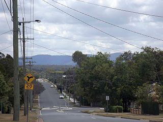
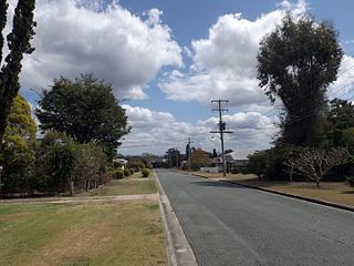
Pine Mountain is a semi-rural locality in the City of Ipswich, Queensland, Australia. In the 2016 census Pine Mountain had a population of 1,667 people.

<span class="mw-page-title-main">Basin Pocket, Queensland</span> Suburb of Ipswich, Queensland, Australia

Basin Pocket is a suburb of Ipswich in the City of Ipswich, Queensland, Australia. In the 2016 census, Basin Pocket had a population of 890 people.

<span class="mw-page-title-main">Bundamba, Queensland</span> Suburb of Ipswich, Queensland, Australia

Bundamba is a suburb of Ipswich in the City of Ipswich, Queensland, Australia. In the 2016 census Bundamba had a population of 6,514 people.

<span class="mw-page-title-main">North Booval, Queensland</span> Suburb of Ipswich, Queensland, Australia

North Booval is a suburb of Ipswich in the City of Ipswich, Queensland, Australia. In the 2016 census, North Booval had a population of 3,175 people.

East Ipswich is a residential inner-city suburb of Ipswich in the City of Ipswich, Queensland, Australia. In the 2016 census, East Ipswich had a population of 2,410 people.

<span class="mw-page-title-main">Newtown, Queensland (Ipswich)</span> Suburb of Ipswich, Queensland, Australia

Newtown is a suburb in the City of Ipswich, Queensland, Australia. In the 2016 census, Newtown had a population of 1,615 people.

<span class="mw-page-title-main">Blackstone, Queensland</span> Suburb of Ipswich, Queensland, Australia

Blackstone is a suburb of Ipswich in the City of Ipswich, Queensland, Australia. In the 2016 census, Blackstone had a population of 1,024 people.

<span class="mw-page-title-main">Ebbw Vale, Queensland</span> Suburb of Ipswich, Queensland, Australia

Ebbw Vale is a suburb of Ipswich in the City of Ipswich, Queensland, Australia. In the 2016 census, Ebbw Vale had a population of 508 people.

<span class="mw-page-title-main">Riverview, Queensland</span> Suburb of Ipswich, Queensland, Australia

Riverview is a suburb of Ipswich in the City of Ipswich, Queensland, Australia. In the 2016 census, Riverview had a population of 3,073 people and an unemployment rate of 15.7%, compared to the Australian unemployment rate of 6.9%.

<span class="mw-page-title-main">Redbank, Queensland</span> Suburb of Ipswich, Queensland, Australia

Redbank is a suburb in the City of Ipswich, Queensland, Australia. In the 2016 census, Redbank had a population of 1,834 people.

<span class="mw-page-title-main">Karrabin, Queensland</span> Suburb of Ipswich, Queensland, Australia

Karrabin is a rural locality in the City of Ipswich, Queensland, Australia. In the 2016 census, Karrabin had a population of 423 people.

<span class="mw-page-title-main">Ripley, Queensland</span> Suburb of Ipswich, Queensland, Australia

Ripley is a suburb in the City of Ipswich, Queensland, Australia. In the 2016 census, Ripley had a population of 1,405 people.

<span class="mw-page-title-main">Deebing Heights, Queensland</span> Suburb of Ipswich, Queensland, Australia

Deebing Heights is a residential and semi-rural southern suburb of Ipswich in the City of Ipswich, Queensland, Australia. In the 2016 census, Deebing Heights had a population of 2,039 people.

<span class="mw-page-title-main">Mutdapilly, Queensland</span> Suburb of City of Ipswich, Queensland, Australia

Mutdapilly is a rural locality in south-east Queensland, Australia. It is split between the local government areas of Scenic Rim Region and City of Ipswich. In the 2016 census, Mutdapilly had a population of 308 people.

Undullah is a rural locality split between the City of Logan and the Scenic Rim Region, Queensland, Australia. In the 2016 census, Undullah had a population of 45 people.

Lockyer is a rural locality in the Lockyer Valley Region, Queensland, Australia. In the 2016 census, Lockyer had a population of 95 people.

Flinders Lakes is a rural locality in the City of Logan, Queensland, Australia. It was gazetted in May 2016.

Riverbend is a rural locality in the City of Logan, Queensland, Australia. Designated as a separate locality in 2017, it will be progressively developed for residential use as the population of the city grows.

References

  1. 1 2 3 Australian Bureau of Statistics (27 June 2017). "South Ripley (SSC)". 2016 Census QuickStats. Retrieved 20 October 2018. OOjs UI icon edit-ltr-progressive.svg
  2. "South Ripley – locality in City of Ipswich (entry 49526)". Queensland Place Names. Queensland Government . Retrieved 13 February 2022.
  3. Council, Ipswich City (6 April 2020). "Division 1". www.ipswich.qld.gov.au. Archived from the original on 16 July 2021. Retrieved 16 July 2021.
  4. "South Ripley, Queensland". Google Maps . Archived from the original on 23 February 2022. Retrieved 20 November 2014.
  5. "Bundamba Lagoon (entry 5210)". Queensland Place Names. Queensland Government . Retrieved 20 November 2014.
  6. "AIATSIS code E66: Yugarabul". Federal government. Australian Institute of Aboriginal and Torres Strait Islander Studies. Archived from the original on 13 August 2020. Retrieved 31 July 2020.
  7. Queensland Family History Society (2010), Queensland schools past and present (Version 1.01 ed.), Queensland Family History Society, ISBN   978-1-921171-26-0
  8. "Moreton 40 Chain map AG2 series sheet 2 south" (Map). Queensland Government. 1922. Archived from the original on 23 February 2022. Retrieved 23 February 2022.
  9. Australian Bureau of Statistics (31 October 2012). "South Ripley". 2011 Census QuickStats. Retrieved 20 November 2014. OOjs UI icon edit-ltr-progressive.svg
  10. "Opening and closing dates of Queensland Schools". Queensland Government . Retrieved 2 March 2022.
  11. "History". Ripley Valley State Secondary College. 22 November 2019. Archived from the original on 11 March 2021. Retrieved 2 March 2022.
  12. "Ipswich Libraries: Mobile library schedule of stops - January to June 2018" (PDF). Ipswich City Council . Archived (PDF) from the original on 30 January 2018. Retrieved 30 January 2018.
  13. "Ripley Valley State School". Ripley Valley State School. 23 July 2019. Archived from the original on 11 March 2021. Retrieved 2 March 2022.
  14. "School Annual Report 2020" (PDF). Ripley Valley State School. Archived (PDF) from the original on 2 March 2022. Retrieved 2 March 2022.
  15. "Ripley Valley State Secondary College". Ripley Valley State Secondary College. 30 July 2019. Archived from the original on 11 March 2021. Retrieved 2 March 2022.
  16. "Annual Report 2020" (PDF). Ripley Valley State Secondary College. Archived (PDF) from the original on 2 March 2022. Retrieved 2 March 2022.