Limestone Ridges, Queensland

Last updated

Limestone Ridges
Queensland
Australia Queensland location map.svg
Red pog.svg
Limestone Ridges
Coordinates 27°50′02″S152°43′29″E / 27.8338°S 152.7247°E / -27.8338; 152.7247 (Limestone Ridges (centre of locality)) Coordinates: 27°50′02″S152°43′29″E / 27.8338°S 152.7247°E / -27.8338; 152.7247 (Limestone Ridges (centre of locality))
Population116 (2016 census) [1]
 • Density8.41/km2 (21.77/sq mi)
Postcode(s) 4305
Area13.8 km2 (5.3 sq mi)
Time zone AEST (UTC+10:00)
Location
LGA(s) Scenic Rim Region
State electorate(s) Scenic Rim
Federal division(s) Wright
Suburbs around Limestone Ridges:
Peak Crossing Peak Crossing Peak Crossing
Milora Limestone Ridges Washpool
Milora Milbong Milbong

Limestone Ridges is a rural locality in the Scenic Rim Region, Queensland, Australia. [2] In the 2016 census, Limestone Ridges had a population of 116 people. [1]

Contents

Geography

The Ipswich Boonah Road marks the eastern boundary of the locality.

Ipswich – Boonah Road (State Route 93) runs along the eastern boundary. [3]

History

The name Limestone Ridges refers from an outcrop now mined for dolomite. [2]

Limestone Ridges Provisional School opened on 11 November 1884. On 1 April 1910, it became Limestone Ridges State School. It closed on 3 May 1974. [4] It was at 335 Limestone Ridges Road ( 27°49′48″S152°43′46″E / 27.8301°S 152.7295°E / -27.8301; 152.7295 (Limestone Ridges State School) ). [5] [6] [7]

In the 2016 census, Limestone Ridges had a population of 116 people. The locality contains 41 households, in which 51.7% of the population are males and 48.3% of the population are females with a median age of 45, 7 years above the national average. The average weekly household income is $1,437, $1 below the national average. [1]

Related Research Articles

Aratula Town in Queensland, Australia

Aratula is a rural town and locality in the Scenic Rim Region, Queensland, Australia. In the 2016 census, the locality of Aratula had a population of 532 people.

Dugandan, Queensland Suburb of Boonah, Queensland, Australia

Dugandan is a rural town and locality in the Scenic Rim Region, Queensland, Australia. In the 2016 census, Dugandan had a population of 593 people.

Harrisville, Queensland Town in Queensland, Australia

Harrisville is a rural town and locality in the Scenic Rim Region, Queensland, Australia. In the 2016 census, the locality of Harrisville had a population of 613 people.

Peak Crossing, Queensland Suburb of City of Ipswich, Queensland, Australia

Peak Crossing is a rural locality split between the City of Ipswich and the Scenic Rim Region of Queensland, Australia. In the 2016 census, Peak Crossing had a population of 965 people.

Coulson, Queensland Suburb of Scenic Rim Region, Queensland, Australia

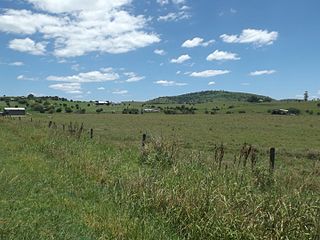
Coulson is a rural locality in the Scenic Rim Region, Queensland, Australia. In the 2016 census, Coulson had a population of 195 people.

Milford, Queensland Suburb of Scenic Rim Region, Queensland, Australia

Milford is a rural locality in the Scenic Rim Region, Queensland, Australia. In the 2016 census, Milford had a population of 207 people.

Hoya, Queensland Suburb of Scenic Rim Region, Queensland, Australia

Hoya is a rural locality in the Scenic Rim Region, Queensland, Australia. In the 2016 census, Hoya had a population of 220 people.

Cannon Creek is a rural locality in the Scenic Rim Region, Queensland, Australia. In the 2016 census, Cannon Creek had a population of 78 people.

Carneys Creek, Queensland Suburb of Scenic Rim Region, Queensland, Australia

Carneys Creek is a rural locality in the Scenic Rim Region, Queensland, Australia. In the 2016 census, Carneys Creek had a population of 51 people. It borders New South Wales.

Fassifern, Queensland Suburb of Scenic Rim Region, Queensland, Australia

Fassifern is a rural locality in the Scenic Rim Region, Queensland, Australia. In the 2016 census, Fassifern had a population of 21 people.

Fassifern Valley, Queensland Suburb of Scenic Rim Region, Queensland, Australia

Fassifern Valley is a rural locality in the Scenic Rim Region, Queensland, Australia. In the 2016 census, Fassifern Valley had a population of 91 people.

Milbong, Queensland Suburb of Scenic Rim Region, Queensland, Australia

Milbong is a rural locality in the Scenic Rim Region, Queensland, Australia. In the 2016 census, Milbong had a population of 161 people.

Croftby is a rural locality in the Scenic Rim Region, Queensland, Australia. In the 2016 census, Croftby had a population of 133 people. The town of Teviot is within the locality.

Anthony is a rural locality in the Scenic Rim Region, Queensland, Australia. In the 2016 census, Anthony had a population of 111 people.

Kulgun is a locality in the Scenic Rim Region, Queensland, Australia. In the 2016 census, Kulgun had a population of 67 people.

Moorang, Queensland Suburb of Scenic Rim Region, Queensland, Australia

Moorang is a rural locality in the Scenic Rim Region, Queensland, Australia. In the 2016 census, Moorang had a population of 46 people.

Frenches Creek, Queensland Suburb of Scenic Rim Region, Queensland, Australia

Frenches Creek is a rural locality in the Scenic Rim Region, Queensland, Australia. In the 2016 census, Frenches Creek had a population of 85 people.

Morwincha is a rural locality in the Scenic Rim Region, Queensland, Australia. In the 2016 census, Morwincha had a population of 30 people.

Radford is a rural locality in the Scenic Rim Region, Queensland, Australia. In the 2016 census, Radford had a population of 41 people.

Wallaces Creek is a rural locality in the Scenic Rim Region, Queensland, Australia. In the 2016 census, Wallaces Creek had a population of 58 people.

References

  1. 1 2 3 Australian Bureau of Statistics (27 June 2017). "Limestone Ridges (SSC)". 2016 Census QuickStats. Retrieved 20 October 2018. OOjs UI icon edit-ltr-progressive.svg
  2. 1 2 "Limestone Ridges – locality in Scenic Rim Region (entry 45160)". Queensland Place Names. Queensland Government . Retrieved 20 July 2021.
  3. Limestone Ridges, Queensland (Map). Google Maps. Archived from the original on 23 December 2021. Retrieved 4 October 2021.
  4. Queensland Family History Society (2010), Queensland schools past and present (Version 1.01 ed.), Queensland Family History Society, ISBN   978-1-921171-26-0
  5. "Flinders" (Map). Queensland Government. 1927. Archived from the original on 29 May 2020. Retrieved 6 June 2022.
  6. "Parish of Normanby County of Churchill" (Map). Queensland Government. 1973. Archived from the original on 6 June 2022. Retrieved 6 June 2022.
  7. "Queensland Globe". State of Queensland . Retrieved 6 June 2022.