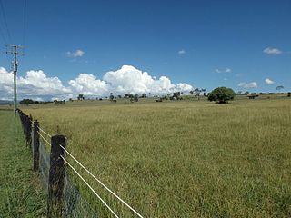
Maroon is a rural locality in the Scenic Rim Region, Queensland, Australia. In the 2021 census, Maroon had a population of 152 people.

Nindooinbah is a rural locality in the Scenic Rim Region, Queensland, Australia. In the 2021 census, Nindooinbah had a population of 95 people.

Rosevale is a rural locality in the Scenic Rim Region, Queensland, Australia. In the 2021 census, the locality of Rosevale had a population of 212 people.

Barney View is a rural locality in the Scenic Rim Region, Queensland, Australia. In the 2021 census, Barney View had a population of 38 people.

Mount Alford is a rural town and locality in the Scenic Rim Region, Queensland, Australia. In the 2021 census, the locality of Mount Alford had a population of 294 people.

Josephville is a rural locality in the Scenic Rim Region, Queensland, Australia. In the 2021 census, the locality of Josephville had a population of 172 people.

Palen Creek is a rural locality in the Scenic Rim Region, Queensland, Australia. It borders New South Wales. In the 2021 census, Palen Creek had a population of 368 people.
Wilsons Plains is a rural locality in the Scenic Rim Region, Queensland, Australia. In the 2021 census, Wilsons Plains had a population of 62 people.

Innisplain is a rural locality in the Scenic Rim Region, Queensland, Australia. In the 2021 census, Innisplain had a population of 79 people.

Knapp Creek is a rural locality in the Scenic Rim Region, Queensland, Australia. In the 2021 census, Knapp Creek had a population of 59 people.

Coulson is a rural locality in the Scenic Rim Region, Queensland, Australia. In the 2021 census, Coulson had a population of 168 people.

Allandale is a rural locality in the Scenic Rim Region, Queensland, Australia. In the 2021 census, Allandale had a population of 69 people.

Charlwood is a rural locality in the Scenic Rim Region, Queensland, Australia. In the 2021 census, Charlwood had a population of 146 people.

Bunjurgen is a rural locality in the Scenic Rim Region, Queensland, Australia. In the 2021 census, Bunjurgen had a population of 107 people.
Cannon Creek is a rural locality in the Scenic Rim Region, Queensland, Australia. In the 2021 census, Cannon Creek had a population of 75 people.

Carneys Creek is a rural locality in the Scenic Rim Region, Queensland, Australia. It borders New South Wales. In the 2021 census, Carneys Creek had a population of 71 people.

Moogerah is a rural locality in the Scenic Rim Region, Queensland, Australia. In the 2021 census, Moogerah had a population of 242 people.
Croftby is a rural locality in the Scenic Rim Region, Queensland, Australia. The town of Teviot is within the locality. In the 2021 census, Croftby had a population of 129 people.

Mount Edwards is a rural locality in the Scenic Rim Region, Queensland, Australia. In the 2021 census, Mount Edwards had a population of 60 people.
Burnett Creek is a rural locality in the Scenic Rim Region, Queensland, Australia. It borders New South Wales to the south. In the 2021 census, Burnett Creek had a population of 16 people.


